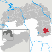
List of natural monuments in Oschatz
In the list of natural monuments in Oschatz , the individual natural monuments , geotopes and area natural monuments in the north Saxon community of Oschatz and its districts Altoschatz , Fliegerhorst , Leuben , Limbach , Lonnewitz , Mannschatz , Merkwitz , Oschatz, Rechau , Schmorkau , Thalheim , Zöschau are listed.
According to sources 5 individual natural monuments , 3 geotopes and 2 area natural monuments are known and listed here.
The information in the list is based on data from the Sachsenatlas geoportal and the data on the Nordsachsen geoportal
definition
"Natural monuments are legally binding individual creations of nature or corresponding areas of up to five hectares, whose special protection is necessary
1. for scientific, natural-historical or regional reasons or
2. because of their rarity, uniqueness or beauty."
Legend
- Image: shows an existing photo of the natural monument.
- ND / GEO / FND-No .: shows the respective no. Of the object - ND (individual) natural monument, GEO Geotope or FND (area natural monument)
- Description: describes the object in more detail
- Coordinates: shows the location on the map
- Source: Link to the reference source
(Individual) natural monuments (ND)
| image | ND no. | District | Age | description | Coordinates | swell |
|---|---|---|---|---|---|---|
| 1 | Oschatz | circa 1853 | the plane tree ( Platanus acerifolia ) in Bahnhofstrasse next to the main post office was placed under protection because of its particular size. | 51 ° 18 ′ 4 ″ N, 13 ° 6 ′ 24 ″ E | Geoportal | |
| 2 | Oschatz | circa 1853 | the ash ( Fraxinus excelsior ) in Bahnhofstrasse next to the main post office was placed under protection because of its particular size. | 51 ° 18 ′ 4 ″ N, 13 ° 6 ′ 24 ″ E | Geoportal | |
| 3 | Rechau | circa 1703 | the pedunculate oak ( Quercus robur ) in Rechauer Strasse "Am Mühlteich" was protected as a landscape trademark. | 51 ° 16 ′ 44 "N, 13 ° 8 ′ 56" E | Geoportal | |
| 4th | Oschatz | circa 1753 | the elm ( Ulmus laevis ) is on a private property at Dresdner Straße 11 with about 4 m circumference, a height of ca.28m she was placed under protection because of their age and size. | 51 ° 17 ′ 52 "N, 13 ° 6 ′ 48" E | Geoportal | |
| ? | Merkwitz | unknown | The winter linden tree ( Tilia cordata ) in Merkwitz is located on the Merkwitzer water stream on the site of the Schmiedeweg 8 plot | 51 ° 19 ′ 4 ″ N, 13 ° 5 ′ 2 ″ E | Geoportal |
Geotopes (geological natural monuments)
| image | GEO no. | District | Age | size | description | Coordinates | swell |
|---|---|---|---|---|---|---|---|
| 1 | Alto treasure | 260–280 million years | 0.34ha | In the quarry in Altoschatz there is a deposit of Rochlitz quartz porphyry, the access is directly opposite the alluvial pond on the Stranggraben. | 51 ° 17 ′ 35 "N, 13 ° 5 ′ 43" E | Geoportal | |
| 2 | Alto treasure | 100,000 y. | ? | On the rocky cliffs in the Oschatz sand pit, there are clear glacier scrapes in a deposit of Rochlitz quartz porphyry | 51 ° 17 ′ 37 "N, 13 ° 5 ′ 37" E | Geoportal | |
| 3 | Lonnewitz | 260–280 million years | 0.08ha | The fire slate deposit at the old quarry in the east of Lonnewitz is a coal bank in the Lonnewitz porphyry tuff and is located within a built-up area next to the B6. | 51 ° 17 ′ 14 "N, 13 ° 8 ′ 45" E | Geoportal |
Area natural monuments
| image | FND no. | District | size | description | Coordinates | swell |
|---|---|---|---|---|---|---|
| 1 | Merkwitz | 3.25ha | the stream meadows in the north of Merkwitz are under special protection because of a near-natural section of the Luppa. The area natural monument is largely located in the Wellerswalde district on the north bank of the Luppa in the neighboring municipality. | 51 ° 19 ′ 56 ″ N, 13 ° 4 ′ 17 ″ E | Geoportal | |
| 2 | Leuben | 6.69ha | The Leuben wood in the floodplain area of the Döllnitz was declared a special protected area because of the preservation of a near-natural oak-hornbeam forest and the protection of the pronounced spring geophyte field. | 51 ° 15 ′ 41 ″ N, 13 ° 4 ′ 48 ″ E | Geoportal |
Web links
Individual evidence
- ^ State enterprise geographic base information and surveying Saxony
- ↑ a b c d e f g h i j k ( Geoportal Nordsachsen )
- ↑ ( laws on the internet )
- ↑ a b c d e f g h i j k Natural monuments according to § 21 SächsNatSchG in the land use plan. Explanatory report , p. 29/30, City of Oschatz 2003
- ↑ ( tree register on Baumkunde.de )
- ↑ 2. Change of the land use plan. Plan drawing , City of Oschatz 2009

