List of historical objects in the Korneuburg district
The list of historical objects in the Korneuburg district contains historical, immovable objects in the Korneuburg district that are not under monument protection. Listed objects in the Korneuburg district see the official project portal: Listed objects in the Korneuburg district
monument
| photo | monument | Location | description | Metadata |
|---|---|---|---|---|

|
Wayside shrine |
Ziegeleigasse KG location : Rückersdorf |
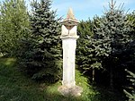
Niche shrine with inscription, 1617 |
ObjectID: missing! Status: Status of the BDA list: Name: wayside shrine GstNr .: 6345 |

|
Wayside shrine |
Kreislgasse location KG: Rückersdorf |
Niche shrine with inscription, 1691 |
ObjectID: missing! Status: Status of the BDA list: Name: wayside shrine GstNr .: 5608 |

|
Wegstein |
Rohrwald location KG: Rückersdorf |
Wegstein, 16th century |
ObjectID: missing! Status: Status of the BDA list: Name: Wegstein GstNr .: 5185/2 |

|
crossroads |
Rohrwald location KG: Rückersdorf |
Stone wayside cross at a striking intersection of seven paths in the Rohrwald , built in 1903, restored in 2003 by the Rückersdorf Agricultural Association. The so-called “shower cross” is supposed to protect the harvest from storms and hail. |
ObjectID: missing! Status: Status of the BDA list: Name: Wegkreuz GstNr .: 4974/1 Schauerkreuz Rueckersdorf |

|
Wayside shrine |
Seebarner Straße KG location : Rückersdorf |
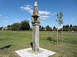
Niche shrine with hexagonal column, approx. 5 m high. |
ObjectID: missing! Status: Status of the BDA list: Name: wayside shrine GstNr .: 5818 |

|
Wayside shrine |
Schloss Seebarn KG location : Seebarn |
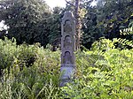
Wayside shrine with three niche attachments |
ObjectID: missing! Status: Status of the BDA list: Name: wayside shrine GstNr .: 16/8 |

|
Wayside shrine |
Seebarner Straße KG location : Seebarn |
Niche shrine with cuboid attachment and four pictures. There is an iron cross at the top. |
ObjectID: missing! Status: Status of the BDA list: Name: wayside shrine GstNr .: 660 |

|
Wayside shrine |
"In Kluppinger" location KG: Seebarn |
Mighty, approx. 7 m high and 1 m wide niche shrine with a square top and four pictures. There is an iron cross at the top. |
ObjectID: missing! Status: Status of the BDA list: Name: wayside shrine GstNr .: 759 |

|
Wayside shrine |
Kirchfeldgasse KG location : Tresdorf |
Niche shrine, with an iron cross on top, relatively low |
ObjectID: missing! Status: Status of the BDA list: Name: wayside shrine GstNr .: 2442 |

|
Wayside shrine |
Am Teiritz location KG: Stetten |
Wayside shrine with iron cross. |
ObjectID: missing! Status: Status of the BDA list: Name: wayside shrine GstNr .: 2613 |
Individual evidence
- ↑ Inscription on the wayside shrine "1617"
- ↑ Inscription on the wayside shrine "1691"
- ↑ Inscription on the waystone "15 ??"
- ↑ inscription
- ^ Lower Austria - immovable and archaeological monuments under monument protection. (PDF), ( CSV ). Federal Monuments Office , as of February 14, 2020.
- ↑ § 2a Monument Protection Act in the legal information system of the Republic of Austria .