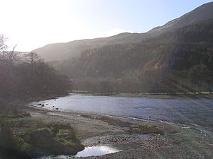
Loch Lubnaig
| Loch Lubnaig | ||
|---|---|---|

|
||
| The south end of the hole | ||
| Geographical location | Stirling , Scotland | |
| Tributaries | River Balvaig from Loch Voil | |
| Drain | River Leny → Teith | |
| Data | ||
| Coordinates | 56 ° 17 '32 " N , 4 ° 17' 47" W | |
|
|
||
| length | 5 km | |
| Maximum depth | 44.5 m | |
Loch Lubnaig ( Gaelic Loch Lùbnaig ) is a small loch near Callander in the Stirling Council Area . It is in the former county of Perthshire .
Loch Lubnaig is about 5 kilometers long and up to 44.5 meters deep. The lake is embedded in the space between Ben Ledi west of the lake and Ben Vorlich and Stùc a 'Chroin east of the lake. Fed by the Balvag in the north and flowing into the River Leny , a tributary of the Teith , in the south , Loch Lubnaig allows fishing from the bank, while canoes can be hired at the north end . The former Callander and Oban Railway runs along the western bank of the loch. This route has now been converted into part of the National Cycle Network's "Route 7" and allows cyclists and hikers to travel nine miles between Callander and Strathyre .
The name Lubnaig comes from Gaelic and means "crooked".

