Lower Horse Island
| Lower Horse Island | ||
|---|---|---|
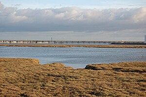
| View from Canvey Island to Lower Horse Island, which runs as a strip of land in the center of the picture | ||
| Waters | Thames | |
| Geographical location | 51 ° 31 ' N , 0 ° 32' E | |
|
|
||
| Residents | uninhabited | |
Lower Horse Island or Lower Horse is an uninhabited island in the Thames .
The island is west of Canvey Island and east of Shell Haven . It is one of the islands that broke away from mainland England in the Middle Ages, others from which were later formed into Canvey Island.
The island is west of the Essex border and is part of Thurrock .
See also
swell
- Thames Estuary, Rochester and Southend-on-Sea (= Landranger Map . Band 178 ). Ordnance Survey , Southampton 2007, ISBN 978-0-319-22967-5 .

