
Mairan (moon crater)
| Mairan | ||
|---|---|---|
|
||
| position | 41.63 ° N , 43.5 ° W | |
| diameter | 40 km | |
| depth | 2670 m | |
| Card sheet | 23 (PDF) | |
| Named after | Jean Jacques d'Ortous de Mairan (1678–1771) | |
| Named since | 1935 | |
| Unless otherwise stated, the information comes from the entry in the IAU / USGS database | ||

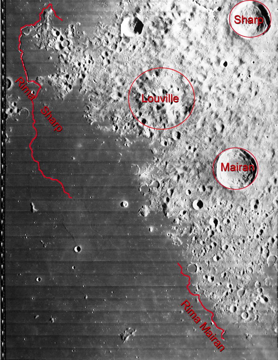
Mairan is an impact crater on the high plateau of the peninsula between Oceanus Procellarum in the west and Mare Imbrium in the east. In a north-northeast direction lies the Sharp crater, which is comparable in size, and the heavily eroded Louville crater to the northwest . Along the southwestern side of the peninsula runs a winding groove called Rima Mairan , which runs from north to south for a distance of about 100 kilometers .
The outer edge of Mairan was only insignificantly damaged by erosion and subsequent impacts and has retained its sharp-edged ridge. The environment is rough and irregular and, especially in the south and west, is pitted by a myriad of tiny craters. The inner walls of the crater have some terraces and slope down to a relatively flat crater floor.
In the Mare west of Mairan there is a small dome-shaped elevation called 'Mairan T'. This has a tiny crater at its highest point.
| Letter | position | diameter | link |
|---|---|---|---|
| A. | 38.61 ° N , 38.82 ° W | 17 km | [1] |
| C. | 38.63 ° N , 46.09 ° W | 6 km | [2] |
| D. | 40.98 ° N , 45.54 ° W | 10 km | [3] |
| E. | 37.8 ° N , 37.25 ° W | 6 km | [4] |
| F. | 40.3 ° N , 45.17 ° W | 8 kilometers | [5] |
| G | 40.89 ° N , 50.82 ° W | 6 km | [6] |
| H | 39.29 ° N , 40.08 ° W | 5 km | [7] |
| K | 40.82 ° N , 41.11 ° W | 6 km | [8th] |
| L. | 39.05 ° N , 43.22 ° W | 6 km | [9] |
| N | 39.17 ° N , 45.6 ° W | 6 km | [10] |
| T | 41.77 ° N , 48.41 ° W | 3 km | [11] |
| Y | 42.78 ° N , 44.14 ° W | 6 km | [12] |
Individual evidence
- ^ John Edward Westfall: Atlas of the Lunar Terminator. Cambridge University Press, Cambridge 2000, ISBN 0-521-59002-7 , p. 279
Web links
- Mairan in the Gazetteer of Planetary Nomenclature of the IAU (WGPSN) / USGS
- Mairan crater in the "Digital Lunar Orbiter Photographic Atlas of the Moon"