Manantali dam
| Manantali dam | |||||||
|---|---|---|---|---|---|---|---|
| NASA World Wind image | |||||||
|
|||||||
|
|
|||||||
| Coordinates | 13 ° 7 ′ 6 ″ N , 10 ° 21 ′ 27 ″ W | ||||||
| Data on the structure | |||||||
| Construction time: | 1981-1988 | ||||||
| Height above foundation level : | 65 m | ||||||
| Crown length: | 1 494 m | ||||||
| Power plant output: | 200 MW | ||||||
| Data on the reservoir | |||||||
| Water surface | 477 km² | ||||||
| Storage space | 11,270 million m³ | ||||||
| Design flood : | 7th 000 m³ / s | ||||||
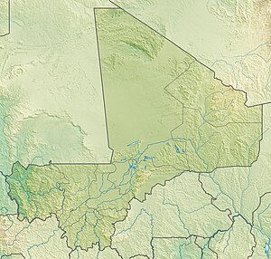
The Manantali dam ( German for Barrage de Manantali ) is a dam in Mali ( West Africa ). The construction was a project of the organization pour la mise en valeur du fleuve Sénégal .
The purpose of the dam is , in addition to generating electricity, agricultural irrigation and low water elevation.
construction
It was built between 1981 and 1988 by ECBM (Entreprises de Construction du Barrage de Manantali), a consortium of the European companies Züblin , Dyckerhoff & Widmann and Losinger AG at Manantali . Planning and construction management was carried out by Rhein-Ruhr Ingenieur GmbH, today RRI GmbH Rhein Ruhr International. The Bafing River is dammed by the dam .
The power plant was built between 1999 and 2002. Electricity was generated for the first time on January 1st, 2002. At that time, however, only one of the five planned 40 MW turbines was installed. Once the power plant is fully developed, it should generate an output of 200 MW. The electricity generated here is distributed in Mali , Mauritania and Senegal via an electricity network of more than 1,300 km .
Data
The structure has a total length of 1494 m (it is also given as 1402 m) and a maximum height of 65 m (is also given as 70 m). It is divided into three sections. The two outer sections of 668 m and 355 m respectively are embankments consisting of a clay core, a filter layer and rock fill as a supporting body . The remaining 471 m consist of a concrete pier dam , in which the seven bottom drains and the eight overflows for the flood relief are housed. In addition, inlets for the later-built Centrale hydroélectrique de Manantali hydropower station have already been planned.
The resulting reservoir has a storage volume of around 11,270 million m³ and an area of around 477 km² and is around 94 km² smaller than Lake Constance .
criticism
The local population (around 10,000 people) was relocated from the fertile river plains to the depleted high altitudes for the implementation. They had to leave their holy places behind and deviate from their traditional cultivation methods. Many young workers were trained and employed in the construction. A small town on the edge of the construction site grew from 200 to 15,000 people within a few weeks. A cinema and night club were built, and markets with European products. This had far-reaching consequences for the local population. The young men left the area after the construction and moved to the cities, as there was no industry on site. The rapid increase in population had far-reaching consequences, especially for young women. In the meantime there are almost only women and elderly on site. The locals were not taught the techniques necessary for changing agriculture. The population now has to pay for water, which is not compatible with their understanding of the world. Despite the enormous amount of energy being generated, there is currently no electricity on site.
See also
- List of power plants in Mali
- List of dams in the world
- List of the largest reservoirs on earth
- List of the largest dams on earth
Web links
Individual evidence
- ↑ Documentation: " Sweet Gift - Help as Business " Peter Heller, 2012 WDR


