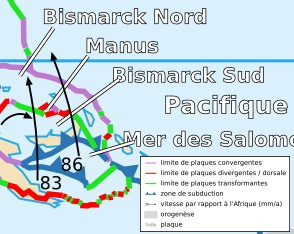
Manus plate
Coordinates: 3 ° 2 ′ 13.2 ″ S , 150 ° 27 ′ 21.6 ″ E
The Manus Plate is a tiny tectonic plate ( microplate ) that is located south of Lavongai Island in the Pacific Ocean . It lies exactly on the plate boundary between the north and south Bismarck plates . The tectonic plate got its name from the nearby island of Manus .
With an area of only 0.00020 steradian , the Manus Plate is probably the smallest tectonic plate in the world.
See also
swell
- Peter Bird: An updated digital model of plate boundaries (2003): PDF , accessed: May 21, 2014
