Mapillary
| Mapillary
|
|
|---|---|

|
|
| Basic data
|
|
| Publishing year | 2014 |
| operating system | Android , Windows Phone , iOS |
| category | Mapping , geotagging |
| License | Data ODbL license; Photos CC BY-SA |
| www.mapillary.com | |
Mapillary is a service for distributing geo-referenced photos . It is being developed by Mapillary AB , based in Malmo , Sweden . The aim is to use crowdsourcing to capture the entire world in images, which should not only include streets. These images are to be used in the public domain and are therefore available to the entire world population free of charge via the Internet.
Foundation and development
The project started in September 2013. In November 2013 an iPhone app was released and in January 2014 an Android app.
Mapillary received start-up capital of $ 1.5 million from a group of investors led by Sequoia Capital since January 2015 .
In June 2020, Mapillary announced that it had been acquired by Facebook .

The number of uploaded photos has so far increased continuously:
| time | Number of pictures |
|---|---|
| April 2014 | 200,000 |
| May 2014 | 500,000 |
| June 2014 | 1 million |
| August 2014 | 3 million |
| November 2014 | 5 million |
| March 2015 | 10 million |
| May 2015 | 17 million |
| August 2015 | 30 million |
| November 2016 | 100 million |
| January 2019 | 440 million |
| September 2019 | 730 million |
| April 2020 | 1,147,562,044 |
Functions

Registered users can use a smartphone to take pictures, which are then automatically uploaded to the server. The Mapillary app offers different recording functions for this purpose: walking, driving (either by bike or car) and panorama. The panorama function was implemented in September 2014.
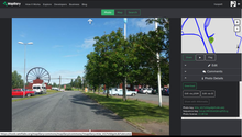
The uploaded images are shown in the form of a line on a road map. After a line has been selected, these images can be viewed by playing back and forth. Faces and license plates were automatically made illegible beforehand. Registered users can also make other objects unrecognizable afterwards. Traffic signs have been recognized automatically since the beginning of 2015 . To improve the recognition algorithm, the community was asked to use a game to visually check the recognized traffic signs. With the help of a filter function, recordings that were made at different times can be limited to a certain period of time. In this way it is possible to follow the development of an area. In the long term, a 3D function is planned in which neighboring recordings will be blended, thus enabling spatial visualization.
License
The images on Mapillary can be used under the international Creative Commons Attribution ShareAlike 4.0 license ( CC-BY-SA ). The developers have explicitly allowed the images to be used to improve the data in OpenStreetMap and Wikimedia Commons . The GPX tracks can be used without restrictions. Data derived from Mapillary must be published under the ODbL license.
The license was changed from CC-BY-NC to CC-BY-SA on April 29, 2014 .
Mapillary wants to generate income by selling certain user data.
Mapillary was sold to Facebook in July 2020.
Web links
swell
- ↑ Mapillary for Android
- ↑ Mapillary for WindowsPhone
- ↑ Mapillary for iOS
- ↑ Mapillary AB, Sweden: Mapillary | Manifesto. In: www.mapillary.com. Retrieved August 14, 2015 .
- ↑ Kristina // Øresund Startups: Jan Erik Solem Launches Mapilary - Putting Images on the Map . In: Arctic Capital . December 11, 2013. Archived from the original on April 2, 2015. Retrieved January 18, 2015.
- ↑ a b Rachel Metz: Putting Crowdsourcing on the Map . In: MIT Technology Review , February 28, 2014. Retrieved October 22, 2014.
- ↑ Mike Butcher: Sequoia Invests In Mapillary To Crowd-Map The World Faster Than Street View . In: TechCrunch , January 15, 2015. Retrieved January 18, 2015.
- ^ Jan Erik Solem: Mapillary Joins Facebook on the Journey of Improving Maps Everywhere. In: Mapillary Blog. Mapillary, accessed June 19, 2020 .
- ↑ Mapillary on Twitter. April 2, 2014, accessed August 14, 2015 .
- ^ Katie Collins: Mapillary is the crowdsourced answer to Street View . Wired. May 9, 2014. Archived from the original on December 13, 2014. Retrieved on December 12, 2014.
- ↑ Mapillary on Twitter. May 8, 2015, accessed August 14, 2015 .
- ↑ Mapillary on Twitter. June 10, 2014, accessed August 14, 2015 .
- ↑ Mapillary on Twitter. August 26, 2014, accessed August 14, 2015 .
- ↑ Mapillary on Twitter. November 21, 2014, accessed August 14, 2015 .
- ↑ 10M Geotagged Connected Photos. In: blog.mapillary.com. March 23, 2015, accessed August 14, 2015 .
- ↑ Mapillary on Twitter. May 29, 2015, accessed August 14, 2015 .
- ↑ Mapillary on Twitter. Retrieved August 14, 2015 .
- ↑ 100 Million Photos - Geotagged, Connected, and Available for All. Archived from the original on November 16, 2016 ; accessed on November 16, 2016 .
- ↑ Jan Erik Solem: Now Supporting Panoramas and Photo Spheres . September 10, 2014. Retrieved September 25, 2014.
- ↑ a b Mapillary AB, Sweden: Mapillary | Legal . Retrieved July 21, 2015.
- ↑ Mapillary, OSM .
- ^ Right to Derive Data from Mapillary images .
- ^ License Update: Now Creative Commons Share Alike . Retrieved July 21, 2015.
- ↑ Facebook acquires crowdsourced mapping company Mapillary . In: Reuters . June 18, 2020 ( reuters.com [accessed July 6, 2020]).

