
Memel Delta

The Memel Delta ( lit.Nemuno delta , formerly also the soot delta ) is the confluence of the Memel on the east side of the Curonian Lagoon . It is located in Lithuania , its southernmost estuary, the Skirvytė , marks the border with the Russian Kaliningrad Oblast .
location
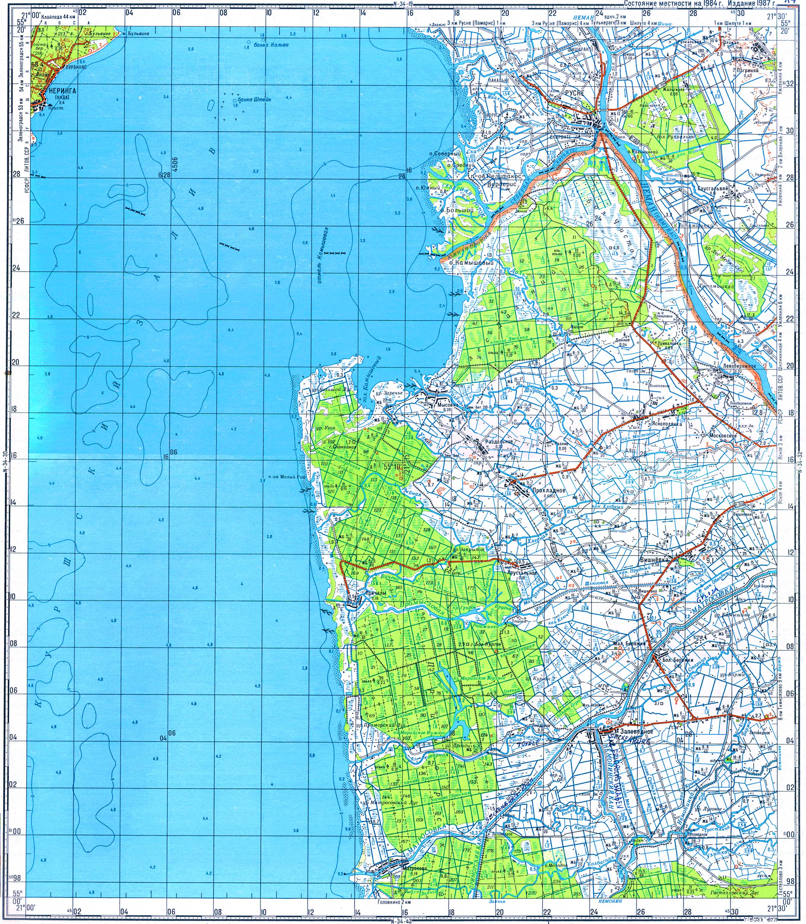
Already 50 km before it flows into the lagoon, the Memel at Sowjetsk (Tilsit) divides into the two main estuary arms Matrossowka (Prussian gilus, gilin, gillis (deep), German Gilgestrom , Lithuanian Gilgė or Gilija ) and Rusnė (Prussian ruset slowly flow, stream, German soot stream ). The right, northern main arm of Ruß then branches into a pronounced delta about 16 km before its mouth near Rusnė ( soot ) .
The Atmata represents the main flow of the delta; The shipping traffic from the lagoon to the Memel and the official mileage runs through them . The Šyša and the Minija , on which shipping also take place , flow into the Atmata . The smaller delta of the Minija is now completely in the Memel Delta.
Geographical limitation
Today, the term Memel Delta is more likely to be equated with the protected area of the same name or with the delta of the main river (the former soot delta), as the adjacent map shows.
The original concept was probably broader and also included parts of southern Elchniederung ; at least to the mouth of the Gilgestrom. However, this is not so much an actual delta, but more a moor area , where there are also several waterways (also due to drainage measures ).

Memel Delta
|
Geology / formation
The delta was formed from alluvia of the Memel. Due to the intensified agriculture in the catchment area and earlier large-scale deforestation of forests for timber production, the input in the industrial era was increased. New islands are formed, which over time join the mainland, which means that the delta continues to expand today. How quickly this happens can be seen by looking at older maps.
Some river arms are closed and form oxbow lakes or chains of small lakes. The former Krokų Lanka bay was separated from the lagoon and now forms a large, shallow, partially silted lake; the same is expected for Kniaupas Bay.
Polders
An inseparable part of the delta are the man-made structures ( polders ) that serve to protect parts of the landscape from periodic flooding and to make them usable for agriculture. A distinction is made between summer and winter polders: the former are only used to hold off minor floods, but are regularly flooded when the spring flood occurs almost annually. Winter polders can also withstand major floods.
Since the polder areas are low, in some cases below sea level (at −1.3 m, the lowest place in Lithuania is on Lake Dumblis), the water has to be carried out by means of pumping stations via drainage ditches . The first pumping station was built in Uostadvaris in 1907 and is now an industrial monument.
(The network of the numerous drainage ditches inside and outside the delta is not shown on the adjacent graphic.)
Nemunas Delta Regional Park

The Nemunas Delta Regional Park was established in 1992 to protect the special landscape and the ecosystem of the estuary as well as its cultural heritage. It covers an area of 29,000 hectares. There are various protection zones in the park in order to place various types of landscape and their animal and plant communities under special protection. A significant part of the park is taken up by moors, reed beds and meadows, lagoon lakes, oxbow lakes and unique dunes and sand meadows still exist.
As early as 1993, the park was placed under protection as an important bird breeding and migratory area under the Ramsar Convention ; An important bird migration route Arctic-Europe-Africa runs through the park . 300 species of birds have been observed in the park and 170 species breed there. There are 50 species of mammals in the territory of the park, 14 of which are on the Lithuanian Red List , including pug bat , two-colored bat and otter.
literature
- Nemuna deltos rigionio parko turizmo infrastructuros pletra, Development of tourism infrastructure of the Nemunas Delta Regional Park, PHARE 2002 ESS No. 6537901-01-0011 Proj. P-3-110.
- Uwe Rada: The Memel. Cultural history of a European river. Siedler Verlag, Berlin 2010. ISBN 978-3-88680-930-1 .
Web links
- Regional park website
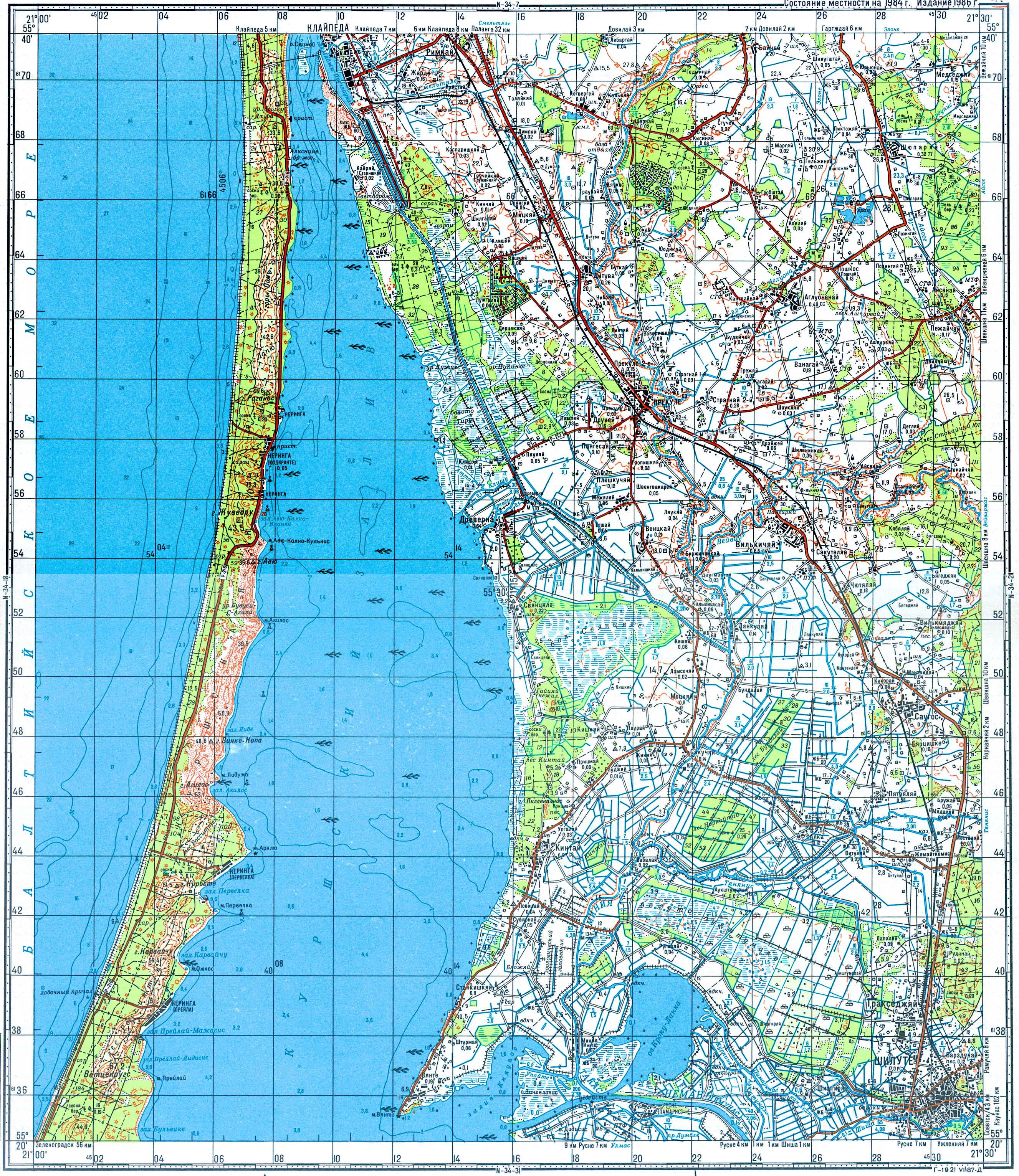
- Soviet topographic maps at a scale of 1: 100,000 from the 1980s:
- Memel basin
Individual evidence
- ↑ a b The soot delta in GenWiki
- ↑ Feasibility study for a protected area in the Memel Delta - which expressly refers to this southern part .
- ↑ Geological overview map of the area around the KURISCHEN HAFFE for Section 2.3.4. the geolog. Card a. Prov: Prussia by Dr G. Berendt - in: Werner Jaeger: The fishing boats on the Curonian Lagoon. ISBN 3-895-34160-6 , p. 327.