
Possjolok imeni Alexandra Kosmodemjanskowo
Coordinates: 54 ° 44 ' N , 20 ° 22' E

Imeni Alexandra Kosmodemyanskogo ( Russian Посёлок имени Александра Космодемьянского translated Alexander Kosmodemjanski settlement; German Metgethen ) is the Kaporner Heath and is a district of Tsentralny rayon (Zentralrajon) of the Russian city of Kaliningrad . The population is about 11,000.
history


The first written mention of the Prussian village Metgethen comes from the year 1278: "in campo, qui dicitur Myntegeiten" The name refers to a spiritual leader called Myntete. A Catholic chapel belonged to the handsome manor in the 18th century. The manor district was assigned to the newly formed district of Königsberg on February 1, 1818 and incorporated into the city of Königsberg on April 1, 1939 when the district was reorganized. In 1894 Metgethen was connected to the railway network of the East Prussian Southern Railway by means of a station on the Pillau - Prostken line .
In 1820 the place had 29 inhabitants in two houses, in 1885 there were 302 inhabitants and in 1933 already 1,946.
Metgethen was originally an estate district. There was a castle in it as a mansion. At the beginning of the 20th century, the "forest villa colony" was built on part of the estate. In 1913 the rural community of Metgethen was founded and separated from the manor district. The place flourished quickly and, as the center of the Kaporn Heath, became the most popular local recreation destination of the Königsbergers, easily accessible by train to Pillau . There was the historic "Vierbrüder-Krug" and the "Forsthaus Metgethen" nearby. In 1912 the economic women's school "Kronprinzessin Cecilie" was founded on the shores of the Hubertus Lake, which later became the rural women's school of the Reifensteiner Verband (the building no longer exists). In 1916 a high school for girls and boys was opened. Immediately after the end of the First World War, a small settlement company built the "Garden City of Metgethen" north of the railway line. The forest church was consecrated in 1925, an octagonal building with a crowning tower. In Metgethen there was the provincial fire brigade school built in 1939 with a characteristic, high hose tower. Far away from Metgethen were the sewage fields for the sewage from Königsberg.
In February 1945, during the battle for Königsberg , the site was the scene of the Metgethen massacre of German and Ukrainian civilians. On January 29, the Red Army had advanced via Metgethen to Großheidekrug to the Frischen Haff and thus interrupted the road and rail connection between Königsberg and Pillau. On February 19, the Wehrmacht was able to recapture Metgethen in hard fighting with simultaneous advances from Samland and Königsberg and thus restore these connections for several weeks, which are important for the evacuation of the population and the wounded and for supplies.
The place kept its German name ( Метгетен ) until 1946 , then it was renamed Lesnoje ( Лесное ). In 1956 the city acquired its current name after the fallen in the Battle of Königsberg, posthumously as a Hero of the Soviet Union excellent Alexander Kosmodemjanski , brother of soy Kosmodemyanskaya . At the place of his death at the then Vierbrüderkrug in the Kaporner Heide (state forest Kobbelbude), about halfway between the settlement now named after Kosmodemjanski and Vsmorje (formerly Groß Heydekrug ) on the Kaliningrad - Baltijsk road, there is a memorial stone with a bust.
At the castle and manor Metgethen were among others resident
- Erhard Ernst von Röder (1665–1743), Field Marshal General
- Ernst von Olfers (1840–1915) Medical Councilor, father of Sibylle von Olfers
- Sibylle von Olfers (1881–1916), children's book author
Images 2014

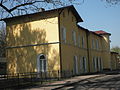
Tower of the former fire brigade school in Metgethen 2014
Metgethen station 2014

Kaliningrad Pillau 2014 railway line
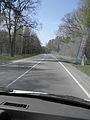
Kaliningrad Baltisk Street 2014

Soviet military cemetery in Metgethen 2014


Sons and daughters of the place
- Sibylle von Olfers (1881–1916), children's book author and illustrator
- Manfred Sult (1934–2016), Baptist pastor and from 1981 to 1991 President of the Federation of Evangelical Free Churches in the GDR
Web links
- Metgethen bildarchiv-ostpreussen.de
Individual evidence
- ↑ East Prussia Map 1: 300,000. In: ostpreussenkarten.de.vu. Archived from the original on January 31, 2004 ; accessed on June 26, 2019 .
- ↑ bildarchiv-ostpreussen.de detailed map
- ↑ Grasilda Blažiene: The Baltic place names in Samland . In: Wolfgang Schmid (Ed.): Hydronymia Europaea , special volume II. Steiner Verlag, Stuttgart 2000, p. 94
- ^ Johann Friedrich Goldbeck : Complete topography of the Kingdom of Prussia . Part I, Königsberg / Leipzig 1785, p. 13.
- ^ Samland district . territorial.de, accessed on January 10, 2011
- ^ A b Michael Rademacher: German administrative history from the unification of the empire in 1871 to the reunification in 1990. Königsberg. (Online material for the dissertation, Osnabrück 2006).
- ↑ a b page of the city of Königsberg. klgd.ru (Russian); Retrieved January 10, 2011