Miantonomi Memorial Park
| Miantonomi Memorial Park | ||
|---|---|---|
| National Register of Historic Places | ||
|
World War I memorial at the highest point in the park |
||
|
|
||
| location | Newport , Rhode Island | |
| Coordinates | 41 ° 30 '38.9 " N , 71 ° 18' 36.7" W | |
| surface | 13 ha | |
| Built | 1637 | |
| Architectural style | Colonial style | |
| NRHP number | 69000003 | |
| The NRHP added | June 23, 1969 | |
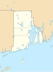
Miantonomi Memorial Park is a public park between Hillside Avenue and Girard Avenue in Newport in the American state of Rhode Island .
history
The Narragansett Indians have used the area for centuries, and the hill and park are named after a sachem (chief): Miantonomo . Miantonomi used the hill as a mansion until it was acquired by English colonists in 1637. The settlers used the hill as a guard post and in 1667 built a beacon on the summit. Fortifications were built during the War of Independence , some of which are still recognizable. In 1921 the City of Newport acquired the property from the Stokes family.
In 2005, the Miantonomi Memorial Park, covering 30 acres , was incorporated into the Aquidneck Land Trust .
monument
The Park Commission built a tower in 1929 as a memorial to the First World War . On September 27, 2017 was Miantonomi Memorial Park Tower as an official of a century monument to the first World War (WWI centennial memorial) excellent and therefore receives funds for restoration.
See also
Individual evidence
- ^ Aquidneck Land Trust .
- ^ NRHP nomination for Miantonomi Memorial Park . Rhode Island Preservation. Retrieved November 6, 2014.
- ^ Miantonomi Memorial Park Tower named official 'WWI Centennial Memorial' . 27th September 2017.
- ↑ 50 WWI Centennial Memorials set for restoration, rededication .


