Miekojärvi
| Miekojärvi | ||
|---|---|---|

|
||
| View from Pieskänjupukka to Miekojärvi | ||
| Geographical location | Lapland ( Finland ) | |
| Tributaries | Iso-Vieton outflow | |
| Drain | Tengeliönjoki | |
| Islands | Vaarasaari | |
| Location close to the shore | Ylitornio , Pello | |
| Data | ||
| Coordinates | 66 ° 36 ′ 0 ″ N , 24 ° 22 ′ 0 ″ E | |
|
|
||
| Altitude above sea level | 76.9 m | |
| surface | 53.34 km² | |
| volume | 0.349 km³ | |
| Maximum depth | 22.84 m | |
| Middle deep | 6.54 m | |
| Catchment area | 2132 km² | |
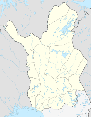
The Miekojärvi is a lake in the west of the Finnish landscape Lapland .
The 53.34 km² large lake is drained by Tengeliönjoki at the southern end of the lake. Miekojärvi is at a height of 76.9 m. The maximum depth is 22.84 m. The largest island in the lake is Vaarasaari with an area of 843 hectares.
The Miekojärvi has a catchment area of 2132 km². The outflow of the neighboring lake Iso-Vietonen to the east forms an important tributary . Here lies the Built in 1954 Kaaranneskoski -Wasserkraftwerk that of Pohjolan Voima is operated and an installed power of 3 MW and a drop height having 16 m.
From the 220 m high mountain Pieskänjupukka to the west you can see the whole lake.
Web links
Individual evidence
- ↑ a b c d e JÄRVIWIKI - Miekojärvi (67.931.1.001)
- ↑ Pohjolan Voima - Power plants- versatile electricity and heat generation ( Page no longer available , search in web archives ) Info: The link was automatically marked as defective. Please check the link according to the instructions and then remove this notice.
- ↑ Finnish Ministry of the Environment - Pieskänjupukka (PDF file; 928 kB)
