Mill – Pine Neighborhood Historic District
| Mill – Pine Neighborhood Historic District | ||
|---|---|---|
| National Register of Historic Places | ||
| Historic District | ||
|
The White House (1895) in the Mill – Pine Neighborhood Historic District (2013) |
||
|
|
||
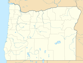
| location | Roseburg, Oregon , along Mill Street SE and Pine Street SE between Rice Ave and Mosher Avenue | |
| Coordinates | 43 ° 12 '13.1 " N , 123 ° 21' 7.3" W | |
| Built | 1878-1927 | |
| NRHP number | 85001348 | |
| The NRHP added | June 20, 1985 | |
The Mill-Pine Neighborhood Historic District is a Historic District in Roseburg , Oregon , United States . From 1878 this was neighborhood of modest houses accessible to employees of the railways to provide living space. Development of the neighborhood largely came to a standstill after the Southern Pacific Transportation Company relocated its operations center from Roseburg to Eugene in 1927 , making this neighborhood an unusually closed example of a late 19th and early 20th century working class housing estate is. The Historic District was added to the National Register of Historic Places in 1985 ; In 2011, the borders were reduced because some of the historic buildings had been demolished.
See also
supporting documents
- ↑ a b c Helen Jane Clarke, Marianne Kadas, Ella Mae Young: National Register of Historic Places Inventory - Nomination Form: Mill – Pine Historic District ( English , PDF) December 1, 1984. Accessed October 3, 2015.
- ↑ a b Oregon Parks and Recreation Department: Oregon Historic Sites Database ( English ) Retrieved on October 3, 2015.


