Minyip
| Minyip | |||||
|---|---|---|---|---|---|
 Evangelical Church (2010) |
|||||
|
|||||
|
|||||
|
|||||
|
|||||
|
|
|||||
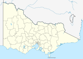
Minyip is a city in the Wimmera region of the Australian state of Victoria . The name of the city is derived from the Aboriginal word for "ashes".
The city calls itself the Heart of the wheat belt ( Heart of the Wheat Belt ) since it lies at the heart of Australia's largest wheat-growing region and the grain production of the largest industry is the region.
history
The region was settled by the first European settlers in the 1870s and a railway line reached the city in 1886 .
traffic
The two highways B210 and C236 cross in Minyip.
A railway line runs from Murtoa (branch of the Melbourne - Adelaide railway line ) through Minyip to Hopetoun , but is now only used sporadically in freight traffic.
Trivia
Minyip was used as a filming location for exterior shots of the fictional location Coopers Crossing in the television series The Flying Doctors . Even today you can find the lettering from series times on some buildings along the main street , memorabilia are displayed in Emma's Cafe .
Web links
Individual evidence
- ↑ Australian Bureau of Statistics : Minyip (L) ( English ) In: 2016 Census QuickStats . June 27, 2017. Retrieved April 19, 2020.
