
Miou
| Vegadeo municipality: Miou | |||
|---|---|---|---|
| coat of arms | Map of Spain | ||
 Help on coat of arms |
|
||
| Basic data | |||
| Autonomous Community : |
|
||
| Comarca : | Eo-Navia | ||
| Coordinates | 43 ° 28 ′ N , 7 ° 4 ′ W | ||
| Height : | 67 msnm | ||
| Area : | 9.79 km² | ||
| Residents : | 111 (2011) INE | ||
| Population density : | 11.34 inhabitants / km² | ||
| Postal code : | 33779 | ||
| Area code: | 33074060400 | ||
| Nearest airport : | Asturias airport 104 km | ||
| administration | |||
| Address of the municipal administration: | Plaza Ayuntamiento, 1 (panes,) 33770 VEGADEO | ||
| Location of the place | |||

|
|||

Miou is a village in the municipality of Vegadeo in the autonomous region of Asturias in Spain .
geography
Miou is located near the mouth of the Rio Eo and has 111 inhabitants (2011) on an area of 9.79 km². The next larger town is Vegadeo , the main town of the municipality of the same name 0.6 km away. The village belongs to the Parroquia Vegadeo .
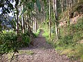
Way of St. James
Miou is also a stop on the Way of St. James , the "Camino Real", which leads via Ferradal , Piñera , Silvayana , San Román del Monte , Vegadeo to the capilla (chapel) de Santa Leocadia. The path continues via Louteiro to the capilla de Nuestra Señora de los Remedios, 1 km away.
climate
Pleasantly mild summers with mild, rarely severe winters. In the high areas, winters can be quite severe.
Worth seeing
- Capilla (chapel) de Santa Leocadia
- Reserva Natural Parcial de la Ría del Eo (Natural Park)
swell
- Population figures see INE
- For height information, see Google Earth
- Postcodes [1]

Miou School
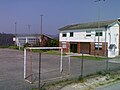
the sports field
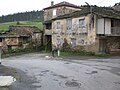
Plaza da Cruz

Calle da Costa
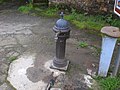
Fonte da Cruz
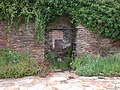
Fonte de Otilia

Pozo de Inselmo
Fonte veya
the hamlet of El Barredal

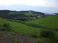
View from Louteiro
on the Ría del Eo

on the Ría del Eo


.JPG)
.JPG)