
Bog pond meadow
| Bog pond meadow | |
|---|---|
| Park in Kiel | |

|
|
| Moorteichwiese in January 2019 | |
| Basic data | |
| place | Kiel |
| District | Südfriedhof |
| Created | 1905-1908 |
| Newly designed | 2015-2018 |
| Surrounding streets | Max-Planck-Strasse, Königsweg, Winterbeker Weg, Theodor-Heuss-Ring |
| Buildings | sports ground |
| use | |
| User groups | Pedestrians , leisure |
| Park design | Ferdinand Hurtzig |
| Technical specifications | |
| Parking area | approx. 140,000 m² |
The Moorteichwiese is a green area in the Südfriedhof district of the Schleswig-Holstein state capital, Kiel . The complex, built as a people's park, with sports areas and allotments, is approx. 14 hectares in size and is located south of the city center between Max-Planck-Straße, Königsweg, Winterbeker Weg and Theodor-Heuss-Ring.
history
After complaints about the dilapidated condition of the area used as a garbage dump had become loud towards the end of the 19th century, the national park-like facility with tennis courts and large lawns was planned. The park on the Moorteichwiese was built from 1905 to 1908, from 1907 under the direction of the city horticultural director Ferdinand Hurtzig .
In 1846, north of the park on Max-Planck-Strasse, the Kieler Actien brewery built underground brewery facilities and the "Felsenhalle" restaurant, including an octagonal tower that was used as a lifting device for the beer kegs and as a lookout tower for guests of the inn served. Machine building, barrel storage, cooperage and five storage cellars were built. In 1872 the cellar vaults were extended. The building above ground was partially destroyed during the Second World War .
photos

Moorteichwiese with gasometer 1972

Similar perspective 2018

Moorteichwiese in winter

sports ground
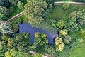
Aerial view of part of the moor pond meadow.

The Max Planck School in Kiel adjacent to the Moorteichwiese.

Open-air festival for the Kiel Week 1974
.jpg)


.jpg)
- Overview panorama
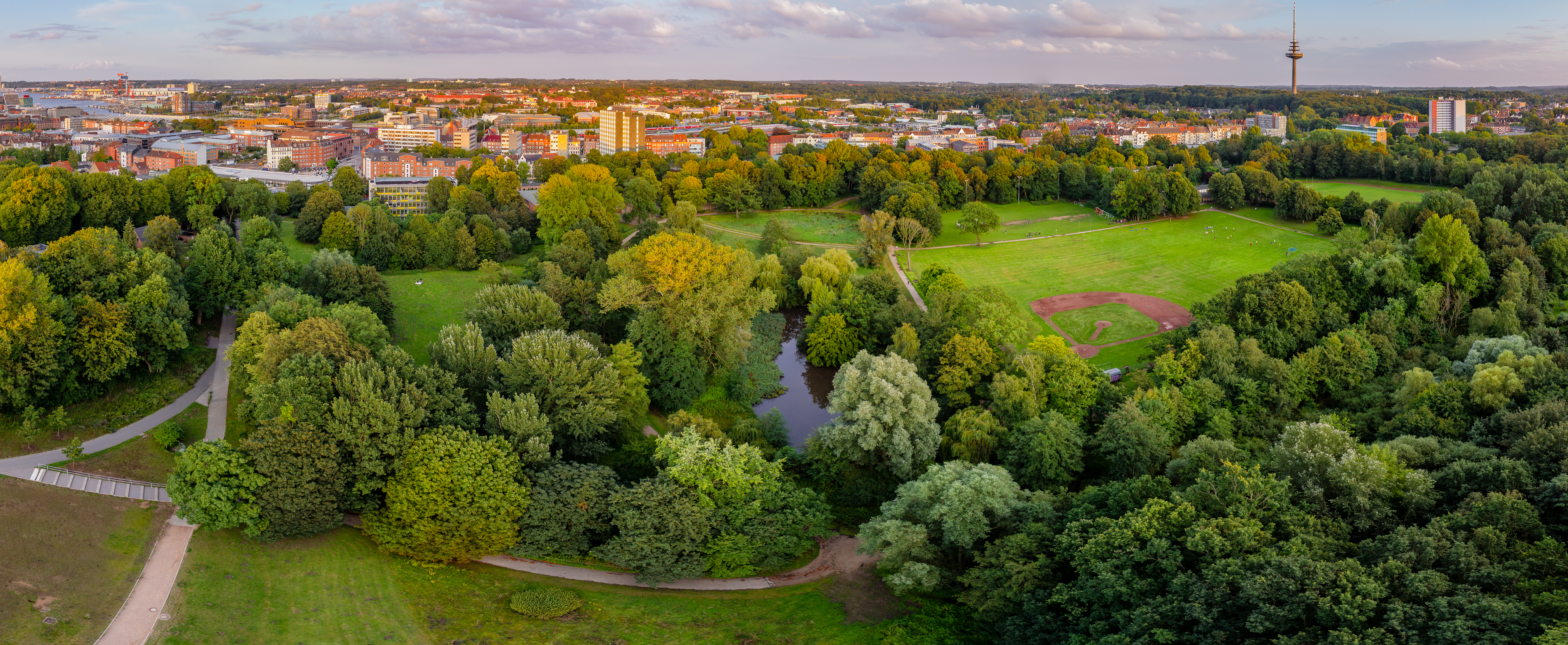
Overview panorama of the Moorteichwiese in Kiel.

Web links
Individual evidence
- ↑ Moorteichwiese opens up to the people of Kiel
- ↑ Moorteichwiese is becoming more attractive
- ↑ Moorteichwiese changes
- ^ Kieler Nachrichten: Apartment buildings released again. December 17, 2010, accessed March 2, 2017 .
Coordinates: 54 ° 18 ′ 35.6 ″ N , 10 ° 7 ′ 17.4 ″ E