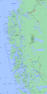
Moraleda Channel
| Moraleda Channel | ||
|---|---|---|
| Connects waters | Laguna San Raffael | |
| with water | Corcovado Gulf | |
| Separates land mass | Mainland South America | |
| of land mass | Chonos archipelago | |
| Data | ||
| Geographical location | 44 ° 24 '53 " S , 73 ° 25' 14" W | |
|
|
||
The Moraleda Canal is a strait between mainland Chile and the Chonos Archipelago . It is named after the Spanish navigator and cartographer José de Moraleda y Montero .
course
In the southern part of the canal there are two arms, the main arm leading to Laguna San Raffael and the national park of the same name . To the north, the Moraleda Canal merges into the Gulf of Corcovado . The channel reaches its deepest point at the level of Isla Magdalena.
use
The Moraleda Canal is an important shipping route in the region. In 1937 there were plans to connect the Moraleda Canal by a canal with the Rio Negro and thus with the Messier Canal , these plans failed when the financial means for the project ran out in 1943. Today cruise ships also pass through the canal.
Individual evidence
- ↑ Earth Snapshot • Moraleda Channel. Retrieved September 29, 2018 (American English).
- ^ Información general Parque Nacional Laguna San Rafael. Retrieved September 29, 2018 .
- ↑ Visiting the last sea nomads in Puerto Edén . In: German newspaper Cóndor - diario alemán Chile . February 5, 2018 ( condor.cl [accessed September 29, 2018]).
- ↑ {0} | Norwegian Cruise Line. Retrieved September 29, 2018 .


