Messier Canal
| Messier Canal | ||
|---|---|---|
| Connects waters | Gulf of Penas | |
| with water | Canal wide | |
| Separates land mass | Mainland South America | |
| of land mass | Wellington Island | |
| Data | ||
| Geographical location | 47 ° 49 ′ S , 74 ° 46 ′ W | |
|
|
||
| length | 133 km | |
| Greatest depth | 1288 m | |
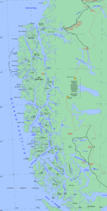
The Messier Canal ( Spanish Canal Messier ) is a strait in southern Chile between the island of Wellington and the mainland. It was named after Charles Messier . In the south, the strait merges into the Angostura Inglesa ( English Narrows ), which is only 180 meters wide .
The canal is one of the most important sea routes in Patagonia . It is located in the province of Capitán Prat of the XI. Aysén region and was already used 6000 years ago until the 20th century by the now extinct tribe of the Kawesqar , who had settled on its coasts.
Web links
- Past Glaciations and "Little Ice Ages". Retrieved February 19, 2011 .
- Sustrato y superestrato multilinguales en la toponimia del extremo sur de Chile. Retrieved February 19, 2011 (Spanish).
Individual evidence
- ↑ Navimag cruise. Retrieved February 19, 2011 .


