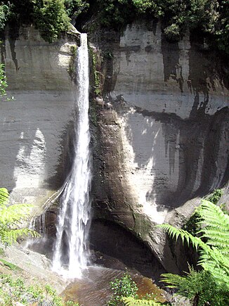
Mount Damper Falls
| Mount Damper Falls | ||
|---|---|---|
|
Mt.Damper Falls, Summer 2007 |
||
| Coordinates | 38 ° 55 '11.9 " S , 174 ° 47' 18.3" E | |
|
|
||
| place | District Stratford District , Region Taranaki , North Island (New Zealand) | |
| Falling watercourse | Mount Damper Stream | |
| Estuarine waters | Mount Damper Stream → Tongaporutu River | |
The Mt. Damper Falls are a waterfall on the North Island of New Zealand . They are located in the Stratford district of the Taranaki region .
With a height of 78 meters, they are the highest on the North Island. They are often referred to as "New Zealand's Second Highest Falls". However, this is not correct as they are dwarfed by many of the South Island's waterfalls , such as Browne Falls (619 m or 836 m depending on the calculation base) or Sutherland Falls at 580 m.

