
Muldenbrücke Nerchau
Coordinates: 51 ° 15 ′ 30 ″ N , 12 ° 47 ′ 0 ″ E
|
|
||
|---|---|---|
 |
||
| Convicted | Federal motorway 14 . | |
| Subjugated | United Mulde . | |
| place | Grimma , district of Nerchau | |
| construction | Composite steel bridge | |
| overall length | 342 m | |
| width | 2 × 20 m | |
| Longest span | Max. 71 m | |
| height | 30 m | |
| start of building | 1970 | |
| completion | 1971 | |
| opening | 1971 | |
| location | ||
|
||

The Muldenbrücke Nerchau is part of the federal motorway 14 and spans the United Mulde in the Nerchau district of Grimma and the Talaue on the west bank with the local road from Grimma OT Bahren to Trebsen OT Wednig. The 342 meter long girder bridge was built from 1970 to 1971 as a section of the Leipzig / East triangle Nossen motorway section.
Location and execution

The bridge is located in the north of Grimma between the districts of Bahren and Nerchau and spans the valley of the United Mulde at a height of around 30 meters above the valley floor.
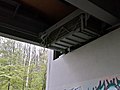
The structure consists of two parallel steel double girders on which the two non-touching directional lanes made of reinforced concrete lie (steel composite superstructure / pre-fabricated pre-stressed concrete). Because some of these reinforced concrete slabs are already very worn, during the emergency renovation in 2014, the carriageways were shifted inwards to the side at the expense of the outer hard shoulder.
The service life of the bridge is coming to an end, so the new building must be in place by around 2020. In order to be able to achieve this in the natural space and while maintaining the flow of traffic, a 361 m long replacement bridge is planned parallel to the south during the multi-year construction work.
The span between the five pairs of pillars from west to east is 41.9 m - 56.8 m - 56.8 m - 56.8 m - 71.5 m (hollow) - 57 m.
The heights are:
- River bed bottom of the United Mulde: 117 m above sea level
- High water mark 2002 on the eastern pier near the Muldentalbahnradweg: 127 m above sea level
- Construction upper edge: 143 m above sea level
- Difference in height of the entire bridge structure = 36 m
Special
The bridge construction together with the new A 14 Leipzig – Nossen was at that time the largest construction project of this kind in the GDR. It should also prove the efficiency of the young GDR and was therefore under special observation by the highest state organs. The size, but also the sinuous curve shape with the incline of the road, was a particular challenge under these conditions. It was not until 15 years later that it became known in Grimma that a planning error had caused an offset of around five meters between the bridge piers and the route to the east.
Extensive additional earthworks on the slope of the steep side valley to the east made it possible to create a compromise course between the two carriageway courses. A small disharmony in the course of the curve shows this even today.
During the floods in August 2002 , the structure was the only regional way to cross the Mulde for weeks. The two bridge piers standing directly on the western bank of the Mulden were not affected by the millennium floods in 2002 and 2013, as they were massive enough.
one of the two maintenance gondolas

View of the road layout

High water mark from 2002


