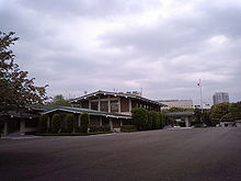
Nagatacho
Nagatachō ( Japanese 永田 町 ) is a district of the Japanese capital Tokyo . It houses the Parliament building , the official residence of the Prime Minister and several other government buildings. According to the 2015 census, Nagatachō had 526 inhabitants in 349 households, the daily population in 2015 was 25,060.
Nagatachō is located in the special Chiyoda district of the capital city of Tokyo and extends just under a kilometer southwest of the imperial residence . Because the elected organs of government have their seat in Nagatachō, the name is often used figuratively for the Japanese government. In contrast, Kasumigaseki - the name of the district that adjoins to the southeast - denotes the ministerial bureaucracy, as many ministries and central government agencies are located there.
Nagatachō has several subway stations: Nagatachō Station, Kokkaigijidō-mae Station, and Tameike-Sannō Station. Akasaka-mitsuke station is on the north-western border. The district is bounded in the northeast by the Uchibori-dōri ( 内 堀 通 り ) and the Tokyo C1 urban highway , in the east and southeast by the Roppongi-dōri ( 六 本 木 通 り ) and also partially underground by the Tokyo C1 urban highway, in the southwest and west by the Sotobori -dōri ( 外 堀 通 り ), as well as in the northwest of the Aoyama-dōri ( 青山 通 り ) and the Tokyo 4 city highway . The postal code of Nagatacho is 100-0014.
The following government buildings are located in Nagatacho:
- The parliament building houses the plenary halls of the lower and upper houses . There are also several office buildings for the MPs.
- Residences of the presidents of both chambers of parliament ( residence of the Shūgiin president and residence of the Sangiin president )
- National Parliament Library ( the German Embassy was located there from the Meiji period until 1945 )
- Kantei , the official seat of the Prime Minister, and his residence, the kōtei
- Cabinet Office and Cabinet Secretariat
In addition, Nagatachō is home to the national party headquarters of the Liberal Democratic Party , the Minshintō and the Social Democratic Party , several embassies, the Hie Shrine , a high school, hotels and some private office buildings, including the corporate headquarters of KK NTT DoCoMo , Prudential Seimei Hoken KK and Philip Morris Japan KK.
Individual evidence
- ↑ Chiyoda-ku / Chiyoda City: 町 丁別世 帯 数 お よ び 人口 (国 勢 調査) (Japanese: "Households and residents by district (census)", Excel), accessed on March 27, 2019.
- ↑ Chiyoda-ku: 千代 田 区 行政 基礎 資料 集 (平 成 30 年 版) (pdf), p. 25: 町 丁目 別 昼夜 間 人口 , accessed on March 27, 2019.
Web links
Coordinates: 35 ° 41 ′ N , 139 ° 45 ′ E

