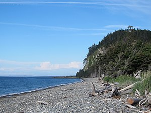
Naikoon Provincial Park
|
Naikoon Provincial Park
|
||
|
Tow Hill in the north of the park |
||
| location | British Columbia (Canada) | |
| surface | 690.71 km² | |
| WDPA ID | 4184 | |
| Geographical location | 53 ° 53 ' N , 131 ° 52' W | |
|
|
||
| Setup date | May 18, 1973 | |
| administration | BC parks | |
The Naikoon Provincial Park is an approximately 690 km² provincial park in the northwest of the Canadian province of British Columbia . It is located in the northeast on Graham Island and belongs to the North Coast Regional District .
In addition to several other protected areas (e.g. various Ecological Reserves ), the park, along with Pure Lake Provincial Park , is one of two provincial parks on the island. Naikoon is, in the Haida language , the name for Rose Point and means "long nose".
investment
The protected area on the Hecate Strait stretches from northeast to east along the coast of the island. The park is accessed from Highway 16 , through the communities of Masset in the north or Tlell in the south. Of the 69,071 ha protected area area, 66,961 ha are land and 2,110 ha are water and tidal fringes.
The park is a category II protected area ( national park ).
history
As with almost all provincial parks in British Columbia, it is also true that long before the area was settled by European immigrants or it was part of a park, it was a hunting and fishing area of various First Nations tribes , here the Haida .
The park was established on May 18, 1973 by Bill 174 , along with 9 other parks. Over time, the status of the park and its boundaries have changed several times. With the Protected Areas of British Columbia Amendment Act of 2009, the park boundaries were last changed. The park was reduced from 72,641 hectares back then to its present size.
Flora and fauna
British Columbia's ecosystem is divided into different biogeoclimatic zones using the Biogeoclimatic Ecological Classification (BEC) Zoning System . Biogeoclimatic zones are characterized by a fundamentally identical or very similar climate and the same or very similar biological and geological conditions. This results in a very similar population of plants and animals in the respective zones. The park is then assigned to the Coastal Western Hemlock Zone with the subzone Wet Hypermaritime (CWHwh).
In addition to the West American hemlock , which still grows here in a primary forest , and the Sitka spruce, there are also rare or threatened species such as the oyster plant ( Mertensia maritima , English sea bluebell) in the park.
According to the park administration, there are 170 different bird species in the park, 46 of which breed there. These include the sandhill crane and the jellyfish .
activities
The park is a popular destination for hikers and other outdoor sports enthusiasts. It offers a variety of hiking opportunities.
The park has a total of 69 parking spaces for mobile homes and tents, divided between a square in the north and a square in the south, and has sanitary facilities with showers.
Web links
- Naikoon Provincial Park . In: BC Geographical Names (English)
- Naikoon Provincial Park . In: English language website of the park at BC Parks
- Information to the park on britishcolumbia.com (Engl.)
Individual evidence
- ↑ World Database on Protected Areas - Naikoon Provincial Park (English)
- ↑ Biogeoclimatic Zones of British Columbia. British Columbia Ministry of Forests, Lands and Natural Resource Operations , accessed May 19, 2016 .
- ^ Naikoon Provincial Park - Management Plan - Section Five: Natural and Cultural Resources Management. (PDF; 51 KB) British Columbia Ministry of Environment, Lands and Parks , April 1999, accessed April 15, 2016 .
- ^ Ecosystems of British Columbia. British Columbia Ministry of Forests, Lands and Natural Resource Operations, February 1991, accessed April 15, 2016 .

