Masset (British Columbia)
| Masset | ||
|---|---|---|
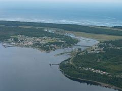
 Aerial view of Masset |
||
| Location in British Columbia | ||
|
|
||
| State : |
|
|
| Province : | British Columbia | |
| Regional District : | North Coast | |
| Coordinates : | 54 ° 1 ′ N , 132 ° 9 ′ W | |
| Area : | 20.61 km² | |
| Residents : | 884 (as of 2011) | |
| Population density : | 42.9 inhabitants / km² | |
| Time zone : | Pacific Time ( UTC − 8 ) | |
| Postal code : | V0T | |
| Website : | www.massetbc.com | |
| Climate diagram | ||||||||||||||||||||||||||||||||||||||||||||||||
|---|---|---|---|---|---|---|---|---|---|---|---|---|---|---|---|---|---|---|---|---|---|---|---|---|---|---|---|---|---|---|---|---|---|---|---|---|---|---|---|---|---|---|---|---|---|---|---|---|
| ||||||||||||||||||||||||||||||||||||||||||||||||
Masset is a village ( Village ) in northwestern British Columbia , Canada . It is located on Graham Island , in the North Coast Regional District and is one of the main settlement areas on the island. At Masset, the Masset Inlet flows into the Dixon Entrance , a Pacific strait between Canada and the United States of America.
To the west of the settlement is the northern entrance to Naikoon Provincial Park , while Pure Lake Provincial Park is 20 km south .
history
Originally the settlement was called Graham City , but was soon renamed New Masset, in contrast to the Haida village of Old Masset . The Haida settled here long before Juan Hernández in 1774 and James Cook in 1778 were the first Europeans to explore the archipelago. Masset is the oldest community founded by Europeans on the island.
The granting of local self-government for the municipality took place on May 11, 1961 ( incorporated as Village Municipality ).
Demographics
The 2011 census showed a population of 884 inhabitants for the municipality. The population decreased by 6.0% compared to the last census in 2006, while the population in the province of British Columbia increased by 7.0% at the same time. The median age of the population is 41.4 years, which is slightly above the provincial average of 39.9 years.
traffic
Masset is located on British Columbia Highway 16 , which is also the western section of the Yellowhead Highway .
Northeast of Masset is the local airfield, the Masset Municipal Airport ( IATA code : ZMT, ICAO code : CZMT, Transport Canada Identifier: -). The airfield only has a short asphalt runway 1,500 meters long.
Web links
- Masset ( English, French ) In: The Canadian Encyclopedia .
- Official website of the small town
- Masset on britishcolumbia.com (engl.)
Individual evidence
- ^ Origin Notes and History. Masset. GeoBC , accessed September 23, 2016 .
- ^ Masset Community Profile. Census 2011. In: Statistics Canada . May 31, 2016, accessed on September 23, 2016 .
- ↑ Canadian Airports Charts. (PDF; 29.5 MB) NAV CANADA , accessed on June 6, 2018 (English).
