Trakai National Park
| Trakai National Park | ||
|---|---|---|
| Trakai Castle in the heart of the park | ||
|
|
||
| Location: | Lithuania | |
| Next city: | Trakai | |
| Surface: | 82 km² | |
| Founding: | 1992 | |
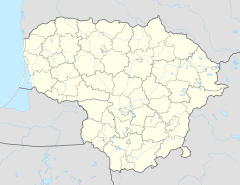
The Trakai National Park , actually Trakai Historical National Park (Lithuanian: Trakų istorinis nacionalinis parkas ) is a national park in Lithuania , 30 km west of Vilnius , which ostensibly serves to preserve cultural heritage. The center and administrative seat of the park with an area of 8,200 hectares is the town of Trakai , once the capital of Lithuania, with the famous moated castle. This also includes the former Senieji Trakai Castle and other archaeological sites.
The park includes numerous lakes, the largest of which are Galvė , Akmena and Skaistis , and the surrounding lakes Totoriškės and Luka Trakai and the moated castle.
Web links
Commons : Trakai National Park - Album with pictures, videos and audio files
- Official website (Lithuanian or English)

