Žemaitija National Park
| Žemaitija National Park | ||
|---|---|---|
| The plateliai lake | ||
|
|
||
| Location: | Lithuania | |
| Next city: | Plateliai , Plungė | |
| Surface: | 217.2 km² | |
| Founding: | 1991 | |
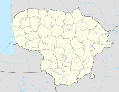
The Žemaitija National Park is a national park in northwest Lithuania , in the Lower Lithuania (Žemaitija) region . The national park was established in 1991. It occupies an area of 21,720 hectares. This is hilly country with many lakes. 7% of the area is occupied by lakes, the largest of which is the Plateliai . 26 lakes, small bodies of water and rivers, moors and floodplains are under protection. There is a strictly protected core zone called Plokštinė.
swell
- ↑ The Žemaitija National Park in Lithuania ( memento of the original from June 22, 2016 in the Internet Archive ) Info: The archive link has been inserted automatically and has not yet been checked. Please check the original and archive link according to the instructions and then remove this notice. // Europe's Wild East, MDR
Web links
- Official website of the national park in German
- Annotation to a TV program of the MDR ( Memento from October 10, 2004 in the Internet Archive )

