Nemuro Street
| Nemuro Street | ||
|---|---|---|
| Connects waters | Sea of Okhotsk | |
| with water | Pacific Ocean | |
| Separates land mass | Hokkaidō | |
| of land mass | Kunashir | |
| Data | ||
| Geographical location | 43 ° 40 ′ N , 145 ° 25 ′ E | |
|
|
||
| length | 74 km | |
| Smallest width | 24 km | |
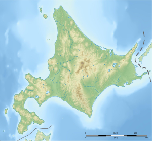
The Nemuro Strait ( Japanese 根 室 海峡 , Nemuro-kaikyō ), also known as Notsuke Strait and Strait of Kunashir ( Russian Кунаширский пролив ), is a strait between the southernmost Kuril Islands Kunashir ( belonging to Russia , claimed by Japan ) and the Shiretoko Peninsula in the northeast of Hokkaidō .
Web links
- Article Nemuro Street in the Great Soviet Encyclopedia (BSE) , 3rd edition 1969–1978 (Russian)
- Nemuro Strait and Shiretoko Peninsula from the NASA Earth Observatory

