Ogurja Ada
| Ogurja Ada | ||
|---|---|---|
| Satellite image | ||
| Waters | Caspian Sea | |
| Geographical location | 38 ° 58 ' N , 53 ° 3' E | |
|
|
||
| length | 35 km | |
| width | 2.5 km | |
| surface | 45 km² | |
| Residents | uninhabited | |
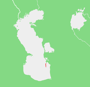
| Location in the Caspian Sea | ||
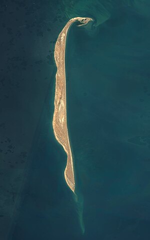
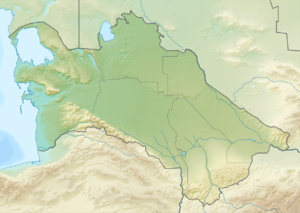
Ogurja Ada (Turkmen Ogurjaly adasy, Russian Ogurchinsky, English Orgurjaly Island ) is an island belonging to Turkmenistan in the Caspian Sea .
Name, history and settlement
The name comes from the neighborhood of Ogurch Stole on the located in the north peninsula Tscheleken back that has the shape of a curved cucumber (Ogurdja), eponymous was thus not the shape of the island itself.
On the island was Ogurdja, known since 1392 as a settlement of the late medieval Turkic tribe Ogurdşale (Ogurjaly, later used synonymously for "mad people", "pirates"). Pirates settled here from the 15th to the 17th century. They crossed over to the mainland in boats and plundered caravans of Persian merchants and sold salt and stolen goods. Relics of their settlement history can be found all over the island.
In the Soviet era, staying on the island was severely restricted. There was a colony for lepers . A lack of water stands in the way of permanent settlement.
geography
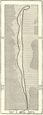
The elongated island, covered by flat sand dunes , is around 35 km long and a maximum of 2.5 km wide. During strong storms, the waves roll over the island in narrow places and change their contours. The northern tip was separated from the island, the southern tip (see map) is completely missing. The island is located around 15 km south of Cheleken and 70 km west of the rest of the Turkmenistan's coastline in the Caspian Sea. Ogurja Ada belongs to the Balkan welaýaty region .
nature
Numerous colonies of the Caspian seal live on the uninhabited island . The Russian naturalist Grigori Karelin (* 1801) visited the island in 1836 and spoke out in favor of using it as a maritime nature reserve and as a transport route for oil and salt to the Persian shore. After being placed under protection, the endangered Turkmenistan goitered gazelle was settled. Their food source is grass and low-growing bushes.
Individual evidence
- ↑ Geonames
- ↑ S. Ataniyazow: Dictionary of Turkmen Folk Names. Ylym, Ashgabat, 1988
- ↑ a b c d Goorchin Ostrow. - Entry in the Great Soviet Encyclopedia (Russian)
- ↑ Change to the map cf. Google Maps
- ^ The number of the Caspian seal on Ogurjaly


