
Olšina (pond)
| Olšina | ||
|---|---|---|
.jpg)
|
||
| Pond in winter | ||
| Geographical location | Bohemian Forest near Polná na Šumavě ( Czech Republic ) | |
| Tributaries | Olšina , Mokrá | |
| Drain | Olšina | |
| Data | ||
| Coordinates | 48 ° 47 '1 " N , 14 ° 6' 15" E | |
|
||
| Altitude above sea level | 731 m nm | |
| surface | 1.38 km² | |

The Olšina Pond (German Langenbrucker Teich ) is located near the villages of Olšina and Hodňov , about five kilometers northeast of Horní Planá in the municipality of Polná na Šumavě (Stone in the Bohemian Forest) in the Czech Republic .
history
It was probably created at the beginning of the 15th century, its first written mention comes from the year 1458. From the 16th century onwards it belonged to the Goldenkron monastery . After the abolition of the monastery, it fell under the rule of Krumlov. The pond has an area of 138 hectares and is located at an altitude of 731 m nm. It is fed by the Olšina ( Olschbach ) and is one of the highest ponds in Bohemia.
literature
- Franz Fink: "Langenbruck im Böhmerwald", documentation from the Langenbruck working group, 1986
gallery
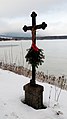
Cross on Olšina

Olschbach

Pond keeper's house
.jpg)
.jpg)
.jpg)
- Commons : Olšina (pond) - collection of pictures, videos and audio files