Orango
| Orango | ||
|---|---|---|
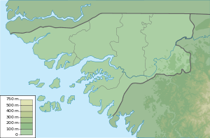
| Map of the Bissagos Islands with Orango | ||
| Waters | Atlantic Ocean | |
| Archipelago | Bissagos Archipelago | |
| Geographical location | 11 ° 6 ′ N , 16 ° 9 ′ W | |
|
|
||
| length | 22.5 km | |
| width | 22.5 km | |
| surface | 122.7 km² | |
| main place | Eticoga | |
| Orango in the UN sector | ||
The Ilha de Orango , also Ilha de Orango Grande or simply Orango , is an island in the Guinea-Bissau archipelago of the Bissagos Islands in the Atlantic Ocean .
With 122.7 km², Orango is the second largest island in the archipelago after Formosa (140.3 km²). The main town is Eticoga in the northwest. Orango is only separated from the neighboring islands in the east and south by narrow inlets. The Rio Anabaca separates the island of Canongo , 400 meters away, in the northeast , and the island of Meneque , 730 meters away, to the south . In the south, a meandering , only 75 meters wide arm of the sea separates the island of Imbane from Orango.
The island, which is part of the UNESCO biosphere reserve , was not colonized like the other islands in the archipelago - apart from the ports of the northern region of Cacheu and neighboring Bubaque . In this way the predominantly traditional beliefs and rites of the residents were preserved. The Austrian ethnologist Hugo Bernatzik lived on Orango in the 1930s and did research a. a. about the matriarchal way of life.
Administratively, Orango belongs to the UN sector of the Bolama region . Until the establishment of the Uno sector in 2004, the island was part of the Bubaque sector.
Individual evidence
- ↑ http://www.unesco.org/mabdb/br/brdir/directory/biores.asp?code=GBS+01&mode=all
- ↑ http://www.rituais.com/Downloads/Guine-Bissau-Bijagos/Guine-Bissau-Bijagos.pdf
Web links
- Private travel report (2009) with photo gallery (Portuguese)


