Pagönnienstrasse

The Pagönnienstraße is a street of Lübeck .
location
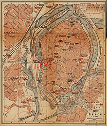
The approximately 70 meter long Pagönnienstraße is located in the south-western part of the old town island, the Marien Quartier . It begins at the Kolk , below the Petrikirche , and runs almost westwards until it joins and ends in the street An der Obertrave .
history
For the short and rather insignificant Pagönnienstraße, more street names and designations have been handed down over the centuries than for most of the other streets in Lübeck's old town. The name established today, which came about through a long series of sometimes bizarre corruptions and misinterpretations, is largely meaningless: The term Pagönnien does not exist; it is neither a Low German expression, nor was there ever a religious community with this name or a little-known saint named Pagönnia, as is sometimes assumed.
- When it was first mentioned in a document in 1317, the Latin name was simply Parva platea (Little Street)
- 1346: Parva platea, qua itur ad sanctum Petrum (small road that leads to St. Petri)
- 1356: Parva platea, qua descenditur ad sinistrum de sancto Petro (Small street that goes down to the left of St. Petri)
- 1421: Parva platea, vulgariter in the Procanien prope plateam Holsatorum (Small Street, commonly called in the Procanien, near the Holstenstraße ). This name became the origin of today's; the term in the Procanien is probably already falsely derived from the Latin word porcus for pig , probably going back to the pigsties located here. An equally probable different interpretation leads the name back to the Low German term Proge , which meant as much as rabble, low people and the character of the street as an area of poor or bad reputation described residents. Procania is changed beyond recognition over the following centuries
- 1428: Platea Braccanicarum and the Low German version Barkanyenstrate
- 1430: Barkenya rate
- 1433: Parkonia rate
- 1441: Burgunnienstrate
- 1443: Procania rate
- 1448: Council of Burgundy
- 1450: Brokinyen
- 1451: Broknigenstrate
- 1456: Broghonnia Council
- 1459: Progon rate
- 1460: Pargonia rate
- 1463: Borkonine estrate
- 1464: Brockoningestrate
- 1491: Prockgonia rate
- 1563: Progonnienstrate
- 1564: Prochgonia rate
- 1570: Progony rate
- 1614: Pockonienstrasse
- 1700: Pogonienstraße
- 1767: Beganienstrasse and Pajönnienstrasse
The current name was officially established in 1852.
The historical buildings on the north side of the street were destroyed in the bombing of March 1942 ; during the reconstruction after the Second World War , the old building line was not restored; Today, the unadorned rear of a department store built in the 1960s dominates with an entrance / exit to the car elevator to the parking deck on the roof and some parking spaces on this side of the street, which means that the spatial impression and scale of the entire street are lost. The Cleysen Almshouse used to be here (nos. 2–12).
On the south side there are preserved historical buildings, mostly simple houses from the late 18th and early 19th centuries.
Corridors and courtyards
One of Lübeck's corridors and courtyards started from Pagönnienstraße (according to house numbers):
- 5: Wendelsaal, a small living corridor with four apartments and two halls.
literature
- W. Brehmer : The street names in the city of Lübeck and its suburbs. HG Rathgens, Lübeck 1889.
- W. Brehmer: Lübeck house names along with contributions to the history of individual houses. HG Rathgens, Lübeck 1890.
- Klaus J. Groth : World Heritage Lübeck - Listed Houses. Over 1000 portraits of the listed buildings in the old town. Listed alphabetically by streets. Verlag Schmidt-Römhild, Lübeck 1999, ISBN 3-7950-1231-7 .
- Max Hoffmann: The streets of the city of Lübeck. In: Journal of the Association for Lübeck History and Archeology. Jg. 11, 1909, ISSN 0083-5609 , pp. 215-292 (also special print: 1909).
Web links
Coordinates: 53 ° 51 ′ 56.4 " N , 10 ° 40 ′ 53.4" E

