Pajusi
| Pajusi | |||
|
|||
| State : |
|
||
| Circle : |
|
||
| Coordinates : | 58 ° 42 ' N , 25 ° 57' E | ||
| Area : | 232.4 km² | ||
| Residents : | 1,457 (2010) | ||
| Population density : | 6 inhabitants per km² | ||
| Time zone : | EET (UTC + 2) | ||
| Website : | |||

|
|||
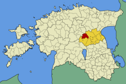
Pajusi (German: Pajus ) was an Estonian rural community in Jõgeva County with an area of 232.4 km². It had 1,457 inhabitants (as of January 1, 2010).
In addition to the main town Kalana (152 inhabitants), the municipality included the villages Aidu, Arisvere, Kaave , Kalana, Kauru, Kose, Kõpu, Kõrkküla, Lahavere, Loopre, Luige, Mõisaküla, Mõrtsi, Nurga, Pajusi, Pisisaare, Sopimetsa, Tapivikere, Uuevälja, Vorsti, Vägari and Väljataguse.
The community was rural (agriculture, forests). The Pajusi manor is particularly worth seeing with its 5.4 hectare park, which was laid out in the 19th century.
Web links
- Website of the Pajusi Municipality (Estonian)

