Pangon Island
| Pangon Island | ||
|---|---|---|
|
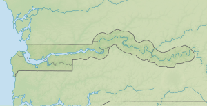
NASA World Wind satellite image : The Gambia flows here in the image section in a westerly and then in a northerly direction. Pangon Island lies in the arc to the north. |
||
| Waters | Gambia (river) | |
| Geographical location | 13 ° 33 '5 " N , 14 ° 47' 35" W | |
|
|
||
| length | 2.7 km | |
| width | 1 km | |
| Residents | uninhabited | |
The Pangon Island is an inland island in the Gambia River in the West African state of Gambia .
geography
Pangon Island is located immediately downstream from Janjanbureh Island and is just under 2.7 kilometers long and about one kilometer wide at its widest point. The island is close to the right bank of the Gambia, so that only a narrow channel remains. The river's fairway is approximately 150 meters wide and five to ten meters deep.
See also
literature
- Stephen C. Stringall, Dody Broyles: Gambia. International Travel Maps, Vancouver 2003, ISBN 1-55341-217-6 (map, 96 × 61 cm, 1: 350,000).
Web links
- Islands of the Central River Division http://www.birdlife.org

