Tank (Remscheid)
|
tank
City of Remscheid
Coordinates: 51 ° 10 ′ 55 ″ N , 7 ° 16 ′ 37 ″ E
|
||
|---|---|---|
| Height : | 277 m above sea level NN | |
|
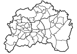
Location of tanks in Remscheid |
||
Panzer was a court in the southeast of the Bergisch city of Remscheid in North Rhine-Westphalia . The residential area has been devastated since the 1970s .
Location and description
Panzer belonged to the Lennep district and was located at a height of 277 meters above sea level on the Panzerbach (also called Lenneper Bach) below the dam of the tank dam . The districts and locations of Hasenberg , Käsberg , Repslöh , Oberfeldbach and Schneppendahl are located around Panzer .
history
Panzer was first mentioned in a document in 1487 as Panßer . The location is recorded in 1789 on the map of the Duchy of Berg by Carl Friedrich von Wiebeking . In 1836 the Ackergut Panzer owned a residential building in which 18 residents lived. In 1815/6 the population was 26 souls.
Individual evidence
- ^ E. Erwin Stursberg : Remscheid and his communities , Remscheid, 1969
- ↑ Johann Georg von Viebahn: Statistics and Topography of the Administrative District of Düsseldorf, 1836
