Parc national des Îles-de-Boucherville
|
Parc national des Îles-de-Boucherville
|
||
|
Chenal du Courant-Îles-de-Boucherville |
||
| location | Quebec , Canada | |
| surface | 8.14 km² | |
| WDPA ID | 66605 | |
| Geographical location | 45 ° 37 ′ N , 73 ° 28 ′ W | |
|
|
||
| Setup date | 1984 | |
| administration | Parcs Québec, SEPAQ | |
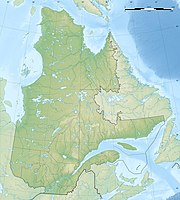
The Parc national des Îles-de-Boucherville is one of the current 27 national parks in the Canadian province of Québec . There a parc national corresponds to what is called a provincial park in the other provinces . The park is operated by Sépaq ( French Société des établissements de plein air du Québec or English Society of outdoor recreation establishments of Quebec ).
The park corresponds to the Îles de Boucherville archipelago belonging to the Hochelaga archipelago in the Saint Lawrence River and is located in the extreme south of the province near Boucherville, east of Montreal . The purpose of the park, which was established in 1984 and only measures 8.14 km², is to preserve the flora and fauna of the area and to protect the buildings dating from the late 17th century from the French colonial era. The provincial government wanted to forestall property speculators when the park was founded and bought the area.
history
At the site, which is called BjFi-7 according to the Borden system , numerous structural remains from the French colonial era were found. They belonged to the Boucher-de-Grosbois house, which was built at the end of the 17th century. Grosbois Island was used for pleasure trips in the 20th century. This included a racecourse, kiosks and stalls, pavilions and exhibition rooms. The amusement mile was known as Parc Edward II . The collaboration with the local Société d'histoire des Îles-Percées , the local history association, was only started in 2010.
Agriculture has been practiced on the islands since the 17th century. The mixed culture was replaced by monoculture around 1964 , so that only maize was planted. When the park was set up, 248 hectares were still cultivated within the protected area. By 2008 this area had decreased to 64 ha. In 2012 a further 48 hectares are to be set aside, and agriculture is to be finally ended by 2016. In 1974 the first investigations were carried out on the fish spawning grounds, which contributed significantly to putting the area under protection.
fauna
The map mute turtle , here called tortue geographique , was first included in an inventory in 2003. It lives mainly in the Marais, the wetlands of the northern arm of the Chenal Grande-Rivière and on the Charron Island. Endangered snakes such as Nerodia sipedon also live in the park.
Coyotes and foxes were counted among mammals, and the same applies to the small mammals in the park. Marsh birds were last counted in 1974. In 2010, the stocks should be recorded mainly on the Saint-Jean island. Insects were examined in 2008.
See also
literature
- The research scientifique dans les Parcs nationaux québécois. Priorités et potentiels de recherche , published by Parcs Québec and Sépaq, undated, pp. 81–86.
Web links
- Parc national des Îles-de-Boucherville , Sépaq (French)
Individual evidence
- ↑ Arkéos inc. (Ed.): Fouille et inventaire archéologique au site BjFi-7 Île Grosbois, parc des Îles-de-Boucherville. Planification stratégique de mise en valeur du patrimoine archéologique du Parc des Îles-de-Boucherville , 2002.
- ↑ J.-Y. Authier: Piégeage d'insectes au parc des Îles-de-Boucherville. Results d'enquêtes de dépistage 2008 , 2009.


