Paso Real de Sarabia
| Paso Real de Sarabia | ||
|---|---|---|
|
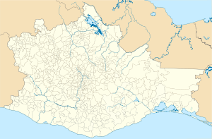
Coordinates: 17 ° 4 ′ N , 95 ° 3 ′ W Paso Real de Sarabia on the map of Oaxaca
|
||
| Basic data | ||
| Country | Mexico | |
| State | Oaxaca | |
| Municipio | San Juan Guichicovi | |
| Residents | 1019 (2010) | |
| Detailed data | ||
| height | 110 m | |
| Waters | Río Sarabia | |
| Post Code | 70340 | |
| Time zone | UTC −6 | |
Paso Real de Sarabia or Sarabia is a Mexican village with about a thousand inhabitants in the state of Oaxaca and belongs to the municipality of San Juan Guichicovi . In the village, as in the entire community of San Juan Guichicovi, the indigenous population forms the absolute majority with a proportion of well over four fifths of the total population.
geography
Sarabia lies at an altitude of about 110 meters above sea level, a few meters above the right bank of the Río Sarabia , which flows in a north-easterly direction to the Río Coatzacoalcos , in the Sarabia plain . The next place is Estación Sarabia , located about one kilometer southeast of Sarabia. The mountain range of the same name of Sarabia (recorded as Cerro Sarabia , Mountain of Sarabia ) is located about five kilometers further south.
history
In the 19th century the place was called Sarabia City in addition to Sarabia . In the middle of the 19th century, an American company set up camp here, consisting of three tents and a few palm houses, which also had objects under construction, as Johann Wilhelm von Müller mentioned in his notes on his trip through Mexico. It is worth mentioning that the mouth of the river Sarabia was called Paso del Sarabia , Malpaso (de Sarabia) or Malo Paso (de Sarabia) and means something like erroneous, wrong passage / pass (of the Sarabia) , while the place is now far from the mouth is called the real or correct passport / passage of the Sarabia in the translation .
swell
- Travels in the United States, Canada and Mexico by Johann Wilhelm von Müller, 1864, p. 402f in the Google book search
- The isthmus of Tehuantepec by JG Barnard, New York 1864 in the google book search
- Data on Sarabia
Individual evidence
- ↑ see The isthmus of Tehuantepec by JG Barnard, p. 16
Web link
- Enciclopedia de los Municipios y Delegaciones de México: details on the environment, population, location of the municipality of San Juan Guichicovi including Paso Real de Sarabia (Spanish)
