Patiti Island
| Patiti Island | ||
|---|---|---|
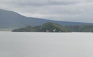
| Patiti Island seen from the boat launch at the end of the Waimangu Valley | ||
| Waters | Lake Rotomahana | |
| Geographical location | 38 ° 16 ′ S , 176 ° 27 ′ E | |
|
|
||
| surface | 17 ha | |
With an area of 17 hectares, Patiti Island is the only larger island in Lake Rotomahana in the Waimangu Valley in the Bay of Plenty region in the north of the North Island of New Zealand .
The approximately 18,000 year old lava dome was separated from the mainland by the rise in the water level in the lake after the eruption of Mount Tarawera . Since the animals in the area were killed as a result of the volcanic eruption, the island remained free from the fox kusu (possum) and other larger introduced animals. Only mice and rats colonized the island and damaged the local fauna and flora. Deer and wild boar occasionally visit the island.
The operator of the tourist use of the Wainmangu Valley, Waimangu Voolcanic Valley Ltd. , agreed with the Department of Conservation in June 2001 to restore the island's native flora and fauna. However, the island itself does not belong to the area that the company operates with a DOC license. Most of the island belongs to the Crown, the eastern part to Iwi Onuku .
By November 2001, the organisms on the island were cataloged by the DOC and the possibilities for restoring the original flora and fauna were assessed. All non-native trees were removed in 2001/2002. From 2003 to 2005, the mice and rats on the island were exterminated with poison bait in order to be able to colonize endangered native birds.
Individual evidence
- Information Sheet Environmental Restoration of Patiti Iceland. , Waimangu Volcanic Valley Ltd.

