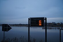
Level in Frankfurt (Oder)
There are five levels in Frankfurt (Oder) ; two on the Oder river and three on the Klinge stream .
Level on the Oder
From October 1, 1810 to 1824, regular water level observations of the Oder were carried out in Frankfurt at a gauge at the road bridge. Because of a bridge fire in 1813, there are no observations for the period from February 24 to March 5, 1813. From 1824 to the end of 1874, the water level was read from a gauge on the wall of the Packhof. The zero point of the level was lowered by 3 cm on May 29, 1841. From January 1, 1875 to March 31, 1896, the water level observations were made at a gauge on the old Frankfurt bridge. From June 1, 1896, the water level was read from a gauge on the Frankfurt road bridge, which was newly built that year. The new location was 130 m upstream of the old road bridge on the left bank of the Oder at river kilometer 584 and was retained into the 21st century.
Today, the observations are carried out 1.3 km downstream at an inclined level with level bars installed diagonally along the embankment, which is called "Level Frankfurt 1 (Oder)". It was built in 2003/04 and equipped with a write level. The operation initially took place parallel to the old gauge. Since the beginning of the discharge year 2006, the water level observations at the new gauge "Frankfurt 1 (Oder)" have been decisive. The level observations at the historic location were discontinued on November 1, 2007.
The water level observations at the Frankfurt (Oder) gauge are consistently documented in the hydrological yearbook from the discharge year 1901 , only for the period from January to June 1945 there are no entries.
| Period | Height above sea level in m | annotation |
|---|---|---|
| before November 1, 1936 | 18,516 | |
| from November 1, 1936 | 17.52 | Lowering of the level zero point on July 7, 1937, valid retrospectively from the beginning of the discharge year |
| from November 1, 1994 | 17.53 | |
| from November 1, 2005 | 17.20 | new gauge Frankfurt 1 (Oder) |
- Gauge Frankfurt (Oder) , level code 6030300, operator: State Office for the Environment, sporadic measurement of the flow, flood reporting level, level is kept in the German Hydrological Yearbook, water body code in the digital water network: 6, catchment area code in the digital catchment area data set: 679151, catchment area size of the level: 53,492, 78 km², distance to the source: 421.77 km

- Level Frankfurt 1 (Oder) , level code 6030300, Oder, operator: Federal Waterways and Shipping Administration, level is listed in the German Hydrological Yearbook

Level on the blade
-
Gauge Frankfurt (Oder) Beckmannstrasse , gauge number 6919600, operator: State Office for the Environment, measurement of the flow, water body code in the digital water network: 67916, catchment area code in the digital catchment area data set: 6791691, catchment area size of the gauge: 20.95 km², distance to the source: 7.012 km

-
Gauge Frankfurt (Oder) Simonsmühle , gauge code 6919300, operator: State Office for the Environment, measurement of the flow, water body code in the digital water network: 67916, catchment area code in the digital catchment area data set: 6791691, catchment area size of the gauge: 13.91 km², distance to the source: 5.094 km

-
Gauge Frankfurt (Oder) Westkreuz , level code 6919100, operator: State Office for the Environment, measurement of the flow, water body code in the digital water network: 67916, catchment area code in the digital catchment area data set: 6791611, catchment area size of the gauge: 8.20 km², distance to the source: 2.434 km

Web links
- Current water levels and discharges for the gauge: Frankfurt (Oder) / Oder. In: www.luis.brandenburg.de. State Office for Environment, Health and Consumer Protection (LUGV) Brandenburg, flood reporting center Frankfurt (Oder), accessed on August 14, 2016 .
- ITZBund: FRANKFURT1 (OR). In: PEGELONLINE. Retrieved August 14, 2016 .
- Current water levels and discharges for the gauge: Ffo., Beckmannstrasse / Klinge. In: www.luis.brandenburg.de. State Office for Environment, Health and Consumer Protection Brandenburg, Flood Reporting Center Frankfurt (Oder), accessed on August 14, 2016 .
Individual evidence
- ^ Level Frankfurt / Oder. In: undine.bafg.de. Project of the Federal Ministry for the Environment, Nature Conservation, Building and Nuclear Safety "Improvement of the data basis for the assessment of hydrological extremes" (project leader: Dr. Daniel Schwandt) c / o Federal Institute for Hydrology, accessed on December 5, 2017 .


