
Pfaffenwald
|
district of Stuttgart |
|
|---|---|
 |
|
| Coordinates | 48 ° 45 ′ 0 ″ N , 9 ° 6 ′ 0 ″ E |
| surface | 2.582 km² |
| Residents | 3407 (May 31, 2020) |
| Population density | 1320 inhabitants / km² |
| Post Code | 70569 |
| prefix | 0711 |
| Borough | Vaihingen |
| Source: Data Compass Stuttgart (PDF) | |
The Pfaffenwald is a wooded area in the southwest of Stuttgart and gives its name to the Vaihinger campus of the University of Stuttgart . Both form the Pfaffenwald district . In the north, the forest of the red and wild boar park joins the park lakes . The Pfaffenwald lies on the wide plateau of the Filder and is now part of the Stuttgart-Vaihingen district .
At the edge of the Pfaffenwald lies the campus of the University of Stuttgart , next to which residential buildings were also built. Later research institutes and other universities were added on Nobelstrasse and newer residential developments on Allmandring. A former private observatory built as a tower is now the Pfaffenwald University Observatory .
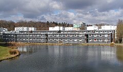
Housing development, observatory
and the forest, a pond in front

