Phu Bia
| Phu Bia | ||
|---|---|---|
|
Phou Bia, the Nam Ngum Lake viewed from |
||
| height | 2850 m | |
| location | Laos | |
| Mountains | Truong Son | |
| Coordinates | 18 ° 59 ′ 0 ″ N , 103 ° 8 ′ 0 ″ E | |
|
|
||
| particularities | highest mountain in Laos | |
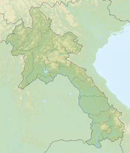
The Phu Bia ( Lao : ພູ ເບັ້ຍ even Phou Bia written) is approximately 2,850 meters the highest mountain in Southeast Asia Laos . It is located in the Truong Song Mountains and lies on the southern edge of the Xieng Khouang Plateau with the plain of the clay jugs . The area around the mountain is in a dense jungle area and is difficult to reach.
After the end of the Vietnam War in 1975, around 60,000 members of the Hmong minority fled to the difficult-to-access area and resisted the new communist government for decades. Many of the refugees served as mercenaries for the American CIA during the Vietnam War , many of them in the secret US military base Long Cheng Code Name Lima Site 20A under the command of Vang Pao . The mountain and its surroundings have been declared a restricted area by the Lao government. Duds from US bombing are also a major threat. There are few foreigners who have climbed the mountain in the past 40 years. But there are plans to change this.
literature
- Christopher Robbins, The Ravens: Pilots of the Secret War in Laos. Asia Books 2000.
Individual evidence
- ↑ www.spiegel.de (2008) Several hundred Hmong are still entrenched in the inaccessible mountains of the Laotian highlands. They are constantly hungry, their children cannot go to schools and they have no future. Sometimes the Hmong guerrillas attack an intercity bus or an army camp, then the Laotian military fights back mercilessly.
- ↑ thaipbs.or.th Phu Bia to be developed as Laos' new tourist site

