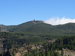
Pico de las Nieves
| Pico de las Nieves | ||
|---|---|---|
| height | 1949 msnm | |
| location | Gran Canaria , Spain | |
| Coordinates | 27 ° 57 '43 " N , 15 ° 34' 19" W | |
|
|
||
At 1949 meters above sea level, the Pico de las Nieves is the second highest point on the Spanish island of Gran Canaria . The summit is on the tip of an extinct volcano in the sparsely populated interior of the island. In winter this elevation is sometimes covered with snow, which is what gave it its name.
Traditionally it was assumed that the Pico de las Nieves is the highest point on the island of Gran Canaria, but this is the Morro de la Agujereada at 1956 meters, which is next to the Pico de las Nieves.
The peak falls in the eastern parish of Tejeda .
Individual evidence
Web links
Commons : Pico de las Nieves - Collection of images, videos and audio files

