
Tejeda
| Tejeda municipality | |||
|---|---|---|---|
| coat of arms | Map of the Canary Islands | ||

|
|
||
| Basic data | |||
| Autonomous Community : | Canary Islands | ||
| Province : | Las Palmas | ||
| Coordinates | 27 ° 58 ′ N , 15 ° 39 ′ W | ||
| Height : | 1050 msnm | ||
| Area : | 103.29 km² | ||
| Residents : | 1,909 (Jan 1, 2019) | ||
| Population density : | 18.48 inhabitants / km² | ||
| Postal code : | 35360 | ||
| Municipality number ( INE ): | 35025 | ||
| administration | |||
| Mayor : | Francisco Juan Perera Hernández (Agrupación de Electores Tejeda (AET); as of 2020) | ||
| Address of the municipal administration: | Plaza de Socorro, s / n 35360 - Tejeda |
||
| Website : | www.tejeda.eu | ||
| Location of the municipality | |||

|
|||

Tejeda is a municipality on the Canary Island of Gran Canaria .
The highest points of the municipality, the Pico de las Nieves ( 1949 msnm ) and the Roque Nublo ( 1813 msnm ), are the highest mountains on Gran Canaria after the Morro de la Agujereada .
Tejeda is located southwest of Las Palmas de Gran Canaria and north of Puerto Rico . The neighboring communities are Valleseco in the north, Vega de San Mateo in the east, San Bartolomé de Tirajana in the southeast, Mogán in the south, San Nicolás de Tolentino in the west and Artenara in the northwest.
Residents
| year | Residents | Population density |
|---|---|---|
| 1991 | 2,361 | - |
| 1996 | 2,552 | - |
| 2001 | 2,400 | 23.3 inhabitants / km² |
| 2002 | 2,402 | - |
| 2003 | 2,351 | 22.8 inhabitants / km² |
| 2004 | 2,374 | 22.7 inhabitants / km² |
| 2005 | 2,341 | 22.7 inhabitants / km |
Picture gallery
Tejeda with Roque Nublo and Roque Bentayga

town hall

The Parador at Cruz de Tejeda

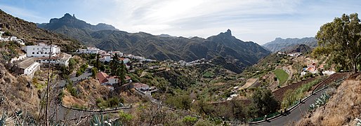
View of the valley


Iglesia Nuestra Señora del Socorro

View from the south
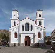
facade

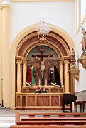
inner space
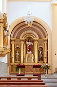
Left side altar
Right side altar
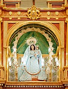
Virgen del Socorro


Web links
Individual evidence
- ↑ Cifras oficiales de población resultantes de la revisión del Padrón municipal a 1 de enero . Population statistics from the Instituto Nacional de Estadística (population update).
Agaete | Agüimes | Artenara | Arucas | Firgas | Gáldar | Ingenio | Mogán | Moya | Las Palmas | San Bartolomé de Tirajana | La Aldea de San Nicolás | Santa Brígida | Santa Lucía de Tirajana | Santa María de Guía | Tejeda | Telde | Teror | Valleseco | Valsequillo | Vega de San Mateo