
Santa Lucía de Tirajana
| Santa Lucía de Tirajana municipality | |||
|---|---|---|---|
| coat of arms | Map of the Canary Islands | ||

|
|
||
| Basic data | |||
| Autonomous Community : | Canary Islands | ||
| Province : | Las Palmas | ||
| Island: | Gran Canaria | ||
| Coordinates | 27 ° 51 ′ N , 15 ° 28 ′ W | ||
| Height : | 680 msnm | ||
| Area : | 61.56 km² | ||
| Residents : | 73,328 (Jan 1, 2019) | ||
| Population density : | 1,191.16 inhabitants / km² | ||
| Municipality number ( INE ): | 35022 | ||
| administration | |||
| Mayor : | Dunia González Vega ( NC ) (as of 11/2014) | ||
| Address of the municipal administration: | Avda. de las Tirajanas n ° 151 35110 Vecindario |
||
| Website : | www.santaluciagc.com | ||
| Location of the municipality | |||

|
|||

Santa Lucía de Tirajana is a municipality on the Canary Island of Gran Canaria . It has 73,328 inhabitants (as of January 1, 2019) on an area of 61.56 km². It is located south of Las Palmas de Gran Canaria and northeast of Puerto Rico . The neighboring communities are Agüimes in the north and San Bartolomé de Tirajana in the south and west. Its area is narrow and elongated and extends from the coast to the interior of Gran Canaria. The center itself is in the mountains, at the top of a barranco. Due to the favorable location, there is enough water so that the valley appears green and palm trees can grow, and a park with lush vegetation could be created in the center. Where there is no water supply, wasteland dominates . The area extends from the town center to the Atlantic Ocean, where more residents and businesses are located than in the mountains.
history
Santa Lucía de Tirajana has an important historical meaning, because there are many cave structures and the fortress "Fortaleza de Ansite" - it consists of countless cave structures and does not look like a classic fortress. The caves there used to be used by the Canarios (indigenous people of Gran Canaria) not only as homes, but also as graves. This fact draws even more attention to the architectural achievements of these cave accommodations in Santa Lucía de Tirajana.
economy
The main economic activities are trade, accompanied by agriculture (fruits, flowers, ...), which grow mainly in greenhouses. Tourism is also a major industry, as it is on the entire island.
Population development
| year | Residents | Population density |
|---|---|---|
| 1991 | 33,059 | 537.0 inhabitants / km² |
| 1996 | 40.127 | 651.8 inhabitants / km² |
| 2001 | 47,653 | 774.0 inhabitants / km² |
| 2002 | 49.902 | 810.6 inhabitants / km² |
| 2003 | 52,684 | 855.8 inhabitants / km² |
| 2004 | 53,820 | 882.6 inhabitants / km² |
| 2005 | 56,268 | 914.0 inhabitants / km² |
| 2006 | 57.211 | 929.4 inhabitants / km² |
| 2007 | 58,335 | 947.6 inhabitants / km² |
Web links
- Santa Lucía de Tirajana in the Gran Canaria Lexicon (German)
- Santa Lucía de Tirajana official website (Spanish)
Picture gallery
Iglesia Santa Lucía de Tirajana


Works of art

El Matriarcado

Lucy and Star Boy
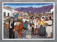
Romeria de los Labradores

Antonius Maria Claret y Clará


Individual evidence
- ↑ Cifras oficiales de población resultantes de la revisión del Padrón municipal a 1 de enero . Population statistics from the Instituto Nacional de Estadística (population update).
- ↑ Cifras oficiales de población resultantes de la revisión del Padrón municipal a 1 de enero . Population statistics from the Instituto Nacional de Estadística (population update).
- ↑ Anuario Estadístico de Canarias. 2007. (PDF; 2.26 MB) In: Gobierno de Canarias. Canarian Institute for Statistics, September 2008, p. 40 , accessed on February 1, 2014 (Spanish).
Agaete | Agüimes | Artenara | Arucas | Firgas | Gáldar | Ingenio | Mogán | Moya | Las Palmas | San Bartolomé de Tirajana | La Aldea de San Nicolás | Santa Brígida | Santa Lucía de Tirajana | Santa María de Guía | Tejeda | Telde | Teror | Valleseco | Valsequillo | Vega de San Mateo