Agaete
| Agaete municipality | ||
|---|---|---|
| coat of arms | Map of the Canary Islands | |

|
|
|
| Basic data | ||
| Autonomous Community : | Canary Islands | |
| Province : | Las Palmas | |
| Coordinates | 28 ° 6 ′ N , 15 ° 42 ′ W | |
| Height : | 43 msnm | |
| Area : | 45.5 km² | |
| Residents : | 5,586 (Jan 1, 2019) | |
| Population density : | 122.77 inhabitants / km² | |
| Postal code : | 35480 (Agaete), 35489 (Puerto de las Nieves) | |
| Municipality number ( INE ): | 35001 | |
| administration | ||
| Mayor : | Maria del Carmen Rosario Godoy | |
| Address of the municipal administration: | C / Antonio de Armas, 1 35480 Agaete |
|
| Website : | www.aytoagaete.es | |
| Location of the municipality | ||

|
||
Agaete is a municipality in the northwest of the Canary Island of Gran Canaria . Politically it belongs to the province of Las Palmas . Most of the residents live in the main town of the same name, which marks the entrance to the Barranco de Agaete . Agaete is west of Las Palmas and northeast of Puerto Rico . The neighboring communities are Gáldar in the northeast and Artenara in the south. The district at the port is called Puerto de las Nieves . The place is strongly agricultural due to its fertile cultural landscape. The products used to be shipped via Puerto de las Nieves .
traffic
From Puerto de las Nieves , the shipping company Fred. Olsen Express offers direct, regular ferry connections to Santa Cruz on the neighboring island of Tenerife . Las Palmas is around 20 minutes by car on the GC-2 motorway . The place is connected to the network of public buses.
As things stand today (summer 2013), the largely four-lane coastal island expressway ends in Agaete, coming from the island's capital Las Palmas and the airport in a counterclockwise direction. Closing the gap to the south in the direction of Mogan and Puerto Mogan is planned and partly in progress, but in view of the financing problems of the Spanish state and the construction industry, it will be a few years away. The rest of the traffic along the western cliffs takes place south of the small port of Puerto de las Nieves via a relatively narrow and winding pass road, which in some places offers breathtaking views of the Atlantic and, if visibility conditions are good, also of the neighboring island of Tenerife and the Pico de Teide volcano .
The cul-de-sac that opens up the Valle de Agaete begins in Agaete, which begins to the east just behind Agaete and is one of the most beautiful valleys ( Barranco ) on the island. The higher you go uphill on this approximately ten kilometer long road in the valley, the greener the valley, which is used for growing fruit and vegetables. Finally, the dew drops of the high air humidity wet you, which mostly blows from the north with the trade wind over the neighboring mountains. At the end of the cul-de-sac there is an abandoned spa hotel complex and a bus stop.
Attractions
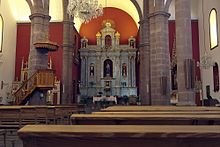
In the old town center, which is dominated by Canarian mansions with typical wooden balconies, the parish church Iglesia de la Concepción rises in the central plaza . The structurally simple church was built in 1875 on the site of an older previous building, which was destroyed by fire the year before. During the annual Bajada de la Rama celebrations, the image of the Snow Maiden kept in the chapel of Puerto de las Nieves is brought to the parish church of Agaete, where the Blessed Mother is invoked as advocate for rain. In the urban park Huerto de las Flores (German: flower garden ) on the edge of the town center, impressive specimens of tropical and endemic Canarian flora ( dragon trees) were planted. The most important landmark and local mountain of Agaete is the Monte Tamadaba .
Web links
Individual evidence
- ↑ Cifras oficiales de población resultantes de la revisión del Padrón municipal a 1 de enero . Population statistics from the Instituto Nacional de Estadística (population update).
- ↑ a b Birgit Borowski, Achim Bourmer, Hans-Jürgen Fründt: Gran Canaria . Baedeker, 2005, ISBN 978-3-8297-1087-9 , pp. 132 .
- ↑ http://www.parquesnaturales.com/municipios/fichamunicipio.asp?MUNICIPIO=35001&T=AGAETE (link not available)


