Santa Cruz de Tenerife
| Santa Cruz de Tenerife municipality | ||
|---|---|---|
| coat of arms | Map of the Canary Islands | |

|
|
|
| Basic data | ||
| Autonomous Community : | Canary Islands | |
| Province : | Santa Cruz de Tenerife | |
| Island: | Tenerife | |
| Coordinates | 28 ° 28 ′ N , 16 ° 15 ′ W | |
| Height : | 4 msnm | |
| Area : | 150.56 km² | |
| Residents : | 207.312 (Jan 1, 2019) | |
| Population density : | 1,376.94 inhabitants / km² | |
| Founding: | 1496 | |
| Postal code : | 38000 | |
| Municipality number ( INE ): | 38038 | |
| Nearest airport : | Aeropuerto de Tenerife Norte (6.2 mi / 10 km from the city center) | |
| administration | ||
| Mayoress : | Patricia Hernández Gutiérrez (PSOE) | |
| Address of the municipal administration: | C / Viera y Clavijo, 46 38004 Santa Cruz de Tenerife |
|
| Website : | santacruzdetenerife.es | |
| Location of the municipality | ||

|
||
Santa Cruz de Tenerife [ ˈsanta ˈkɾuθ ðe ˌteneˈɾife ], also abbreviated Santa Cruz , is the capital of the province of the same name and next to Las Palmas de Gran Canaria one of the two capitals of the autonomous community of Canarias . The full name and title of the city has been since August 28, 1803: Muy Leal, Noble e Invicta Villa, Puerto y Plaza de Santa Cruz de Santiago (Very loyal, noble and undefeated city, port and place of the Holy Cross of Saint Jacob) . The city in the northeast of Tenerife has a population of 207,312 (as of January 1, 2019) and, together with La Laguna , Tegueste and El Rosario, forms the second largest metropolitan area in the Canary Islands after Las Palmas de Gran Canaria with a total of around 423,000 inhabitants. The area administered by Santa Cruz extends into the sparsely populated Anaga Mountains in the east of the island. The city is significantly shaped by its port, which is one of the largest Spanish seaports in the Atlantic .
climate
The city's meteorological data are shaped by the trade winds (wet winds from the northeast). This results in different weather developments for parts of the city: Sunny and dry on the coast, humid and cloudy on the heights and in the valleys of the Anaga Mountains. The warmest year for the city recently was 1995 with an average temperature of 22 ° C. The coldest, with an average temperature of 20 ° C, was the year 1920. The rainfall is low and has a focus in the months of October to March.
| Santa Cruz de Tenerife, downtown | ||||||||||||||||||||||||||||||||||||||||||||||||
|---|---|---|---|---|---|---|---|---|---|---|---|---|---|---|---|---|---|---|---|---|---|---|---|---|---|---|---|---|---|---|---|---|---|---|---|---|---|---|---|---|---|---|---|---|---|---|---|---|
| Climate diagram | ||||||||||||||||||||||||||||||||||||||||||||||||
| ||||||||||||||||||||||||||||||||||||||||||||||||
|
Average weather data for the period 1981-2010
Source: aemet.es
|
||||||||||||||||||||||||||||||||||||||||||||||||||||||||||||||||||||||||||||||||||||||||||||||||||||||||||||||||||||||||||||||||||||||||||||||||||||||||||||||||||||||||||||||||||||
location
The place is located on the eastern tip of Tenerife, the largest island in the Canary Archipelago. The area of the urban area is about 150 km². It comprises very different areas, on the one hand the rocky, almost uninhabited area of the Anaga Mountains, on the other hand the sloping terrain from the area of the Acentejo to the coast. The highest point in the city is around 750 meters above sea level. (Vienna is about 150 meters above sea level.) In contrast, there are parts of the city in the center of the city, such as B. the Plaza de España, which are barely 4 meters above sea level. The city has a coastline of 58 kilometers.
Administrative division
The city is divided into five administrative districts (Distritos Administrativos), in each of which several districts (Barrios) are combined.
- Zona Anaga is the largest district in terms of area, but with the smallest number of inhabitants (13,806 in 2010). It covers the area of the Anaga Mountains in the northeastern part of the island, in which there are barrios that are difficult to access. The largest part of the district is San Andrés . There is the Playa de Las Teresitas , a bathing beach that has been filled with sand that is repeatedly imported from Africa. San Andrés is connected to the city center by an expressway.
- Zona Centro is the district of the city in which the oldest settlement areas are located. The three listed ensembles of historical importance ( Bien de Interés Cultural , Conjunto Histórico) are part of this urban district. In this district is the main economic center of the city with the shopping streets, the administrative offices, the large bank branches and some traditional residential areas and parks. In 2010, 52,698 people lived in this district.
- Zona Salud is the district with the largest population (67,916 in 2010). On the one hand there are industrial areas with the refinery, but there are also historical areas such as the Castillo Negro with the Polveron. The Torres de Santa Cruz are located in this district as well as the Auditorio de Tenerife and the modern buildings on Avenida Tres de Mayo.
- Zona Ofra was transformed from a small industry district to a new residential area in the 1970s with the support of the city. There is a large number of high-rise apartment buildings here, such as B. along the avenue Avenida Príncipes de España, which was redesigned as part of the construction of the tram. In this district there is also the Universitario Nuestra Señora de Candelaria Hospital, one of the hospitals of the University of La Laguna. In 2010, 45,273 people lived in the district.
- Zona Suroeste is a district that is separated from the rest of the city by the Montaña de Taco and the TF2 motorway. In this district, as in the district of Anaga, urban development is expanding slowly due to the nature of the terrain. There are also areas used for agriculture here. The population was 47,408 in the year.
Area metropolitana de Santa Cruz de Tenerife
In the course of the 20th century, the number of inhabitants increased and with it the areal expansion not only of the city of Santa Cruz, but also of the neighboring communities. This resulted in the cities of Santa Cruz de Tenerife, San Cristóbal de La Laguna and Tegueste and El Rosario growing together. The area of these four cities, where more than half the population lives, makes up about 15% of the total area of the island. So far (2013) there has been no formal merger to form the Área Metropolitana de Santa Cruz de Tenerife, only agreements and close cooperation between the city administrations, e.g. B. in the field of transport, education, sport etc.
population
The common name for the inhabitants of the city is Chicharrero or Chicharrera . It used to be a derogatory term used by the wealthy inhabitants of the city of La Laguna to name the inhabitants of the poor and small fishing port of Santa Cruz. These fishermen lived on chicharro ( horse mackerel ), a cheap fish that they ate themselves or sold on the streets of La Laguna after shouting out loud. According to the lexicon of the Spanish language of the Real Academia Española , the name today denotes all residents of the island of Tenerife (synonym for Tinerfeño).
While the city's population increased by around 1.75% per year over the course of the 20th century, the numbers stagnated in the 21st century. This is e.g. This is partly due to the fact that an expansion of the residential development is becoming more and more difficult and the population is moving to the neighboring communities (Área Metropolitana).
In 2010 the number of foreign residents was 17,990, which corresponds to 7.92% of the total population. This proportion varied in the individual districts: in the district of Anaga, 3.59%, in the district of Centro, 11.14% of the inhabitants were foreigners. At 10,733 people (59.66%), the majority of foreigners came from Latin America (although it cannot be determined whether at least some of the 124 North Americans were Latinos ). 23.79% came from Europe, 656 of them (approx. 0.3% of the total population) from Germany. 0.17% of the population have Indian citizenship.
Population development of the municipality

history
Situation before 1495
After several attempts at proselytizing and occupying the Canary Islands since the 13th century, the systematic conquest of the archipelago began in 1402 under the suzerainty of the kings of Castile by the Norman Jean de Béthencourt . By 1405 he brought the islands of Lanzarote , Fuerteventura , La Gomera and El Hierro under his rule, which he exercised in the name of the Crown of Castile. In 1464, Diego García de Herrera tried to take possession of Tenerife for his wife Inés Peraza de las Casas , who had inherited the right to take all the Canary Islands from her father. He built a temporary fortification near the later Castillo de Paso Alto. His efforts to bring the island under his government, however, failed. Some monks settled near the later city of Candelaria , but they were not very successful in their missionary work.
In 1477 Queen Isabella I regained the right to conquer the large Canary Islands (Tenerife, La Palma and Gran Canaria) in return for a severance payment. As a result, there were counties ( condados ) and lordships ( señorías ) on the small islands (hence Islas de señorío ), while the large islands were directly subordinate to the queen or king ( Islas de realengo ). In the Treaty of Alcáçovas in 1479 , Castile and Portugal agreed on a division of the world. The Canary Islands fell to Castile. Since the Canary Islands were on the cheapest sea route to America, they gained special importance after 1492. In order to confirm the property claims on all islands against Portugal, the large islands now also had to be captured. By the year 1493 - with the exception of Tenerife - all the islands of the archipelago had been incorporated into the dominion of the Crown of Castile. Queen Alonso entrusted Fernández de Lugo , who had already led the conquest of La Palma , with the task of conquering Tenerife .
Conquest by Castilian troops
The area that is now the inner city of Santa Cruz de Tenerife was inhabited by some Guanche families before the subjugation of the Crown of Castile and Leon , who lived here primarily from agriculture, especially from the rearing of goats . The people lived in naturally formed caves. There are also some traditional descriptions of simple, free-standing stone buildings. The focus of the settlement was the upper area of the Barranco de Santos. The landscape was rich in water, but mainly overgrown with Tabaiba and Brezo . In the language of the indigenous people of Tenerife, the area was called Añazo or Añaza and belonged to the Menceyato (Principality) of Anaga. This menceyato belonged to the four areas (Anaga, Güimar, Abona and Adeje) whose inhabitants were not hostile to the Castilians. In contrast, resistance was to be expected from the inhabitants of the areas on the north side of the island (Tegueste, Tacoronte, Taoro, Icod and Daute).
For a landing to conquer the island, the coastal area of today's Santa Cruz offered the advantage that it was on the Gran Canaria side of Tenerife. In contrast to other landing sites on the same side of the island, e.g. B. San Andrés , there was also the opportunity to get into the interior of the island or to the north side of the island without encountering mountain slopes and gorges that could hardly be negotiated. On May 1, 1494, Castilian troops under the leadership of Alonso Fernández de Lugo landed on the coast from Gran Canaria. The information about the strength of the troops vary between 1000 and 2000 men and 120 and 200 horses. It is certain that in addition to Castilian soldiers, auxiliary troops who had been recruited from the local population on the other Canary Islands also took part.
The landing probably took place at two landing sites, which were near today's oil refinery south of the Castillo Negro (Castillo San Juan). Landing was not easy, as both the soldiers and the horses had to be brought to the beach by rowing boats from the ships lying in the roadstead, in order to come ashore wading through the water. A fortified camp was built north of the Barranco de Santos. This place offered better protection against attacks from the mountains than the place where the troops had landed. The wooden cross erected here by Fernández de Lugo is still in the Iglesia de la Concepción today . The first mass is said to have been celebrated in the quickly erected chapel on May 3rd, 1494. May 3rd is the holiday of the finding of the cross . Hence the settlement founded later got the name "Santa Cruz". After the First Battle of Acentejo , in which the indigenous Guanches caused a severe defeat for the Castilians, the remaining troops left the island at the same point at which they had entered it.
At the end of 1495 the Castilians landed again on the coast of Añazo under the leadership of Alonso Fernández de Lugo. This campaign of conquest was successful after the battles near what is now La Laguna , known as the Battle of Aguere, and La Victoria de Acentejo , known as the Second Battle of Acentejo. The natives surrendered to the Castilians in the army camp that was built in the area of today's city of Los Realejos .
Development in the 16th and 17th centuries
As the first city Alonso Fernández de Lugo had the city of San Cristóbal de La Laguna founded. For the foundation of a new city on the plateau of Aguere about ten kilometers from the sea and more than 550 meters above sea level, in contrast to an expansion of Santa Cruz, three reasons are put forward by historians: The first reason is an appropriate distance from the coast. Even without fortifications, this offered protection from attacks by pirates, who were always to be expected at the time. The second reason was the location on one of the few almost flat land areas on the island. The last reason was the nature of the soil and the climate in Aguere, as the plain was named. This enabled the cultivation of grain and provided good pastures for livestock. There was also a lake through which a stream flowed, the Laguna, whose water could be used to irrigate the fields in the area. In addition, the city of La Laguna could be supplied with drinking water from the Mercedes Forest through a water pipe without too much effort. The city of La Laguna was created as a residential, commercial and administrative city. In the center of what was then the only town on the island, apart from a town granary, no agricultural buildings were built.
After the island was firmly in the hands of the Castilian conquerors, Alonso Fernández de Lugo distributed the land in the name of the Queen of Castile to those who had contributed in a special way to the victory. The queen's demand to respect the rights of the indigenous peoples who did not oppose Christianization was hardly met. Individual conquistadores were given agricultural land and urban building plots in different areas of the islands. The transfer of ownership of the land happened with various conditions. So z. For example, that the new owners had to provide for the agricultural use or, in the case of urban land, for adequate development, that if they had a family, they had to bring them to the island within 18 months; if they did not have a family, they should have a family within 18 months. In the case of irrigated land, there was sometimes the requirement to build a plant for processing sugar cane. The land could not be transferred to another person (except by inheritance) within the first five years. The new owners of larger estates in the area of today's Santa Cruz de Tenerife built their main residence mostly in La Laguna. The place Santa Cruz was only the port of the city of San Cristóbal de La Laguna. All business deals and all customs formalities for export and import were done in La Laguna. Puerto de La Orotava (now Puerto de la Cruz) was in a similar situation across from La Orotava.
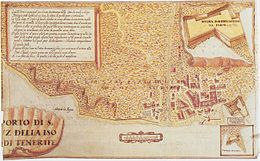
In 1584, King Philip II sent the Italian fortress builder Leonardo Torriani to La Palma and commissioned him in 1587 to write a report that should show the existing defenses on all Canary Islands and make suggestions for improvement. From 1588 there is a depiction of the town and port of Santa Cruz de Tenerife. He proposed improvements to the Castillo San Cristóbal and other strategic points in the port. Shortly before 1551, a pier was built as a landing stage at the point where the access to the quays is still located today (east of today's Plaza de España). Here the rowing boats that transported the goods between the ships in the roadstead and the land could be unloaded. The breakwater was repeatedly damaged by heavy seas and storms. After a storm in 1600 there was no pier until 1604.
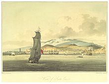
Although the bay was visited by various ships of European countries to wine and sugar produced in Tenerife to load, but also often by only drinking water for the crossing to America bunkering , Santa Cruz appears de Tenerife in the illustrations as a poor Village of fishermen and dock workers with around 200 households. In addition, the place and some landing sites had strategic importance for the defense of the island. Torriani's interest was therefore directed more towards the landing sites on the north side of the island, which he classified as considerably more important.
During the 16th and 17th centuries, the military installations on the coast were expanded according to the recommendations of Torriani. In addition to the Castillo San Cristóbal, which was started in 1575, the Castillo de Paso Alto was built in 1625 and the Castillo de San Juan (Castillo Negro) in 1641. In addition, further batterias (gun posts) were built between these fortresses. Whether the attack by a squadron of the English fleet on Santa Cruz in 1657 was against the city and the port of Santa Cruz, or the ships of the Spanish Silver Fleet, is disputed. Coming from America, they had headed for Santa Cruz because of the blockade of the port of Cadiz. The ports of Garachico and Puerto de La Orotava, today's Puerto de la Cruz, experienced a great boom in the 16th and 17th centuries when a large part of the products intended for export, first sugar and later wine, were opened up the north side of the island. At the end of the 17th century over 80% of the island's exports and imports went through Puerto de La Orotava.
Development in the 18th century
The boom for Santa Cruz began in the 18th century. In 1707, Santa Cruz had 1,707 residents. In 1739 6,000 people inhabited the place and in 1768 already 7,399. More fishermen and dock workers settled on the south side of the Barranco de Santo in the Barrio del Cabo. The economic center of the city shifted from the church square to the Plaza Candelaria, where numerous merchants, some of foreign origin, settled.
One reason for the upswing is the decision of the then general captain of the Canary Islands, who moved his official seat from La Laguna to Santa Cruz. Other administrative institutions followed, such as most of the customs and tax authorities, so that all customs and tax matters on the island, including those of the other ports, were settled in Santa Cruz. The Supreme Court of the Canary Islands (Audiencia real), chaired by the Captain General, continued to meet in Las Palmas de Gran Canaria, as has been customary since 1527. The island's transport system has been improved. As a result, goods made on the north side of the island could be brought to Santa Cruz more easily. At the latest after the English attack was fended off in 1706 , the city was considered safe, so that many traders also moved their residential and business headquarters from La Laguna to Santa Cruz.
Whether the volcanic eruption, which lasted from May 5 to June 13, 1706 and destroyed the city and port of Garachico , was responsible for the rise of Santa Cruz is controversial. The known export figures indicate that the importance of the port of Garachico for exports had already declined considerably before its destruction.
The attack on Santa Cruz de Tenerife (1797) was the first serious attempt by foreign troops to land after the Canary Islands were incorporated into the Kingdom of Castile. This attempt could be effectively repulsed. This defensive work, which was also provided with militia troops from other parts of the island, increased the prestige of the place.
Development in the 19th century
Since when Santa Cruz de Tenerife is a city independent of the administration in La Laguna is considered controversial. While some historians consider 1803 (award of the title "Muy Leal, Noble, Invicta y Muy Benéfica Ciudad, Puerto y Plaza de Santa Cruz de Santiago de Tenerife") as the year of the declaration of Santa Cruz as an independent city, the city administration also called the date 1859.
As part of the reorganization of Spain into "Provincias" by the Cortes of Cádiz and again by decrees of King Ferdinand VII , Santa Cruz de Tenerife became the capital of the Provincia Santa Cruz de Tenerife. However, these decrees were all repealed. It was not until the administration of Spain was reorganized in 1833 that the city of Santa Cruz de Tenerife was established as the capital of the province of Santa Cruz de Tenerife , which until 1927 included all of the Canary Islands.
When the diocese, which so far comprised all of the Canary Islands, was divided into an eastern and a western diocese in 1819, not Santa Cruz but La Laguna was designated as the bishopric of the western islands.
In the middle of the 19th century, an overall plan to expand the port facilities was decided and largely implemented. On the one hand, it provided for new piers and landing stages, but also orderly storage facilities, better traffic management and a separation of trading and fishing ports. In 1852 the Canary Islands were declared a free trade area. This meant that the islands were not part of Spain for customs purposes and that all imports and exports from the islands were duty-free. At that time, supplying ships on the American route with coal was an important source of income. The imported coal was stored in the port and then brought with barges to the ocean liner anchored in the roadstead.
In the 19th century, the population of the city rose sharply: 1824 = 7,822 inhabitants, 1860 = 14,146 inhabitants, 1877 = 16,610 inhabitants, 1887 = 19,722 inhabitants and 1897 = 33,421 inhabitants. This increase in population led to an expansion of the built-up urban area. At the end of the 19th century, the city administration drew up development and city expansion plans for the first time. The systematic development of the outskirts of the then urban area was carried out by private construction companies, with the city participating financially in the companies. The layout of the Barrio de los Hoteles district, which is now a listed building, is an example of the approach taken by these companies . The growth of the city and the expansion of the city, state and military administration led to the construction of a number of representative buildings in the mid to late 19th century. So z. B. the Town Hall (started in 1899) and the Capitanía General de Canarias (started in 1879). The building of the dissolved Dominican monastery was demolished and a new market hall (started in 1847) and the Guimerá theater (started in 1848) were built on this site. On December 6, 1883, the first telegraph connection was established by a submarine cable between Cadiz and Santa Cruz de Tenerife. In 1893 a cholera epidemic spread to the city and neighboring communities. The disease was brought by an Italian ship returning from Brazil. There were 382 deaths.
Development in the 20th century
With the construction of a tram connection between Santa Cruz and La Laguna in 1901, the two cities began to grow together to form the Área metropolitana de Santa Cruz de Tenerife. The tram line was extended to Tacoronte in 1904.
In the 1912 Law on the Creation of Cabildos in the Canary Islands, Santa Cruz de Tenerife was confirmed as the capital of the province, which at that time included all the Canary Islands. However, some higher authorities and courts have also been set up on other islands. As a special facility, a separate cabildo was created for each island. It is a collegial body elected by the population that performs administrative tasks above the local government and below the provincial administration. In 1913 the first Cabildo for Tenerife met in Santa Cruz de Tenerife. In 1933 the first plans for an administration building for the Cabildos (Palacio Insular) were drawn up. The construction on the Plaza de España could not be completed until 1940.
The division of the Canary Islands into two provinces in 1927 led to the loss of importance of the city of Santa Cruz in favor of the city of Las Palmas de Gran Canaria. The provinces were directly subordinate to the government in Madrid. An administrative unit encompassing the entire archipelago was only created again in 1996 through the creation of the Comunidad Autónoma de Canarias.
After the Popular Front's electoral victory in the election of the Cortes on February 16, 1936, the government in Madrid restructured the army command and relocated all generals suspected of a coup to places as far away as possible from Madrid. General Francisco Franco y Bahamonde was appointed Capitan General of the Canary Islands in Santa Cruz de Tenerife. At the beginning of the coup that led to the Spanish Civil War, Franco flew to Morocco from Gran Canaria.
During the civil war of 1936, large numbers of citizens of the city of Santa Cruz de Tenerife took part in hostilities on the mainland. In the first months of the civil war, around 1,400 people who were suspected of being opponents of the coup were interned on a camp site in Santa Cruz de Tenerife, which the English banana export company Fyffes made available to the insurgent military. The whereabouts of many of these people is still largely unclear. In the period from 1936 to the mid-1950s, many residents of the city immigrated illegally to South America - particularly Venezuela - for political and economic reasons.
The self-sufficiency policy of the Spanish government during World War II and until the mid-1950s resulted in major economic losses in the port's sales. Only the more open trade policy introduced at the end of the 1950s led to an expansion of economic activity, which was also reflected in an increase in private construction activity.
In 1982 Santa Cruz de Tenerife and Las Palmas de Gran Canaria became the capital of the Comunidad Autónoma de Canarias. This means that the seat of the Presidente del Gobierno (which roughly corresponds to the German Prime Minister of a federal state) changes in each legislative period. Parliament always meets in Santa Cruz de Tenerife.
Development in the 21st Century
The economic development of the first years of the 21st century led to the merging of the cities of Santa Cruz de Tenerife and La Laguna into the Área metropolitana de Santa Cruz de Tenerife , particularly through the construction of houses and the establishment of small business zones . The redesign of the Plaza de España and the fundamental redesign of the port zone, as well as the blocking of the city center for through traffic and the tunneling under Avenida Tres de Mayo led to a traffic calming in the area of the city center.
Various spectacular buildings, such as B. El Rascacielo from 1974, the trade fair and congress center Centro Internacional de Ferias y Congresos de Tenerife (1996) by the architect Calatrava, the Auditorio (1997–2003) by the same architect, the Torres de Santa Cruz (2004–2006) , the TEA (2008) or the Edificio Olympo (1976), shape the cityscape almost as much as the traditional historical buildings.
Tourism is of great importance for the city, even if not as "overnight tourism", but as "shopping tourism" for tourists from the tourist centers of Playa de las Americas / Los Cristianos and Puerto de la Cruz, which have the advantages of being cheaper compared to mainland Spain Use VAT of 7% (2013) especially for technical devices.
Protected cultural assets
There are a number of cultural assets in the city that were already protected before the Del Patrimonio Histórico Español Cultural Protection Act came into force . After the Cortes Generales passed the law in 1985 , the boundaries and surroundings of many of these cultural assets were clearly delineated and protected by new legal instruments issued by the government of the Canary Islands. Some of the cultural assets in the area of the city of Santa Cruz de Tenerife are located in rural areas e.g. B. in the Anaga mountains. The following list is u. This may be inaccurate, as some of the cultural assets have been included in the list of "Bienes" as a preventive measure for a long time, but the final determination has not yet been made or because the ordinance specifies a different category than the entry in Madrid. Sometimes in the Registro in Madrid the city of Santa Cruz de Tenerife is confused with the province (with *). The order corresponds to the arrangement in the register. Multiple answers are mostly due to changes in the inclusion of the environment.
- Table of cultural assets in the area of the city of Santa Cruz de Tenerife
| Cultural asset | category | number of registration | Illustration |
|---|---|---|---|
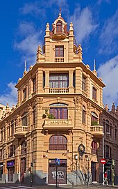
| La Financiera | Monumento | (RI) 51-0010987-00000 |

|
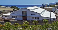
| Almacén de Cepsa | Monumento | (ARI) - 51 - 0010991 - 00000 |
|
| Templo Masónico | Monumento | (RI) - 51 - 0010945 - 00000 |

|
| El Barranco del Muerto | Zona Arqueológica | (ARI) - 55 - 0000756 - 00000 | |
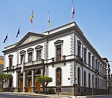
| El Ayuntamiento | Monumento | (ARI) - 51 - 0007041 - 00001 |

|
| Iglesia de Nuestra Señora de la Concepción | Monumento | (RI) - 51 - 0004924 - 00001 |

|
| Museo Municipal | Monumento | (ARI) - 51 - 0001343 - 00001 |

|
| Antiguo Hospital Civil | Monumento | (ARI) - 51 - 0004989 - 00001 |

|
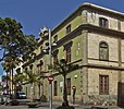
| Delimitación de la Escuela de Artes Aplicadas y Oficios | Monumento | (ARI) - 51 - 0007042 - 00001 |
|
| Palacio de Cartas | Monumento | (ARI) - 51 - 0001208 - 00001 |

|
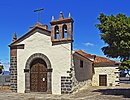
| Delimitación de la Ermita de San Telmo | Monumento | (ARI) - 51 - 0007043 - 00001 |
|
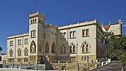
| Delimitación Antiguo Colegio de la Asunción | Monumento | (ARI) - 51 - 0007048 - 00001 |
|
| Delimitación Círculo de Amistad XII de Enero | Monumento | (ARI) - 51 - 0008723 - 00001 |

|
| Delimitación del Teatro Guimerá | Monumento | (ARI) - 51 - 0004828 - 00002 |

|
| Parlamento de Canarias | Monumento | (RI) - 51 - 0011237 - 00000 |

|
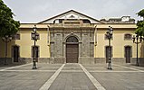
| Delimitación del Antiguo Mercado | Monumento | (RI) - 51 - 0004828 - 00001 |
|
| Biblioteca Pública del Estado | Bibliotecas | (RI) - BI - 0000026 - 00000 |

|
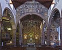
| Delimitación de la Iglesia Parroquial de San Francisco | Monumento | (ARI) - 51 - 0008731 - 00001 |
|
| Iglesia de Nuestra Señora de la Concepcion | Monumento | (RI) - 51 - 0004924 - 00000 |

|
| Molino del Llano del Moro | Monumento | (RI) - 51 - 0010632 - 00000 |

|
| Casona de la calle del General Franco (Casa esquina de los carros) * | Monumento | (ARI) - 51 - 0010633 - 00000 | |
| Museo Municipal | Monumento | (RI) - 51 - 0001343 - 00000 |

|
| Palacio de Cartas | Monumento | (ARI) - 51 - 0001208 - 00000 |

|
| Inmueble Calle del Castillo 44 | Monumento | ./. | |
| Antiguo Hospital Civil | Monumento | (RI) - 51 - 0004989 - 00000 |

|
| Teatro Guimerá y Antiguo Mercado | Monumento | (RI) - 51 - 0004828 |

|
| Edificio Calle Castillo 45 | Monumento | (ARI) - 51 - 0006909 - 00000 | |
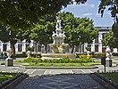
| Plaza Weyler | Monumento | (ARI) - 51 - 0007046 - 00000 |
|
| Monumento del Parlamento de Canarias Institucion Musical Santa Cecilia | Monumento | (ARI) - 51 - 0007047 - 00000 |

|
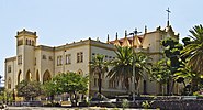
| Antiguo Colegio de la Asunción Tenerife Santa Cruz de Tenerife | Monumento | (RI) - 51 - 0007048 - 00000 |
|
| Institucion de Villasegura (Antigua Escuela de Comercio) | Monumento | (ARI) - 51 - 0007049 - 00000 |

|
| Casas Consistoriales del Ayuntamiento | Monumento | (RI) - 51 - 0007041 - 00000 |

|
| Ermita de San Telmo | Monumento | (RI) - 51 - 0007043 - 00000 |

|
| Cementerio de San Rafael y San Roque | Monumento | (RI) - 51 - 0007044 - 00000 |

|
| Museo Municipal de Bellas Artes etc. | Monumento | (ARI) - 51 - 0007045 - 00000 |

|
| Escuela de Artes Aplicadas y Oficios Artísticos | Monumento | (RI) - 51 - 0007042 - 00000 |

|
| Casino | Monumento | (RI) - 51 - 0007420 - 00000 |

|
| Castillo de Paso Alto | Monumento | (RI) - 51 - 0008255 - 00000 |
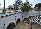
|
| Castillo de San Andrés | Monumento | (RI) - 51 - 0008256 - 00000 |
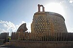
|
| Castillo de San Juan | Monumento | (RI) - 51 - 0008257 - 00000 |

|
| Castillo de San Joaquín | Monumento | (RI) - 51 - 0008258 - 00000 |
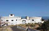
|
| Edificio Circulo de Amistad XII de Enero | Monumento | (RI) - 51 - 0008723 - 00000 |

|
| Iglesia Parroquial de San Francisco | Monumento | (RI) - 51 - 0008731 - 00000 |
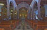
|
| Parroquia de María Auxiliadora (Barrio de Duggi) | Monumento | (ARI) - 51 - 0009272 - 00000 |
|
| Barrio de los Hoteles - Pino de Oro | Conjunto Histórico | (RI) - 53 - 0000394 - 00000 |

|
| Conjunto Histórico Artístico El Toscal | Conjunto Histórico | (ARI) - 53 - 0000395 - 00000 | |
| Conjunto Histórico Artístico El Tanque * | Conjunto Histórico | (ARI) - 53 - 0000409 - 00000 | |
| Zona Arqueológica Barranco del Muerto | Zona Arqueológica | (ARI) - 55 - 0000355 - 00000 | |
| Zona Arqueológica Barranco del Pilar | Zona Arqueológica | (ARI) - 55 - 0000356 - 00000 | |
| Archivo Histórico Provincial | Archivos | (RI) - BI - 0000026 - 00000 |

|
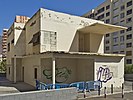
| Casa Mascareño | Monumento | (RI) - 51 - 0010602 - 00000 |
|
| Casa Sixto Machado | Monumento | (ARI) - 51 - 0010603 - 00000 |

|
| Church of San Antonio de Padua * | Monumento | (RI) - 51 - 0010623 - 00000 |
Attractions
Places
- Plaza de la Candelaria
The Plaza de la Candelaria forms the center of the city's pedestrian area. For many years the square was the political and economic center of the city with the building of the city administration and the seat of the Capitan General as well as the proximity of the most important trading houses. An important aqueduct ended at this place. Events are held regularly on the square. For this purpose, a stage is usually set up on the east side and the place rising to the west is used as an auditorium.
- Plaza de España
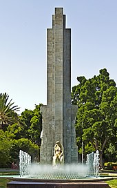
The Plaza de España is partially located on the site of the Castillo de San Cristóbal defensive structure, which was demolished at the beginning of the 20th century. At the end of the 1940s, an imposing memorial for those who died in the civil war was erected here at the entrance to the city from the harbor. The central importance of this monument for the square was weakened by the redesign of the area in 2006 - 2008.
- Alameda
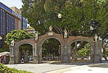
The Alameda del Duque de Santa Elena was a park that is now included in the overall design of the Plaza de España . The plant was suggested by the Comandante General Miguel de la Grúa Talamanca, Marqués de Branciforte. The military engineer Andrés Amat de Tortosa was commissioned with the planning. The costs were raised through donations from the citizens and contributions from the Marqués de Branciforte. The entrance to the avenue was formed by three arches that were crowned by a royal coat of arms. Between the arches there were allegorical marble figures of spring and summer on pilasters. The park had three parallel paths on which Indian laurel and plane trees were planted. At the end of the middle path there was a marble fountain made in Genoa. Due to the proximity of the sea, the planting suffered a lot from the salt water and the wind. As part of the port expansion, the gate was demolished in the 20th century. When the Plaza de España and the banks were redesigned in the years 2006 - 2008, the Alameda was included in the overall plan, the archway was rebuilt, the marble fountain was relocated and the planting and development of the areas with natural architecture created a flowing transition between the various areas created.
- Plaza del Principe
The Plaza del Príncipe was laid out in the mid-19th century on the grounds of the garden of the Franciscan monastery of San Pedro de Alcántara. On the densely tree-covered square there is a restaurant and a bandstand (kiosco) which is often the focus of events.
- Plaza del Chicharro
The Plaza del Chicharro is a small trapezoidal square in the city center. It connects directly to the Plaza del Príncipe. After the closure to general traffic, a large part of the paved area is used by street cafes. The name, which the place officially bears since 2009, is derived from the fish Chicharro ( horse mackerel ). This fish, on which the inhabitants of the place lived according to the citizens of the city of La Laguna , led to the name Chicharrero for the inhabitants of the city of Santa Cruz de Tenerife. A sculpture of this fish, which the Venezuelan cultural association “Los Liqui-Liquis” gave to the inhabitants of the city, was made by students of the Escuela de Industriales in Caracas . After this memorial was lost, a new bronze sculpture on a basalt stone plinth has adorned the square since 2003.
- Plaza de 25 de Julio
The Plaza de 25 de Julio is the center of the listed Barrio de los Hoteles district . The current design of the square with a fountain and benches with ceramic tiles dates from the 1920s.
- Plaza Weyler
The Plaza Weyler was laid out in the last years of the 19th century. After the construction of the Palacio de la Capitanía General de Canarias, the extension of the Calle del Castillo to the west and the construction of the Avenida 25 de Julio, the city administration of Santa Cruz de Tenerife commissioned the architect Vicente Armiño to design a square that was unpaved and on which previously military exercises were held. In the center was a simple round fountain bowl. Then in 1899 the fountain made of white Carrara marble by the sculptor Achille Canessa was installed. The various redesigns in the adjacent areas have not changed the basic structure of the square. The square has been a listed building since 1985.
- Plaza de la Iglesia
The Plaza de la Iglesia extends north of the Iglesia de Nuestra Señora de la Concepción . Today (2013) the square is divided into two areas: a paved part with trees and benches and a part delimited with bars. The church square was the center of the village in the 16th century. The social and economic life of Santa Cruz de Tenerife took place in the vicinity of this square, which later moved to the Plaza del Pilar, today's Plaza Candelaria . Like the church itself, the houses that are now on the north side of the square have been repeatedly adapted over time to the style of the time. The house on the west side of the square, the Casa Carta, was rebuilt in 1724 on the foundations of a house from the 17th century. The paved part of the square was built on until the middle of the 20th century. After the buildings were demolished because of their poor condition, the view of the church has changed today. Public events are held here on Carnival and other occasions. The part delimited with grids is the original square that has existed since the early 16th century. Today there is a stone cross that Don Bartolomé Antonio Méndez Montañéz had erected in the Plaza Candelaria in 1759.
Parks
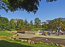
- Parque de la Granja
The park is located in the El Chapatal district in the La Salud-La Salle district. The name La Granja (in German: the farm) results from the fact that part of the site used to belong to the Ministry of Agriculture. The park was planned from 1969. The first section could be used from 1976. Indigenous plants such as palms and dragon trees as well as imported plants grow on 64,310 m² . B. Jacaranda or dioecious pokeweed . Extensive lawns are suitable for various sports. The paths are partly asphalt, partly strewn with ash. There is a café, children's playgrounds and sports equipment for adults. In 2005, a ten-meter-high sculpture by the artist José de Guimaraes, who was born in Guimaraes (Brazil) in 1939, was erected in the south corner of the park as part of the “Exposición Internacional de Escultura en la Calle”. The monument to the naturalist Félix Rodríguez de la Fuente is a work by María Belén Morales. In the north-west corner is the Biblioteca Pública del Estado en Santa Cruz de Tenerife.
- Parque García Sanabria
The Parque García Sanabria is a 6.7 hectare park in the northern part of the city center. The park was laid out in the 1920s and fundamentally renovated between 2004 and 2006 without changing the basic concept of the complex. There are many sculptural works of art in the park, a large number of which were set up as part of the Exposición Internacional de Escultura en la Calle . Various events take place regularly in the park.
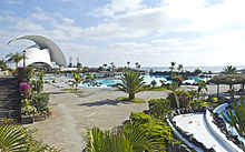
- Parque Marítimo César Manrique
The Parque Marítimo César Manrique is an outdoor swimming pool in the Los Llanos district, right by the sea next to the Castillo San Juan near the auditorium. The park was designed by César Manrique but was only completed three years after the artist's death in 1995. In 2010 the facility was completely renovated. Similar to the Lago de la Costa de Martiánez in Puerto de la Cruz , elements of the volcanic nature of the Canary Islands and subtropical plants were incorporated into the buildings as design elements.
The facility has a floor area of 22,000 m². The three basins in which the planted islands are located have irregular shapes. The water is pumped directly from the sea. There are restaurants, changing rooms, showers, facilities for various activities and sun loungers and parasols are available.
- Palmetum
The Palmetum is a botanical garden with a focus on palm trees . The site, which was used as a garbage dump until 1983, is located on a peninsula in the Los Llanos district next to the Parque Marítimo César Manrique opposite the Centro Internacional de Ferias y Congresos de Tenerife. On an artificial mountain at a height of 42 meters above sea level lies a flat area of 55,000 m². The remaining 65,000 m² are embankments. The project started in 1995 with support from the European Union and the city of Santa Cruz de Tenerife. The plans came from the agronomists Manuel Caballero and José Timón, the biologist Carlo Morici and the garden architect Carlos Simón. The practical implementation of the work was in the hands of the company Zona Verde under Fernando Ascanio Amigó.
Between 1996 and 1999 a large collection of suitable plants was created with the help of many external gardens. At the end of 1999 the project had to be scaled back without being completed. Of the 460 species that grew on the site in 1999, only 296 were left in 2006. In 2007 work was resumed. The government of the Canary Islands financed the most important work on the south side of the park, which until then had hardly been planted. In 2010, 3,600 specimens of 1,600 plant species grew on the park grounds, 470 of which are valuable, rare palm trees, 72 of which are on the UICN's red list. The Palmetum was opened in January 2014 and can be visited daily from 10:00 a.m. to 6:00 p.m.
Streets
- Rambla de Santa Cruz
The Rambla de Santa Cruz is a street that leads from Plaza La Paz in a northeastern direction and ends at Avenida Francisco La Roche (Avenida Anaga). On the other side of Plaza La Paz, Avenida de la Asunción leads south over the Barranco de Santos to Plaza de la Republica Dominicana. The extension, Avenida Reyes Catolicos, ends in the northern motorway (TF5). Due to their similar layout, the three streets form a unit. Traffic flows in two lanes on both sides of a wide asphalt pedestrian zone. The central area is separated from the roadways by trees, bushes or flower beds. There are cafes, kiosks , children's playgrounds and plenty of seating in the area. As part of the Exposición Internacional de Escultura en la Calle , works of art were set up, of which today (2013) eleven are still in the central area or on the central island of a roundabout. The Rambla runs partially through or borders on the listed Barrio de Los Hoteles with the Parque García Sanabria . The former bullring protrudes somewhat into the course of the road so that both the lanes and the pedestrian area are narrowed at this point.
As part of the annual Fiestas de Mayo , free-standing crosses made of fresh flowers will be exhibited on the piece south of Parque García Sanabria on May 3rd. Most of the exhibits are over two meters high (17 in 2013) are created by various associations in the city. Another exhibition has been showing crosses made from recycled materials by students in different schools for some years now.
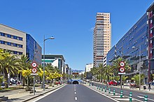
- Avenida Tres de Mayo
The Avenida Tres de Mayo separates the districts of El Cabo and Los Llanos. In its subterranean part it is the beginning of the northern motorway (TF5) towards Los Realejos. The name Tres de Mayo recalls the founding of the city on May 3, 1494.
At the end of the 1990s, Avenida Tres de Mayo had three lanes in and out of town. Because of the many intersections, traffic regularly came to a standstill at peak times. To remedy this, the road was tunnelled over a length of almost one kilometer. The tunnel is about eight meters below the level of the road above. In addition to the entrance from Avenida Marítima, there are two other side entrances from Calle José Hernández Afonso and Avenida La Salle. At these entrances there are acceleration lanes in addition to the two-lane carriageway. Since the tunnel can only be used in one direction, traffic in the opposite direction reaches the city of Santa Cruz de Tenerife via Calle Alfaro Ródrigez or Avenida Manuel Hermoso Rojas.
The above-ground part of the road can be used in both directions on two lanes each. A pedestrian zone with trees, flower beds and benches was set up between the lanes. There are parking and loading bays at the roadside.
On Avenida Tres de Mayo there are administrative buildings of the Gobierno de Canarias (Government of the Autonomous Community of the Canary Islands), the new courthouse, the Intercambiador (bus station), the first residential high-rise in the city (Rascaciellos) from 1975, the high-rise of the department store group El Corte Inglés , hotels and shopping centers.
building
- Nuestra Señora del Pilar (1752)
The parish church is located in the El Toscal district between Calle San Lucas and Calle de San Clemente on Calle del Pilar. It was built as a single-nave church with a short transept. The side aisles added in 1967 contain no altars, only confessionals . Of particular importance for the faithful is the procession of the Señora de las Angustias, which starts and ends on Good Friday at this church.
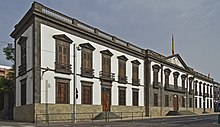
- Palacio de la Capitanía General de Canarias (1880)
The Capitanía General de Canarias building is on the west side of Plaza Weyler. The seat of the military commander in chief of the Canary Islands was originally in Las Palmas de Gran Canaria. After the Capitán General Lorenzo Fernández de Villavicencio Marqués de Villahermoso moved the seat of the Capitán General to the Castillo San Cristóbal in Santa Cruz de Tenerife in 1723, the Capitanía was housed in different buildings. In 1878 the then Capitán General Valeriano Weyler had a new building planned on the site of the old military hospital, which at that time was still outside the city center. The designs come from the commander of the pioneer troops Tomás Clavijo y Castillo Olivares. The wall and ceiling paintings inside the building and the relief on the facade were designed by Gumersindo Robayna. Plaza Weyler had not yet been laid out at the time. The building still serves as the office of the Canary Islands' Supreme Military Commander.
- Plaza de Toros (1893)
In 1892 the company “La Tinerfeña” had a plot of land marked out and leveled. It was west of the city center on a path called the Camino de los Coches, today's Rambla de Santa Cruz. The architect Antonio Pintor y Ocete, originally from the province of Granada, had designed a building that, through the horseshoe arch, adopted an element that had already been used in the old Plaza de Toros in Madrid. The walls were primarily made of concrete. The iron girders of the stands in the stands came from Seville. The building was opened during the “Fiestas del Mayo” in 1893. On the night of May 1st, 1924, a fire destroyed a large part of the facility. As a result, large parts of the furnishings that were previously made of wood (stairs, seats, etc.) were replaced by concrete. In 1927 the arena could be reopened with a bullfight. In 1983 the last bullfight took place in the Plaza de Toros. In 1991 the Canary Islands Animal Welfare Act, which, unlike the laws of other Comunidades Autonomas, does not provide for exceptions to bullfighting, banned this type of show. After a renovation (especially the installation of sun protection), the building was used for concerts and as part of the carnival. Due to various construction defects, a use z. Currently (2013) no longer possible. Protection as a monument is being considered on the one hand as a single building and in the context of protecting the district “Barrio de los Hoteles”.
- Escuelas Pías (antiguo Hotel Quisisana; 1904)
The former Hotel Quisisana was designed by Mario Estanga y Arias Girón in the last years of the 19th century . The building stands on a slope above the Rambla de Santa Cruz. When it opened on December 5, 1904, it was outside the city. With a view to the target group, the hotel was designed in a “Victorian” style which, thanks to the choice of shapes, should be reminiscent of a castle in Great Britain. The owner of the hotel, the Englishman Enrique Wolfson, had the hotel built as the first port of call for guests who went ashore in Santa Cruz de Tenerife and then traveled to the north of the island for a longer spa stay. The building was equipped with every luxury imaginable at the time, such as electric lighting and exemplary sanitary facilities and a magnificent ballroom. The furniture came from England. The hotel operations were so successful at the beginning that serious plans for expansion were tackled in the year, but these could not be realized.
Due to the decline in tourism in the 1930s, the company had to cease operations. The building became the property of the Cabildos de Tenerife . After various renovations and additions on the west side (the mountain side) from 1940, which were led by the architect José Blasco Robles, the teaching of the school "Escuelas Pías" was able to start in 1942.
- Edificio Elder (1905)
The company Elder Dempster and Company was founded in 1890 in Liverpool. Her activity as a shipping company focused on trade with the British colonies in West Africa and the operation of various shipping lines. In 1905 she opened a branch on Calle Robayna on the corner of Calle Castillo. The architect of the building, Antonio Pintor, designed it in the style of eclecticism . The carved entrance door, which goes back to a design by the architect, and the stained glass window in the stairwell are particularly striking. After a thorough restoration, the building is now (2013) the headquarters of the insurance company MAC.
- Fábrica "La Lucha" (1923)
The Fábrica building "La Lucha" was built in 1923 as a commercial and residential building. The company "La Lucha" was a cigarette factory that had part of its business and production facilities here. The name “La Lucha” refers to a regionally widespread sport “Lucha Canaria”, a type of wrestling match. The building is on the corner of Calle del Pilar and Calle Suarez Guerra, near Plaza del Príncipe. The architect was Domingo Pisaca Burgada. Today (2013) the building is used as a commercial and residential building.
- Edificio "El águila" (1926)
The building was built between 1923 and 1926 according to the plans of the architect Domingo Pisaca Burgada as the headquarters of the tobacco factory El águila ("The Eagle") at the intersection of Calle Pérez Galdós and Calle Suárez Guerra. Due to the sales difficulties for the products in the 1950s, the company was closed and the house was used by the daily newspaper La Tarde ("The afternoon"). The newspaper stopped appearing in 1982. In 1984 the library, parts of the archive and the workrooms of various parliamentary groups of the Comunidad Autónomo de Canarias were housed in the building. In 2000 the house underwent major renovations and became the seat of the Audiencia de Cuentas (Auditing Office) of the Parliament of the Canary Islands. Stylistically, the building can be assigned to eclecticism despite its construction date .
- Consejería de Sanidad (1931)
The building of the former hygiene institute on Rambla de Santa Cruz was designed in 1930 by the architect Antonio Pintor Ocete and completed in 1932. It is the seat of the Consejería de Sanidad (Ministry of Health of the Government of the Autonomous Community of the Canary Islands). Access is now through some buildings on Calle Horatio Nelson designed by Tomás Machado y Méndez Fernández de Lugo.
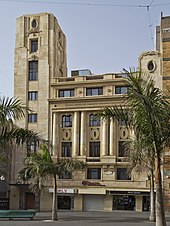
- Palacio Insular (1940)
The Palacio Insular de Tenerife is the seat of the Cabildo Insular de Tenerife in Santa Cruz de Tenerife. It was planned from 1934 by the architect José Enrique Marrero Regalado and completed in 1940. Its main entrance facade faces the Plaza de España. The east facade was previously only separated by a street directly on the sea. The approximately 200 m² large wall paintings of the building, which were created by the painter José Aguiar, have been considered a cultural asset worthy of protection ( Bien de Interés Cultural ) since 2002 .
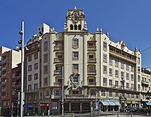
- Círculo Mercantil (1943)
The building known as Círculo Mercantil on the south side of Plaza de la Candelaria is the seat of the Camara Oficial de Comercio, Industría y Navegación de Santa Cruz de Tenerife . This public corporation can be compared to a German Chamber of Commerce and Industry .
In 1927, the president of the Circulo de la Union Mercantil y Agricola de Tenerife announced that the association intends to build a new administrative building. The architect José Enrique Marrero Regalado from Granadilla de Abona was commissioned with the planning in 1932. Construction work began in 1933. In April 1935, the city administration granted permission to use the lower and ground floor as well as a mezzanine floor. The work on the higher floors continued very slowly, at times even completely stopped. The rest of the building could only be occupied in 1943.
José Enrique Marrero Regalado has developed a personal, locally influenced eclectic style in his designs , which is also known as Clásico Monumentalista . In the architect's designs, there are elements of older Canarian architecture on the one hand, and Baroque decorative elements on the other.
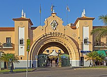
- Mercado Nuestra Señora de Africa (1943)
After the beginning of the Second World War, the Spanish government felt compelled to strengthen the self-sufficiency of the Canary Islands. Therefore, the economic administration was brought together by a decree of August 5, 1941 under the name "Mando Económico del Archipiélago" in the hands of the Capitán General. Most of the intervention of the “Mando Económico” in the economy focuses on the compulsory management of food. A mixture between economic development and job creation measures such as the construction of water pipes or the improvement of the infrastructure were another area of work of the economic administration. As part of these measures, a market was built on the right side of the Barranco de Santos, which was connected to the city center by a new bridge (Puente General Serrador). The designs came from the architect José Enrique Marrero Regalado. The construction work was under the supervision of the architect Enrique Rumeu. The model for the design of the market was the “Canary Village” at the Exposició Internacional de Barcelona .
The building is divided into three “courtyards” (patios) on the upper level. In the Patio Central there is now a children's playground and various special events take place here. The "Patio del Poniente" (the courtyard of the sunset, i.e. the west courtyard) also has market stalls in its center, in contrast to the "Patio del Naciente" (the courtyard of the sunrise, i.e. the east courtyard) where the center of the square is free for a fountain and a Coffee shop. In the basement, which can be reached by escalators, there are also market stalls and a supermarket under the Patio Central. The fish market, which has a direct entrance to Avenida San Sebastian (Rambla Azul), is also located in the basement. The name of the market goes back to the name of the wife of the then head of the "Mando Económico del Archipiélago" who opened the market; her baptismal name was "Maria de Africa".
- Cine Victor (1954)
The building of the Cine Victor is in the Plaza de la Paz on the corner of the Avenida de la Asunción and the Rambla de Pulido. The building is a cinema on the one hand and a six-storey residential and office building on the other, with shops on the lower storey. It was planned by the architect José Enrique Marrero Regalado from 1947 and opened in 1954. A feature that is also found in other buildings by the architect (Edificio García Feo, Edificio Padrón) is the flattened corner on which a tower protrudes above the rest of the structure. Stylistically, the building is assigned to a Canarian variant of the Arquitectura regionalista. Typical stylistic features are the covered balconies as well as the different shapes of the window fillings and the baroque ornaments. The hall is not only used for cinema screenings, but also for concerts and folklore events.
- Edificio de Correos y Telégrafos (1957)
The building of the post and telegraph office in the Plaza de España in Santa Cruz de Tenerife was planned by the architect Luis Lozano Lasilla from 1943. Construction work began in May 1946. Due to a lack of cement, the building could not be completed until 1957. In 1936 the architect José Enrique Marrero Regalado was commissioned to design a building for a post office, which was to be connected to the Palacio Insular and the tax office on Avenida Marítima to the south. Because of the civil war, the plan was dropped. Instead, the post office was to be built directly on the Plaza de España on a plot of land that was west of the Palacio Insular and on which the old customs building and some smaller residential buildings had previously stood. It should fill the gap between the Cabildo and the Hotel La Orotava. Luis Lozano Lasilla, the Post's architect, took into account the style of the rest of the development on the square before the “Monumento a los caidos” was built. The inside of the building has been completely redesigned and has been covered with nets and scaffolding since 2011 to protect passers-by from falling stones.
- Caja Canarias (1987)
The building of the headquarters of the Caja Canarias was completed in 1987. The architects were Francisco Artengo Rufino, José Ángel Domínguez Anadón and Carlos Schwartz Pérez. The plot has an area of 3,600 m². The facade is covered with natural stone slabs that come from the Montaña de Tindaya area on Fuerteventura. In addition to the ticket hall and administration offices, there is an underground car park on a total of 14 floors. A large part of the building is used as the “Espacio Cultural CajaCanarias” (cultural space of the Caja Canarias), the bank's cultural foundation. In the exhibition halls on two floors there are regular art exhibitions that enjoy great international renown. The lecture hall can hold around 500 people. Here not only lectures take place, but also poetry readings z. B. by Rafael Alberti, Ángel González or Hans Magnus Enzensberger and Manuel Vázquez Montalbán. The singers Jorge Drexler, Sinead O'Conor, Ana Belén and Víctor Manuel have already given concerts here.
- Presidencia del Gobierno de las Islas Canarias (1993)
The building of the Presidencia del Gobierno de las Islas Canarias in Santa Cruz de Tenerife is one of the two official seats of the President of the Government (Prime Minister) of the Canary Islands . According to the Statute of Autonomy of the Autonomous Community of the Canary Islands, the seat of the President changes between Las Palmas de Gran Canaria and Santa Cruz de Tenerife with each legislative period . In the center of the building there is a patio , which was furnished with wood from a demolished house. The outer walls are clad with basalt slabs from the south of the island of Tenerife. Stone slabs from other Canary Islands were used to clad some of the interiors.
- Centro Internacional de Ferias y Congresos (1996)
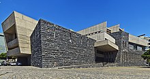
The Centro Internacional de Ferias y Congresos (International Exhibition and Congress Center) is located about two kilometers south of the city center of Santa Cruz de Tenerife on Avenida de la Constitución in the Los Llanos district. The building was designed by the architect Santiago Calatrava Valls. It opened in May 1996.
The large exhibition hall on the upper floor is the largest covered space in the Canary Islands with a length of 190 m, a width of 70 m and a height of around 20 m. It can hold up to 15,000 people. The congresses take place on the ground floor. The congress hall seats 334 people. There is another multi-purpose room with a floor area of 3,800 m². The technical facilities and offices of the Sociedad de Promoción de Tenerife (Tenerife Economic Development Agency) are located in an adjacent building.
A wide variety of events have taken place in the building since it opened: business fairs, concerts, carnival events, congresses, seminars, art exhibitions, TV recordings, fashion shows, etc.
- Auditorio de Tenerife Adán Martín (2003)
The Auditorio de Tenerife “Adán Martín” concert hall , which was opened in 2003 and was designed by Santiago Calatrava , is located approx. 1.5 km south of the city center in the Los Llanos district, right by the sea. Events take place in two halls. The large hall offers 1658 and the small 428 seats. The building is the seat of the Orquesta Sinfónica de Tenerife .
- Torres de Santa Cruz (2006)
The two identical high-rise residential buildings were built in the years 2001 - 2004 and 2004 - 2006 in the Cabo Llanos district. The buildings were designed by the architect Julián Valladares Hernández. The 120 m high buildings have 35 floors above ground which are primarily used as apartments, the lower floors e.g. T. can also be used as office space.
- Intercambiador de Transportes de Santa Cruz de Tenerife (2006)
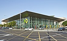
The Intercambiador de Transportes de Santa Cruz de Tenerife consists of a bus station , the tram terminus and a parking garage . The task of the building erected in 2006 on the site of the old Estación de Guaguas (bus station) is to make it easier for passengers to switch between different modes of transport. It is opposite the Corte Inglés department store and Rascacielos, between Avenida Tres de Mayo, Calle Fomento and Calle Victor Zurita Soler. The building has six floors of which the third to the east and the sixth to the west are at ground level.
- Tenerife Espacio de las Artes (2008)
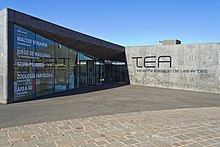
The Tenerife Espacio de las Artes (TEA) institution is an art and cultural center in Santa Cruz de Tenerife. In the building there are various exhibition, cinema and lecture halls, the Biblioteca Municipal de Santa Cruz de Tenerife and the Centro de Fotografía Isla de Tenerife on a floor area of 20,622 m². The opening took place on October 31, 2008. In the planning and construction phase, the project was called Instituto Óscar Domínguez de Arte y Cultura Contemporánea (IODACC) . The building was designed by the Swiss architects Herzog & de Meuron together with the local architect Virgilio Gutiérrez.
traffic
North-west of Santa Cruz , near La Laguna , is Tenerife North Los Rodeos Airport . The port of Puerto de Tenerife is an important trading port on the island, through which the supply of oil, raw materials, etc. is handled. From here there are direct and regular ferry connections to the neighboring islands such as Agaete de Gran Canaria in about 60 minutes driving time (from Agaete to Las Palmas de Gran Canaria it is about 20 minutes by car via the GC-2 motorway ), and with the Acciona (formerly Trasmediterranea) to Cádiz in southern Spain. The southern motorway TF-1 and the northern motorway TF-5 have their starting point here. The new Tranviá Tenerife tram to La Laguna has been officially in operation since June 2nd, 2007. Two railway lines are planned to start in Santa Cruz: The Tren del Sur to Adeje and the Tren del Norte to Puerto de la Cruz.
sons and daughters of the town
- Leopoldo O'Donnell (1809–1867), politician
- Àngel Guimerà (1845–1924), writer
- Teobaldo Power (1848-1884), composer
- Eduardo Westerdahl (1902–1983) art critic and author
- Rafael Arozarena (1923–2009), writer
- Luis Molowny (1925-2010), football player
- Hans Leopold Davi (1928–2016), Swiss writer and translator
- Fernando Fernández Martín (* 1943), politician
- Adán Martín Menis (1943–2010), politician
- María Orán (1943–2018), singer and vocal teacher
- Fernando Menis (* 1951), architect
- Sabas Martín (* 1954), poet, playwright, publicist
- Kike Perdomo (* 1961), jazz musician
- Juan Carlos Fresnadillo (* 1967), director
- Alfonso de Orléans-Borbón (* 1968), nobleman and racing team owner
- Víctor Álamo de la Rosa (born 1969), writer
- Agustín Amigó (* 1970), guitarist and composer
- Mario Pestano (* 1978), athlete
- Pedro Mario Álvarez (* 1982), football player
- Vitolo (* 1983), football player
- Sergio Rodríguez Gómez (* 1986), basketball player
- Pedro (* 1987), football player
- Ayoze Pérez (* 1993), football player
- Cristo (* 1997), soccer player
politics
The city has been administered by democratically elected mayors since 1979.
| year | mayor | Political party |
| 1979-1983 | Manuel Antonio Hermoso Rojas | Unión de Centro Democrático (UCD) |
| 1983-1991 | Manuel Antonio Hermoso Rojas | Agrupación Tinerfeña de Independientes (ATI) |
| 1991-1995 | José Emilio García Gómez | Agrupación Tinerfeña de Independientes (ATI) |
| 1995-2011 | Miguel Zerolo Aguilar | Coalición Canaria (CC) |
| since 2011 | José Manuel Bermúdez Esparza | Coalición Canaria (CC) |
Twin cities
Santa Cruz de Tenerife has partnerships with the following cities:
-
 Santa Cruz (California) , USA (1974)
 -
 Santa Cruz de la Sierra , Bolivia (1978)
 -
 Caracas , Venezuela (1981)
 -
 San Antonio , USA (1983)
 -
 Cádiz , Spain (1984)
 -
 Rio de Janeiro , Brazil (1984)
 -
 Nice , France (1989)
 -
 Santa Cruz del Norte , Cuba (1997)
 -
 Aranda de Duero , Spain (1997)
 -
 Ciudad de Guatemala , Guatemala (2002)
literature
- Alejandro Cioranescu: Historia de Santa Cruz de Tenerife I 1494-1803 . Servicio de Publicaciones de la Caja General de Ahorros de Santa Cruz de Tenerife, Santa Cruz de Tenerife 1977, ISBN 84-500-1652-5 (Spanish).
- Alberto Darias Principe: Santa Cruz de Tenerife, Ciudad, Arquitectura y Memoria Histórica 1500–1981 . Ayuntamiento de Santa Cruz de Tenerife, Santa Cruz de Tenerife, ISBN 84-89350-92-2 (Spanish).
- Luis Cola Benítez: Barrancos de Añazo . Excmo. Ayuntamiento de Santa Cruz de Tenerife, Tenerife 1986, ISBN 84-505-3870-X , p. 149 (Spanish).
- Elías Serra Ráfols: Alonso Fernández de Lugo, primer colonizador español . Ediciones Idea, Santa Cruz de Tenerife 2005, ISBN 84-96505-96-0 (Spanish).
Web links
- Zedler Lexicon entry on Santa Cruz from 1742, (vol. 33, col. 1809).
- ISTAC (Statistical Department of the Regional Government of the Canary Islands)
Individual evidence
- ↑ Cifras oficiales de población resultantes de la revisión del Padrón municipal a 1 de enero . Population statistics from the Instituto Nacional de Estadística (population update).
- ↑ Alejandro Cioranescu: Historia de Santa Cruz de Tenerife I 1494 - 1803 . Servicio de Publicaciones de la Caja General de Ahorros de Santa Cruz de Tenerife, Santa Cruz de Tenerife 1977, ISBN 84-500-1652-5 (Spanish). The name and title is actually used on official occasions by the Ayuntamiento (city council / city administration).
- ↑ Cifras oficiales de población resultantes de la revisión del Padrón municipal a 1 de enero . Population statistics from the Instituto Nacional de Estadística (population update).
- ↑ Anuario estadístico de Puertos del Estado 2010 (accessed on October 15, 2012; PDF; 10.9 MB)
- ↑ a b c d Localización, clima, población. In: santacruzdetenerife.es. Ayuntamiento Santa Cruz de Tenerife, archived from the original on October 8, 2014 ; accessed on March 7, 2019 (Spanish).
- ↑ Datos estadísticos de Población. In: santacruzdetenerife.es. Ayuntamiento de Santa Cruz de Tenerife, archived from the original on July 16, 2013 ; accessed on January 21, 2019 (Spanish).
- ↑ chicharrero. In: Diccionario de La Lengua Española. Real Academia Española, 2001, accessed June 20, 2013 (Spanish).
- ↑ Evolución. In: santacruzdetenerife.es. Ayuntamiento Santa Cruz de Tenerife, archived from the original on July 4, 2012 ; accessed on March 16, 2019 (Spanish).
- ↑ Estudio de la Poblaciónen en el Municipio de Santa Cruz de Tenerife 2010. (PDF; 3.4 MB) In: santacruzdetenerife.es. Ayuntamiento de Santa Cruz de Tenerife, July 2010, archived from the original on May 13, 2014 ; accessed on January 28, 2019 (Spanish).
- ↑ Elías Serra Ráfols: Alonso Fernánde de Lugo, primer colonizador español . Ediciones Idea, Santa Cruz de Tenerife 2005, ISBN 84-96505-96-0 (Spanish).
- ↑ Most of the dates of the first few years are controversial. On the one hand, this is due to the lack of time information in the surviving documents, and on the other hand, the days of remembrance of a saint are often given as "dates" and were subject to changes. In addition, when specifying dates in the 16th century, it should also be taken into account that the changeover to the Gregorian calendar in Spain took place in 1582, but in England only in 1752, so the original dates often differ by about ten days. The information provided by Alejandro Cioranescu is used below.
- ↑ Alejandro Cioranescu: Los primeros Pobladores de Santa Cruz de Tenerife. Anuario de estudios atlánticos, 1975, p. 65 , accessed December 29, 2012 (Spanish).
- ↑ Alejandro Cioranescu: Los primeros Pobladores de Santa Cruz de Tenerife. Anuario de estudios atlánticos, 1975, p. 71 , accessed December 29, 2012 (Spanish).
- ↑ Alejandro Cioranescu: Los primeros Pobladores de Santa Cruz de Tenerife. Anuario de estudios atlánticos, 1975, p. 63 , accessed December 29, 2012 (Spanish).
- ↑ Antonio Rumeu de Armas: Piraterías y Ataques Navales contra las Islas Canarias . Volume II 1 2. Consejo Superior de Investigaciones Científicas, Instituto Jerónimo Zurita, Madrid 1948, OCLC 770892681 , p. 397 .
- ↑ Antonio Rumeu de Armas: Piraterías y Ataques Navales contra las Islas Canarias . Volume II 1 2. Consejo Superior de Investigaciones Científicas, Instituto Jerónimo Zurita, Madrid 1948, OCLC 770892681 , p. 319 ff .
- ↑ Antonio Rumeu de Armas: Piraterías y Ataques Navales contra las Islas Canarias . Volume II 1 2. Consejo Superior de Investigaciones Científicas, Instituto Jerónimo Zurita, Madrid 1948, OCLC 770892681 , p. 405 ff .
- ↑ José Manuel Ledesma Alonso: Rutas con Historia. Fortifications in Tenerife. Retrieved December 31, 2012 (Spanish).
- ↑ Antonio Rumeu de Armas: Piraterías y Ataques Navales contra las Islas Canarias . Volume III 1 1. Consejo Superior de Investigaciones Científicas, Instituto Jerónimo Zurita, Madrid 1948, OCLC 626733584 , p. 182, footnote 99, and p. 192 .
- ^ A b Manuel Hernández González: Tenerife - Patrimonio Histórico y Cultural . Editorial Rueda, Madrid 2002, ISBN 84-7207-134-0 , p. 184 (Spanish).
- ↑ Manuel Hernández González: Tenerife - Patrimonio Histórico y Cultural . Editorial Rueda, Madrid 2002, ISBN 84-7207-134-0 , p. 4 (Spanish).
- ↑ Antonio Rumeu de Armas: Piraterías y Ataques Navales contra las Islas Canarias . Volume III 1 2. Consejo Superior de Investigaciones Científicas, Instituto Jerónimo Zurita, Madrid 1950, OCLC 770892683 , p. 383 .
- ↑ Erupciones históricas de Tenerife. In: Volcanes de Canarias. Retrieved August 13, 2018 (English, Spanish).
- ^ A b Alberto Darias Principe: Santa Cruz de Tenerife: Ciudad, Arquitectura y Memoria Histórica 1500–1981 . Ayuntamiento de Santa Cruz de Tenerife, Santa Cruz de Tenerife 2004, ISBN 84-89350-92-2 . Page 20
- ↑ E.g. in the inscription on the monument to General Leopoldo O'Donnell in Parque García Sanabria .
- ↑ See Real Decreto de 30 de noviembre de 1833 in Wikisource.
- ↑ La ciudad de Santa Cruz de Tenerife, capital de Canarias: 1822-1927 . In: El Día . Editorial Leoncio Rodríguez, Santa Cruz de Tenerife January 13, 2008 (Spanish, eldia.es [accessed September 28, 2018]).
- ^ Diócesis Nivariense - Historia. Diócesis de San Cristóbal de La Laguna, accessed September 27, 2018 (Spanish).
- ↑ Santa Cruz, Muy Benéfica. El cólera de 1893
- ^ Ley Constitutiva de los Cabildos Insulares (1912). July 11, 1912. Retrieved February 12, 2013 (Spanish).
- ↑ LEY ORGÁNICA 4/1996, de 30 de diciembre, de reforma de la Ley Orgánica 10/1982, de 10 de agosto, de Estatuto de Autonomía de Canarias (BOE nº 315, de 31.12.96). December 30, 1996, Retrieved February 12, 2013 (Spanish).
- ↑ Walther L. Bernecker et al .: Lectures on the exhibition La Guerra Civil Espanola 1936-1939 . Library of the Friedrich-Ebert-Stiftung, Bonn 1988, p. 27 .
- ↑ José Manuel Pérez Lorenzo: Años de Guerra y Miseria (1936-1959) . Consejería de Educación, Cultura y Deportes del Gobierno de Canarias, Canarias 2006, ISBN 84-689-9443-X , p. 59 (Spanish).
- ↑ José Manuel Pérez Lorenzo: Años de Guerra y Miseria (1936-1959) . Consejería de Educación, Cultura y Deportes del Gobierno de Canarias, Canarias 2006, ISBN 84-689-9443-X , p. 153 (Spanish).
- ↑ José Manuel Pérez Lorenzo: Años de Guerra y Miseria (1936-1959) . Consejería de Educación, Cultura y Deportes del Gobierno de Canarias, Canarias 2006, ISBN 84-689-9443-X (Spanish).
- ^ Estatuto de Autonomía de Canarias. Congreso de los Diputados, 2003, accessed March 28, 2012 (Spanish, legal text).
- ↑ Ley 16/1985, de 25 de junio, del Patrimonio Histórico Español. June 25, 1985, Retrieved September 8, 2012 (Spanish).
- ^ Bienes culturales protegidos. Ministerio de Educación, Cultura y Deporte, accessed July 9, 2013 (Spanish).
- ↑ Alberto Darias Principe: Santa Cruz de Tenerife, Ciudad, Arquitectura y Memoria Histórica 1500–1981 . Ayuntamiento de Santa Cruz de Tenerife, Santa Cruz de Tenerife, ISBN 84-89350-92-2 , pp. 540 f . (Spanish).
- ↑ Un grupo de vecinos logra que la plaza del Alférez Provisional de Santa Cruz pase a denominarse plaza El Chicharro. February 9, 2009, Retrieved June 19, 2013 (Spanish).
- ↑ Alberto Darias Principe: Santa Cruz de Tenerife, Ciudad, Arquitectura y Memoria Histórica 1500–1981 . Ayuntamiento de Santa Cruz de Tenerife, Santa Cruz de Tenerife, ISBN 84-89350-92-2 , pp. 544 f . (Spanish).
- ↑ Alberto Darias Principe: Santa Cruz de Tenerife, Ciudad, Arquitectura y Memoria Histórica 1500–1981 . Ayuntamiento de Santa Cruz de Tenerife, Santa Cruz de Tenerife, ISBN 84-89350-92-2 , pp. 61 f . (Spanish).
- ↑ Alberto Darias Principe: Santa Cruz de Tenerife, Ciudad, Arquitectura y Memoria Histórica 1500–1981 . Ayuntamiento de Santa Cruz de Tenerife, Santa Cruz de Tenerife, ISBN 84-89350-92-2 , pp. 535 f . (Spanish).
- ^ Parque Marítimo César Manrique. Parque Marítimo César Manrique, 2013, accessed June 20, 2013 (Spanish).
- ^ Fernando Ascanio Amigó: Palmetum. Zona Verde, 2013, accessed June 23, 2013 (Spanish).
- ↑ Carlo Morici: El Jardin Botanico del Palmetum de Santa Cruz de Tenerife (Islas Canarias). 2010, Retrieved June 20, 2013 (Spanish).
- ↑ Natalia Torres: Los Príncipes inauguran el “admirable y ejemplar” Palmetum. diario de avisos.com, January 20, 2014, accessed February 28, 2014 (Spanish).
- ↑ El Concurso de Cruces de flores naturales. Ayuntamiento Santa Cruz de Tenerife, May 2, 2013, accessed June 20, 2013 (Spanish).
- ↑ El tunnel de la 3 de Mayo. (No longer available online.) In: atan.org. January 2001, archived from the original on July 15, 2013 ; accessed on May 13, 2019 (Spanish).
- ↑ Cande Castillo: El culto a la Virgen del dolor. In: archivo.diariodeavisos.com. March 25, 2005, archived from the original on October 29, 2013 ; Retrieved April 24, 2019 (Spanish).
- ^ Archivo Intermedio Militar de Canarias. (No longer available online.) Ministerio de Defensa de España, 2009, archived from the original on February 22, 2017 ; Retrieved June 20, 2013 (Spanish). Info: The archive link was inserted automatically and has not yet been checked. Please check the original and archive link according to the instructions and then remove this notice.
- ↑ Alberto Darias Principe: Santa Cruz de Tenerife, Ciudad, Arquitectura y Memoria Histórica 1500–1981 . Ayuntamiento de Santa Cruz de Tenerife, Santa Cruz de Tenerife, ISBN 84-89350-92-2 , pp. 106 f . (Spanish).
- ↑ Alberto Darias Principe: Santa Cruz de Tenerife, Ciudad, Arquitectura y Memoria Histórica 1500–1981 . Ayuntamiento de Santa Cruz de Tenerife, Santa Cruz de Tenerife, ISBN 84-89350-92-2 , pp. 153 f . (Spanish).
- ↑ El Ayuntamiento de Santa Cruz de Tenerife niega que el Cabildo haya declarado la Plaza de Toros como BIC. (No longer available online.) San Borodon April 5, 2013, archived from the original September 27, 2013 ; Retrieved June 20, 2013 (Spanish). Info: The archive link was inserted automatically and has not yet been checked. Please check the original and archive link according to the instructions and then remove this notice.
- ↑ El Cabildo tinerfeño including the plaza de toros de Santa Cruz en the BIC del barrio de los Hoteles. eldía.es, April 4, 2013, accessed May 6, 2013 (Spanish).
- ^ Alberto Darias Principe: Santa Cruz de Tenerife: Ciudad, Arquitectura y Memoria Histórica 1500–1981 . Tomo I. Ayuntamiento de Santa Cruz de Tenerife, Santa Cruz de Tenerife 2004, ISBN 84-89350-92-2 , p. 164 ff . (Spanish).
- ^ Agustín Guimerá Ravina: La sede MAC. Mutua de Accidentes de Canarias, accessed May 6, 2013 (Spanish).
- ↑ Alberto Darias Principe: Santa Cruz de Tenerife, Ciudad, Arquitectura y Memoria Histórica 1500–1981 . Ayuntamiento de Santa Cruz de Tenerife, Santa Cruz de Tenerife, ISBN 84-89350-92-2 , pp. 260 f . (Spanish).
- ↑ La Sede. In: acuentascanarias.org. Archived from the original on May 28, 2013 ; Retrieved July 15, 2018 (Spanish).
- ↑ Declaradas BIC las pinturas del Salón Noble del Cabildo. laopinion.es, November 8, 2011, accessed July 31, 2012 (Spanish).
- ↑ Cámara Oficial de Comercio, Industria y Navegación de Santa Cruz de Tenerife. Cabildo de Tenerife, 2013, accessed June 20, 2013 (Spanish).
- ↑ Alberto Darias Principe: Santa Cruz de Tenerife, Ciudad, Arquitectura y Memoria Histórica 1500–1981 . Ayuntamiento de Santa Cruz de Tenerife, Santa Cruz de Tenerife, ISBN 84-89350-92-2 , pp. 426 f . (Spanish).
- ↑ Sebastián Matías Delgado Campos: La Fachada Principal del Palacio Insular, Santa Cruz de Tenerife. Tertulia Amigos del 25 julio, November 2009, accessed June 20, 2013 (Spanish).
- ^ A b Emilio Abad Ripoll: El Mando Económico. 2006, Retrieved June 20, 2013 (Spanish).
- ↑ Jorge Grostiza in Maria Isabel Navarro Segura, Álvaro Ruíz Rodríguez: La arquitectura como escenografía: José Enrique Marrero Regalado (1897-1956) . Colegio de Arquitectos de Canarias, Demarcación de Tenerife-Gomera-Hierro, Santa Cruz de Tenerife 1992, ISBN 978-84-600-8262-0 , p. 237 ff . (Spanish).
- ^ Alberto Darias Principe: Santa Cruz de Tenerife: Ciudad, Arquitectura y Memoria Histórica 1500–1981 . Tomo I. Ayuntamiento de Santa Cruz de Tenerife, Santa Cruz de Tenerife 2004, ISBN 84-89350-92-2 , p. 439 ff . (Spanish).
- ↑ Sedes de la Presidencia del Gobierno. Gobierno de Canarias, accessed May 7, 2013 (Spanish).
- ^ Centro Internacional de Ferias y Congresos. area 25, 2013, accessed in 2013 (Spanish, the German version of the site does not go into such detail).
- ↑ Las guaguas iniciarán sus servicios desde el Intercambiador el sábado, 17 de junio, a partir de las 5:00 horas. (No longer available online.) Gobierno de Canarias, June 16, 2006, formerly in the original ; Retrieved August 16, 2013 (Spanish). ( Page no longer available , search in web archives ) Info: The link was automatically marked as defective. Please check the link according to the instructions and then remove this notice.
- ↑ Ciudades hermanadas con Santa Cruz de Tenerife ( Memento of the original of July 16, 2011 in the Internet Archive ) Info: The archive link was automatically inserted and not yet checked. Please check the original and archive link according to the instructions and then remove this notice.


