
Arico
| Arico municipality | |||
|---|---|---|---|
| coat of arms | Map of the Canary Islands | ||

|
|
||
| Basic data | |||
| Autonomous Community : | Canary Islands | ||
| Province : | Santa Cruz de Tenerife | ||
| Coordinates | 28 ° 10 ′ N , 16 ° 28 ′ W | ||
| Height : | 525 msnm | ||
| Area : | 179.16 km² | ||
| Residents : | 7,988 (Jan 1, 2019) | ||
| Population density : | 44.59 inhabitants / km² | ||
| Postal code : | 38580 | ||
| Municipality number ( INE ): | 38005 | ||
| administration | |||
| Mayor : | Maria Elena Fumero Garcia ( CC ) | ||
| Address of the municipal administration: | C / El Carmen, 10 38580 - Arico |
||
| Location of the municipality | |||

|
|||

Arico is a municipality ( municipio ) in the southeast of the Canary Island of Tenerife with 7988 inhabitants (as of January 1, 2019). It is connected to the capital Santa Cruz de Tenerife by the southern TF-1 motorway and by the old Santa Cruz de Tenerife - Adeje road. The coastline is 17 km. Neighboring municipalities are Fasnia in the north, Granadilla de Abona in the south and south-west and La Orotava in the north-west. The seat of the municipal administration is Villa de Arico. Other places are: Arico Nuevo, Arico Viejo, Abades , La Jaca, La Listada and Poris de Abona.
The municipality of Arico has an area of 179.16 km² with an altitude difference of 0 to 2529 m above sea level (the highest point is the Montaña de la Grieta mountain ).
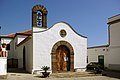
Arico Nuevo
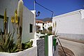
Arico Nuevo


Residents
| year | Residents | Population density |
|---|---|---|
| 1991 | 4,567 | - |
| 1996 | 5,064 | - |
| 2001 | 5,824 | 32.5 inhabitants / km² |
| 2002 | 6,653 | - |
| 2003 | 6,928 | 38.8 inhabitants / km² |
| 2004 | 7.005 | 39.1 inhabitants / km² |
| 2005 | 7.159 | 40.0 inhabitants / km² |
| 2006 | 7.104 | 39.7 inhabitants / km² |
| 2007 | 7,565 | 42.2 inhabitants / km² |
| 2014 | 7,670 | 42.8 inhabitants / km² |
swell
Web links
Individual evidence
- ↑ Cifras oficiales de población resultantes de la revisión del Padrón municipal a 1 de enero . Population statistics from the Instituto Nacional de Estadística (population update).