
Fuerteventura
| Fuerteventura | ||
|---|---|---|
 |
||
| Waters | Atlantic Ocean | |
| Archipelago | Canary Islands | |
| Geographical location | 28 ° 26 ′ N , 14 ° 0 ′ W | |
|
||
| length | 98 km | |
| width | 28 km | |
| surface | 1 660 km² | |
| Highest elevation |
Pico de la Zarza 807 msnm |
|
| Residents | 116,886 (2019) 70 inhabitants / km² |
|
| main place | Puerto del Rosario | |
 |
||

Fuerteventura is one of the Canary Islands in the Atlantic Ocean , around 120 kilometers west of the Moroccan coast. With an area of 1659.74 km² it has a share of 22.15 percent of the land area of the Canaries. This makes it the second largest island in the archipelago after Tenerife . In 2018 the island had 116,886 inhabitants. Its capital is Puerto del Rosario . This is where the international airport of Fuerteventura is located . The national language is Spanish . Fuerteventura forms the eastern border of the Canaries and, like the other Canary Islands, geographically belongs to Africa, with the island of Lanzarote in the north, separated from it by the 11½ kilometers wide La Bocayna strait . The entire island has been a UNESCO biosphere reserve since May 26, 2009 and a UNESCO light protection area since 2015 .
With Lanzarote and Gran Canaria , Fuerteventura belongs to the Spanish province of Las Palmas . In July 2019, Blas Acosta from the PSOE replaced Lola García from the Coalición Canaria as president of the island's government after a successful vote of no confidence .
geography
Fuerteventura is the oldest island in the Canaries. It was formed about 20.6 million years ago and is of volcanic origin. Most of the island's mass was formed around 5 million years ago and has been severely eroded by wind and weather since then . The last volcanic activity on Fuerteventura extinguished between 4000 and 5000 years ago.
The highest point on Fuerteventura is the mountain Pico de la Zarza (807 m), also called Pico de Jandía , on the peninsula of the same name .
In the northeast of the island, near Corralejo, there are large shifting dunes ( Parque Natural de Corralejo ). The sand consists to a large extent of ground shellfish ( mussels , snail shells ). In some places, limestone formations from the former seabed, which, like the black volcanic remains, are severely eroding, contribute to the mostly speckled sand.
The island reaches a length of almost one hundred kilometers between the north and south-west tip and measures 31 kilometers at its widest point. The Istmo de la Pared is the narrowest part of Fuerteventura with a width of five kilometers and divides the island into two parts: the northern part of Maxorata , after which the original islanders Majoreros are named, and the southern Jandía peninsula . Compared to other Canary Islands, the island's area of almost 1700 square kilometers is only sparsely populated with around 68 inhabitants per km².
geology
Phases of creation
The geological age of the volcanic island, i.e. the rocks solidified above water, was determined using Ar / Ar dating to be around 22 million years, other researchers speak of 20.6 million years. The neighboring island of Lanzarote , which was originally connected to it, was created around 15.5 million years ago.
As with other islands in the archipelago, the formation of Fuerteventura is based on three shield volcanic structures (12–22 million years old). These are a southern, a central and a northern volcanic complex, which have since been severely eroded and are partly below the sea surface. Above all, the radial swarms of veins were examined.
The shield volcanoes, on the other hand, rest on even older structures, which either acted as submarine volcanoes ( seamounts ) and remained below sea level, or later protruded above the water surface due to land uplifts due to volcanic activity ( intrusions ) or falling sea levels. They are around 22 to 48 million years old. Below the seamounts, in turn, there are layers of sediment and oceanic crust , which is 180 million years old here.
As on other islands of the Canary Islands, the building periods were followed by a phase of erosion and a pause in volcanic activity lasting several million years. This only started again around five million years ago and lasted into the present geological history; the last eruptions took place a few thousand years ago.
erosion
The oldest parts of the island are visible in the west, the youngest in the east. This shows that the erosion has destroyed large parts of the former island structure, which, according to the prevailing doctrine, is not least due to enormous flank collapse events. Water and especially sea erosion and wind contributed to the current appearance of the island. During the cold periods when the sea level was low, the wind carried away a lot of material and accumulated it in dunes, with sediments such as shell sand mixed with volcanic rock particles. Intrusions under Fuerteventura and La Palma also raised parts of these islands by several thousand meters.
climate
The climate is mild all year round, which has earned the Canary Islands the nickname Islands of Eternal Spring . The sea levels out the temperatures, and the trade winds largely keep the hot air masses away from the nearby Sahara . With 147 mm per year, Fuerteventura has very little precipitation compared to the Canaries. The clouds move over it because the mountains are too low. Increased by the mistakes of the past (firewood harvesting, keeping free-range goats ), this has recently had a particular impact on agriculture - tomato cultivation is declining sharply, olive trees are only on the rise, only aloe vera is still grown in abundance. One speaks of semi-desert with a tendency to desert. Palm trees and other plants are almost exclusively irrigated artificially. The sometimes heavy rains in the winter months flow largely unused and unchecked into the sea , favored by the lack of vegetation . The erosion is very high. Storage basins keep filling up with material and have to be dredged or rebuilt. A special weather phenomenon is the calima , a hot east wind from the Sahara. During a Calima weather situation, the temperature can jump by 10 ° C and the air can become extremely dry. In addition to fine sand, which can darken the sky and lower visibility, the wind can also bring African migratory locusts and other insects with it.

|
Monthly Average Temperatures for Corralejo (Fuerteventura)
Source: missing
|
|||||||||||||||||||||||||||||||||||||||||||||||||||||||||||||||||||||||||||||||||||||||||||||||||||||||||||||||||||||||||||||||||||||||
Residents
| year | Residents |
|---|---|
| 1991 | 36,908 |
| 1995 | 42,882 |
| 1999 | 53.903 |
| 2003 | 74,983 |
| 2007 | 94,386 |
| 2008 | 100,929 |
| 2011 | 104,072 |
Although today the population is concentrated in the touristy places on the coast, the seats of the municipal administrations, with the exception of the capital Puerto del Rosario, are located in comparatively small historical places in the interior of the island. Fuerteventura is divided into six municipal districts (population as of January 1, 2008 / comparison January 1, 2000):
- Antigua (9715 inhabitants / 4821 inhabitants), with the El Castillo / Caleta de Fuste tourist center
- Betancuria (715 inhabitants / 677 inhabitants)
- La Oliva (21,354 inhabitants / 10,578 inhabitants), with El Cotillo and the Corralejo tourist center
- Pájara (20,283 inhabitants / 12,923 inhabitants), with the tourist centers Costa Calma and Morro Jable / Jandía
- Puerto del Rosario (35,293 inhabitants / 21,274 inhabitants), formerly Puerto de las Cabras, capital
- Tuineje (13,569 inhabitants / 9,851 inhabitants), with Gran Tarajal and Tarajalejo
The population increased by 146.82% from 1996 to 2006. In December 2006 the island had 105,980 inhabitants. Of these, just under a third (29.20%) are foreigners.
Natural symbols of the island
The bustard ( Chlamydotis undulata fuertaventurae ) and the endemic milkweed Euphorbia handiensis have been declared natural symbols of the island of Fuerteventura .

Collared Bustard

Euphorbia handiensis


history
Meaning and origin of the name
The island of Fuerteventura was first recorded in its approximate form on the nautical chart of the cartographer Angelino Dulcert in 1339 . On this map it was marked as laforte ventura . This name was probably used by the Majorcan sailors of that time. Later in the 14th century the spelling in one word was used. The Canary Islands were then known as the islas a fort unadas ('happy islands'). That would make Fuerteventura the great bliss .
First settlement
The first people to visit the island of Fuerteventura were probably Phoenician seafarers who lived in the 10th century BC. BC reached the then uninhabited Canary Islands. Contact was maintained until the 6th century BC. Chr. Maintained. Archaeological finds indicate that no later than the 1st century BC There were close links between the island of Fuerteventura and the Mediterranean region until the 3rd century AD and that people from the area of the Círculo del Estrecho, the area north and south of the Strait of Gibraltar , were settled on the island.
Time of isolated development
The political and economic crisis of the Roman Empire at the end of the 3rd century AD led to the cessation of contacts between the Canary Islands and the Mediterranean . The islands' inhabitants did not have the tools and nautical skills necessary to make seagoing ships. Therefore, there were no connections between the islands and the outside world, but also between the islands among themselves, from the 4th century to the beginning of the 14th century. The majoreros , the natives of the Canary Island Fuerteventura, developed their own culture in these 1000 years, separated from the other islands and the mainland. Since they did not leave any written evidence themselves, the cultures of the ancient Canaries are only known from archaeological finds and reports by European seafarers from the 14th century.
Rediscovery of the Canary Islands in the 14th century
In the 14th century, the seafarers of the Italian trading centers were looking for a new route to India . The area along the west coast of Africa was explored and the results published in maps, portolans and sea books. During the 14th century, a multitude of expeditions by Genoese , Portuguese , Mallorcans , Catalans and Andalusians came to the island to catch people who they sold as slaves in the markets in the Mediterranean and on the Spanish peninsula .
Submission of the majoreros by Europeans
Around 1390, the French nobleman Jean de Béthencourt learned of the existence of the Canaries. 1402 he started together with Gadifer De La Salle order from Lanzarote to build from the Canary Islands trading posts to resettle Europeans to Christianize the native population and the rule of the Crown of Castile to subdue. Immediately after the arrival of the French, Gadifer de La Salle had stayed in Fuerteventura for eight days without meeting any residents. They had fled into the interior of the island for fear of slave hunters.
At the beginning of the 15th century, the majoreros lived in two domains, which were separated by a wall that ran across the island. After a few clashes between the indigenous people and the Europeans, it was clear to the two rulers of the majoreros that, due to their inferior weapon technology, they could not offer any lasting resistance to the Europeans despite their small number. So they offered Jean the Béthencourt an armistice. They also indicated that they wanted to become Christians and recognized the King of Castile as their overlord. On January 18, 1404, Guize, king of the northern part of the island, was baptized Luis and on January 25, 1404 Ayoze, king of the southern part of the island, was baptized Alfonso. After the subjugation of the majoreros, Jean der Béthencourt redistributed the property on the island. Not only did the new settlers from France receive land, but also the former rulers of the Majoreros. Betancuria was the seat of administration .
Dominance and ownership relationships
After the subjugation of the people of the islands of Lanzarote, Fuerteventura and El Hierro and unsuccessful attempts to conquer other islands, Jean de Béthencourt left the Canary Islands in December 1405 and entrusted his relative Maciot de Béthencourt with the rule of the islands. Although Jean de Bethencourt had sworn a vassal oath to the new King John II in Castile in 1412 , his deputy Maciot de Béthencourt was forced to cede the islands to the Count of Niebla in 1419. In the years that followed, ownership of the Canary Islands was repeatedly passed on to other feudal men of the King of Castile through gifts, purchases and inheritance. In 1452 Inés Peraza de las Casas and her husband Diego García de Herrera y Ayala inherited the rulership rights on the island of Fuerteventura. After the death of Inés Peraza de las Casas in 1503 there was a complicated testamentary disposition over the property and sovereign rights of the islands, which could not be carried out by the heirs. It emerged that the Herrera family on Lanzarote, the Saavedra family on Fuerteventura and the Peraza family on La Gomera and El Hierro ruled. The Saavedras had their rights on the island of Fuerteventura exercised by proxy and finally left the island in 1675.
In the period after that, the militia officer Sebastian Trujillo Ruiz exercised great political influence as administrator of the island. In 1708 the Spanish crown set up the landowner Pedro Sánchez Dumpiérrez (1659–1733) as their political and military governor on Fuerteventura, who had married a daughter of Sebastian Trujillo Ruiz. Dumpiérrez became the first of the "Coronels" ( colonels ). As a result, the descendants of this connection kept this office beyond the end of feudal rule in 1811 until the death of the seventh coronel in 1870. Until the abolition of the Señorios in Spain in the 19th century, members of the Saavedra family were formally "Señores de Fuerteventura".
Developed under the rule of the Crown of Castile
In the middle of the 15th century, the population of Fuerteventura consisted of indigenous people and new settlers, some of whom came from Normandy, but most of them from the Iberian Peninsula. In the beginning, the export of orchilla and some livestock products such as skins, fat, etc., came first. An economy based on agricultural self-sufficiency soon developed. Due to the intensification of agriculture, mainly the production of grain soon exceeded the needs of the island population. The surpluses were exported to the other Canary Islands and Castile. 20% of the proceeds had to be passed on to the lords of the island as export tax. Another source of income for the Señores were attacks on the population of the African mainland, called "cabalgadas". Precious metals, ivory and slaves were captured. Some of these slaves of Moorish origin were sold in Castile, and some of them closed the gaps on the island of Fuerteventura left by people who preferred to move to the newly conquered islands of Gran Canaria, La Palma and Tenerife to live there. The emigration of the population was caused by the fact that the señores had the privilege to demand a fifth of the export products. In addition there was the payment of a tenth to the church and various community taxes to the Cabildo , which made life on Fuerteventura more difficult than on the other islands. The baptized Moors of the Canary Islands were not expelled in 1609 as they were in mainland Spain. On Fuerteventura they were regarded as “naturales” (local-born residents) with full and equal citizenship, regardless of the rest of the population of the Spanish empires.
In 1740 English corsairs landed at Gran Tarajal and wanted to subjugate the island, but they were defeated in two battles at Tuineje . During the 17th and 18th centuries there were frequent attacks by privateers. Therefore, to protect the island, the two fortress towers of El Cotillo and Caleta de Fuste were built in 1740 .
In 1834 Antigua became the new capital, in 1835 the administrative headquarters were moved to Puerto de Cabras (today: Puerto del Rosario). In 1836 the feudal rule of the Señores was abolished. In 1852 Isabella II declared the Canary Islands a free trade area. Military rule over the island was dissolved in 1859 and Puerto de Cabras finally became the new and current capital of the island in 1860.
In 1912 the Canary Islands were granted self-government rights (Cabildo Insular). Fuerteventura and Lanzarote became part of the Las Palmas province in 1927. The first vacationers came to the island in 1966. In 1975 about 4,500 Spanish Foreign Legionnaires were relocated to Puerto del Rosario. In 1982 the Canary Islands were given their own autonomous status. In 1986 Spain joined the European Community , but the Canary Islands retained their special status. Tourism became the island's main source of income in 1990, and construction activities reached their peak. The Foreign Legion was withdrawn from Fuerteventura in 1996.
economy


The main branch of the economy is tourism : from gentle, natural tourism in the interior of the island to larger and heavily frequented hotel chains for mass tourism in the coastal area. Of the two million tourists a year, 35 percent are Germans. Many sports are offered - especially water sports: sailing, surfing, swimming, water skiing, jet skiing, diving and, with restrictions, hiking and (camel) riding. Farmers offer regional products and thus participate marginally in tourism. If they do not have pastures close to the coast, however, the progress bypasses the majority of the long-established population or even harms traditional large families through the migration of young people to tourist locations and the rise in prices, especially for real estate. Advantages can be seen in the improved infrastructure.
Fuerteventura was hit by the economic crisis in 2008/2009 - like Spain as a whole. The construction industry, which had been emerging in previous years and was one of the pillars of the economy alongside tourism, temporarily collapsed. Unemployment had risen to over 33 percent during the crisis, while youth unemployment (among those under 25) was even higher at around 55 percent during this period.
Regional products are mainly goat cheese and sea salt, Canarian potatoes ( Papas Arrugadas ) and Canarian tomatoes (declining). Gofio is made from grain or maize . However, the importance of agriculture is also declining due to the lack of water. Goat farming and fishing ( eagle fish , various types of perch such as sea bass or barracudas ) play a certain role.
In some communities, the medicinal plant aloe vera has been bred, grown and exported for a long time . However, this local organic product is threatened by brand piracy and cheap imports, especially from China, India and Pakistan. Investigations in 2015 put the damage caused by incorrectly declared imported products at 21 million euros per year.
traffic
The island, which today lives mainly from tourism, has connections to several European countries with the international airport .
The seaport of the island's capital Puerto del Rosario is the largest transshipment point on the island. Among other things, the shipping company Naviera Armas maintained a direct ferry connection to the Moroccan port of Tarfaya since the beginning of 2008 , but this was interrupted for an indefinite period when the car ferry Assalama sank on April 30, 2008 off Tarfaya. There are other ports in Morro Jable, Corralejo, Gran Tarajal and El Castillo. From Corralejo there is an hourly ferry to Playa Blanca on the northern neighboring island of Lanzarote. Morro Jable has a ferry connection with Las Palmas on Gran Canaria. The ferry crosses once a day and takes around three and a half hours. The port of Gran Tarajal as well as the port of Morro Jable are still under construction (as of 2007). From Las Palmas there is a connection to Gran Tarajal.
Road transport and regional bus routes
The road network is well developed and every place on the island can be easily reached.
There is a network of regional bus routes between the larger towns . The traffic is primarily carried out by the regional transport company Tiadhe , which, according to its own information, has around 100 vehicles in June 2015. The central hub of the network is the Puerto del Rosario bus station. Line 1 runs as an important connection between the island's capital and the touristically important peninsula Jandía between Puerto del Rosario and Morro Jable and also crosses important places in the hinterland of the island such as Antigua. But it also connects centers such as Gran Tarajal, La Lajita, Costa Calma and other places along the FV-2 highway. It is offered approximately every hour. Depending on the time of day, in sections with numerous high-density journeys (e.g. as line 5 or 25) or with slight gaps in intervals at times of the day with less demand.
Lines 3 and 6, which connect Puerto del Rosario with Caleta de Fuste (and the airport) or Corralejo, run just as frequently. With line 10 there is also an express bus (with a comparable fare) between Puerto del Rosario and Morro Jable, which also connects the airport and Caleta de Fuste and thus differs in its route from line 1.
Some lines, which connect places in the hinterland of Fuerteventura, sometimes only run with very few or even only one daily trip. The bus on lines 4 and 9 between Morro Jable and Pájara (with different routes) only runs once a day.
Attractions


The wide sandy beaches along the east coast are popular with tourists. In the north, near Corralejo, there is the under nature conservation standing Dunes Park, the barrier island to the Lobos belongs. The constant winds make the island's beaches interesting for water sports enthusiasts, surfers on the west coast, windsurfers in the north near Corralejo or on the east coast (especially on the long stretch of beach between Costa Calma and Jandía). Kitesurfing has also established itself here. The west of the island consists to a large extent of steep coast with life-threatening offshore currents.
In La Lajita there is the Oasis Park, a zoo with animal shows and a camel safari. This includes a botanical garden.
The Ecomuseo La Alcogida museum in Tefia is located in the northwestern interior of the island . With funds from the European Union, several dilapidated farms have been restored here. It shows the craftsmanship and way of life of the people of Fuerteventura before the era of tourism. You can see stonemasons, bakers, wheelwright and embroiderers, among others.
In Fuerteventura's mountain landscape, but also on the slopes that slope towards the beaches of the east coast, you can encounter atlas squirrels ( Atlantoxerus getulus ), which move nimbly through the stones and are used to people from time to time. The first animals were introduced from North Africa in 1965; they multiplied quickly and today sometimes cause severe damage to the vegetation. You can also come across the North African hedgehog ( Erinaceus algirus , which is valued as an insect killer), bats and a species of shrew ( Crocidura canariensis ) as well as rabbits (game).
In Cofete on the peninsula Jandía is the Villa Winter , a named after the former owner of property with opaque past.
La Montaña Tindaya is located in the municipality of Tindaya. It is also known as the sacred mountain. Not so long ago, significant indigenous remains were found there. A stone found in 2016 shows a few letters that - similar to the stone from Rosette - come from more than one script: on the one hand the Libyan-Latin script, on the other hand the Libyan- Berber or the Old Iberian script. This means that the stone cannot decide whether the indigenous population of Fuerteventura (predominantly) comes from African Berber peoples or from southwestern European peoples. The short text was deciphered as "son of Makuran and Timamasi, daughter of Timamasi". The authenticity of the Zanata stone found in 1992 is, however, controversial.
In Esquinzo in the south of the island, the “sugar house” is a popular photo opportunity with tourists.
Personalities
- Miguel de Unamuno (1864–1936), a Basque philosopher , lived on the island for a few months in 1924 as a political exile . He wrote the line “Fuerteventura is an oasis in the desert of civilization”. For several years now, a monument has stood in his honor at the foot of the Montaña Quemada, near Tindaya.
- Jürgen Hönscheid (* 1954) has lived on the island since 1986. He became the first German windsurfing professional in 1982.
Picture gallery

Typical island building entrance

Cliffs at Ajuy

Hiking trail to the highest mountain in Fuerteventura
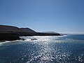
Black coast Playa de los Muertos


Web links
- Fuerteventura in the Global Volcanism Program of the Smithsonian Institution (English)
- Hendrik Mehrens: Geology and Landscape Development of Fuerteventura (PDF; 1.1 MB)
Individual evidence
- ↑ Población según indicadores. Municipios por islas de Canarias y años. In: gobiernodecanarias.org. Retrieved September 21, 2019 (Spanish).
- ↑ Biosphere Reserve Island and Marine World Fuerteventura. In: spain.info. Spanish Tourist Office, accessed September 17, 2019 .
- ↑ Fuerteventura officially declared a UNESCO light protection area. In: fuerteventurazeitung.de . August 1, 2015, accessed May 30, 2020.
- ↑ Blas Acosta is the new President of the Cabildo de Fuertevenutra. In: fuerteventurazeitung.de. July 8, 2019, accessed October 16, 2019 .
- ^ A b c Juan Carlos Carracedo, Simon Day: Canary Islands. Terra, Harpenden 2002, ISBN 1-903544-07-6 , p. 29 ( Classic Geology in Europe 4).
- ^ CJ Stillman: Giant Miocene landslides and the evolution of Fuerteventura, Canary Islands. In: Journal of Volcanology and Geothermal Research , 94, 1/4, 1999, pp. 89-104 ( abstract ), (English); Accessed June 24, 2011.
- ^ A b Juan Carlos Carracedo, Simon Day: Canary Islands. Terra, Harpenden 2002, ISBN 1-903544-07-6 , p. 24 ( Classic Geology in Europe 4).
- ↑ E. Ancochea, JL Brändle, CR Cubas, F. Hernán, MJ Huertas: Volcanic complexes in the eastern ridge of the Canary Islands. The Miocene activity of the island of Fuerteventura. In: Journal of Volcanology and Geothermal Research , 70, 3/4, March 1996, pp. 183-204 ( abstract ), (English); Accessed June 24, 2011.
- ↑ Juan Carlos Carracedo, Simon Day: Canary Islands. Terra, Harpenden 2002, ISBN 1-903544-07-6 , p. 21 ( Classic Geology in Europe 4).
- ↑ Hans-Ulrich Schmincke : Vulcanism. 2nd revised and expanded edition. Wissenschaftliche Buchgemeinschaft, Darmstadt 2000, ISBN 3-534-14102-4 , p. 65.
- ↑ 577 - LEY 7/1991, de 30 de April, de símbolos de la naturaleza para las Islas Canarias . Legal text in the Official Journal of the Canaries. In: Boletín Oficial de Canarias (BOC) . tape 061 , May 10, 1991 (Spanish, gobiernodecanarias.es [accessed December 7, 2019]).
- ↑ Meaning and origin of the name Fuerteventura. In: fuerteventurazeitung.de. July 16, 2019, accessed September 4, 2019 .
- ↑ Pablo Atoche Peña: Consideraciones en relación con la colonización protohistórica de las Islas Canarias . In: Anuario de estudios atlánticos . No. 59 , 2013, ISSN 0570-4065 , p. 536 (Spanish, online [accessed May 17, 2017]).
- ↑ Pablo Atoche Peña: Canarias en la Fase Romana (circa s. I ane al s. III dne) Los hallazgos arqueológicos . In: Almogaren . No. 37 , 2006, ISSN 1695-2669 , pp. 27-59 (Spanish, online [accessed May 22, 2017]).
- ↑ Pablo Peña Atoche: Las Culturas Protohistóricas Canarias en el contexto del desarrollo cultural mediterráneo: propuesta de fasificación . In: Rafael González Antón, Fernando López Pardo, Victoria Peña (eds.): Los fenicios y el Atlántico IV Coloquio del CEFYP . Universidad Complutense, Centro de Estudios Fenicios y Púnicos, 2008, ISBN 978-84-612-8878-6 , pp. 329 (Spanish, [1] [accessed May 25, 2017]).
- ↑ Juan Francisco Navarro Mederos: The original inhabitants (= everything about the Canary Islands ). Centro de la Cultura Popular Canaria, o.O. (Las Palmas de Gran Canaria, Santa Cruz de Tenerife) 2006, ISBN 84-7926-541-8 , p. 19 .
- ↑ José Carlos Cabrera Pérez, María Antonia Perera Betancort, Antonio Tejera Gaspar: Majos, la primitiva población de Lanzarote - Islas Canarias . Fundación César Manrique, Teguise (Lanzarote) 1999, ISBN 84-88550-30-8 , p. 104 (Spanish, [2] [accessed May 22, 2017]).
- ↑ Buenaventura Bonnet y Reverón: Las Canarias y la conquista franco-normanda . Instituto de Estudios Canarios, La Laguna 1954, p. 36 (Spanish, [3] [accessed December 24, 2017]).
- ↑ Eduardo Aznar: Le Canarien: Retrato de dos mundos I. Textos . In: Eduardo Aznar, Dolores Corbella, Berta Pico, Antonio Tejera (eds.): Le Canarien: retrato de dos mundos (= Fontes Rerum Canarium ). tape XLII . Instituto de Estudios Canarios, La Laguna 2006, ISBN 84-88366-58-2 , p. 250 (Spanish).
- ↑ Alejandro Cioranescu: Le Canaries: crónicas francesas de la conquista de Canarias . Ed .: Elías Serra, Alejandro Cioranescu (= Fontes rerum canarium . Volume VIII ). Instituto de Estudios Canarios, La Laguna 1959, p. 328 (Spanish, mdc.ulpgc.es [accessed October 22, 2019]).
- ↑ Miguel Ángel Ladero Quesada: Jean de Béthencourt, Sevilla y Henrique III . In: Eduardo Aznar, Dolores Corbella, Berta Pico, Antonio Tejera (eds.): Le Canarien: retrato de dos mundos II. (= Fontes Rerum Canarium ). tape XLIII . Instituto de Estudios Canarios, La Laguna 2006, ISBN 84-88366-59-0 , p. 30 (Spanish).
- ↑ Roberto Hernández Bautista: Los naturales canarios en las islas de señorío: Lanzarote, Fuerteventura, El Hierro y La Gomera . Mercurio Editorial, Madrid 2014, ISBN 978-84-943366-3-8 , p. 23 (Spanish).
- ↑ José Concepción Rodríguez, Juan Ramón Gómez-Pamo Guerra del Río: Los Coroneles . Catalog text for the exhibition Arte, sociedad y poder. La Casa de los Coroneles , Fuerteventura. 2009 (Spanish, lacasadeloscoroneles.org [accessed November 30, 2018]).
- ↑ Roberto Hernández Bautista: Los naturales canarios en las islas de señorío: Lanzarote, Fuerteventura, El Hierro y La Gomera . Mercurio Editorial, Madrid 2014, ISBN 978-84-943366-3-8 , p. 30 (Spanish).
- ↑ Fernando Bruquetas de Castro: El Mundo moderno . Ed .: Armando del Toro García. tape 1 . Dirección General de Patrimonio Histórico, Viceconsejería de Cultura y Deportes, Consejería de Educación, Cultura y Deportes, Gobierno, Las Palmas 1998, ISBN 84-7947-213-8 , p. 235-239 (Spanish).
- ↑ Productos de aloe vera asiático se comercializan como canarios e ingresan hasta 21 millones gracias al engaño. In: eldiario.es. November 20, 2015, Retrieved September 28, 2018 (Spanish).
- ↑ Harald Braem : On the trail of the indigenous people: An archaeological travel guide for the Canaries . 240 p., Zech-Verlag, 2018, ISBN 978-84-934857-3-3 , e ISBN 978-84-943429-8-1
Main islands: Fuerteventura | Gran Canaria | La Gomera | La Graciosa | El Hierro | Lanzarote | La Palma | Tenerife
Secondary islands: Lobos | Roque de Garachico | Chinijo Archipelago ( Alegranza | Montaña Clara | Roque del Este | Roque del Oeste )
Grazalema (1977) | Ordesa-Viñamala (1977) | Montseny (1978) | Doñana (1980) | Mancha Húmeda (1980) | La Palma (1983) | Marismas del Odiel (1983) | Sierras de Cazorla, Segura y Las Villas (1983) | Urdaibai (1984) | Sierra Nevada (1986) | Cuenca Alta del Río Manzanares (1992) | Lanzarote (1993) | Menorca (1993) | Sierra de las Nieves y su Entorno (1995) | Cape Gata-Nijar (1997) | Bardenas Reales (2000) | El Hierro Island (2000) | Muniellos (2000) | Somiedo (2000) | Redes (2001) | Sierra Morena pasture landscape (2002) | Terras do Miño (2002) | Valle de Laciana (2003) | Monfragüe (2003) | Picos de Europa (2003) | Valle de Jubera, Leza, Cidacos and Alhama (2003) | Babia (2004) | Alto de Bernesga (2005) | Área de Allariz (2005) | Gran Canaria (2005) | Los Argüellos (2005) | Los Valles de Omaña y Luna (2005) | Sierra del Rincon (2005) | Las Sierras de Béjar y Francia (2006) | Los Ancares Leoneses (2006) | Os Ancares Lucenses y Montes de Cervantes, Navia y Becerrea (2006) | Intercontinental Mediterranean Biosphere Reserve (2006) | Rio Eo, Oscos y Terras Buron (2007) | Fuerteventura (2009) | Xurés (2009) | La Gomera (2012) | Las Ubinas – La Mesa (2012) | Mariñas Coruñesas e Terras do Mande (2013) | Terres de l'Ebre (2013) | San Ildefonso – El Espinar (2013) | Meseta Iberica (2015) | Anaga Mountains (2015) | Tagus / Tejo (2016) | Ponga (2018) | Alto Turia (2019) | La Siberia (2019) | Valle del Cabriel (2019)