
Agüimes
| Agüimes municipality | |||
|---|---|---|---|
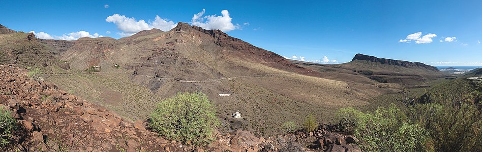
 Panorama of Agüimes
|
|||
| coat of arms | Map of the Canary Islands | ||

|
|
||
| Basic data | |||
| Autonomous Community : | Canary Islands | ||
| Province : | Las Palmas | ||
| Island: | Gran Canaria | ||
| Coordinates | 27 ° 53 ′ N , 15 ° 26 ′ W | ||
| Height : | 275 msnm | ||
| Area : | 79.28 km² | ||
| Residents : | 31,619 (Jan 1, 2019) | ||
| Population density : | 398.83 inhabitants / km² | ||
| Postal code : | E-35260 (Agüimes) E-35270 (Temisas) E-35118 (Arinaga) E-35119 (Los Espinales) |
||
| Municipality number ( INE ): | 35002 | ||
| administration | |||
| Mayor : | Antonio Morales Méndez (RA) (as of 2005) | ||
| Address of the municipal administration: | C / Dr. Joaquin Artiles, 1 35260 Agüimes |
||
| Website : | www.aguimes.es | ||
| Location of the municipality | |||

|
|||

Agüimes is a municipality on the Canary Island of Gran Canaria . It has 31,619 inhabitants (as of January 1, 2019) on an area of 79.28 km². A distinction must be made between the municipality of Agüimes and the town of Agüimes . This article refers to the municipality.
geography
Agüimes is located south of Las Palmas de Gran Canaria and northeast of Puerto Rico . Neighboring communities are Ingenio in the north, Santa Lucía de Tirajana in the south, San Bartolomé de Tirajana in the west and Valsequillo de Gran Canaria in the west.
Buildings and sights
The center of the village of Agüimes was classified as a conjunto histórico-artístico .
- Salinas de Arinaga 1820 built complex of sea water: saline
- Morros de Ávila : man-made hills and caves from pre-Hispanic times
- Barranco de Guayadeque : originally a pre-Hispanic cave settlement, partially inhabited to this day
- Barranco de Balos : Area of discovery of pre-Hispanic petroglyphs
- Faro from Orinaja / Aguimes
- Parish Church of San Sebastián : Classicist building from 1796
- Casa de la Cámara Episcopal
- Barrio de Temisas
- Cuevas y Graneros de la Audiencia
- Cuevas y Hornos del Centro Alfarero de la Atalaya
- Emicela solar power plant , since 2011
Residents

| year | Residents | Population density |
|---|---|---|
| 1991 | 16,156 | - |
| 1996 | 16,284 | - |
| 2001 | 20,124 | 254.7 inhabitants / km² |
| 2002 | 22,567 | - |
| 2003 | 23,572 | 297.3 inhabitants / km² |
| 2004 | 24,460 | 309.0 inhabitants / km² |
| 2005 | 25,541 | 322.2 inhabitants / km² |
economy
The Emicela solar power plant went online in 2011.
- Poligono Agüimes Collection of several hundred companies
- Zona ZEC Important free trade area
Barranco de Balos
Barranco de Balos

Letreros de Balos

Petroglyphs

Petroglyphs

Petroglyphs

Petroglyphs

.png)

.png)
.png)

Individual evidence
- ↑ Cifras oficiales de población resultantes de la revisión del Padrón municipal a 1 de enero . Population statistics from the Instituto Nacional de Estadística (population update).
swell
Web links
Agaete | Agüimes | Artenara | Arucas | Firgas | Gáldar | Ingenio | Mogán | Moya | Las Palmas | San Bartolomé de Tirajana | La Aldea de San Nicolás | Santa Brígida | Santa Lucía de Tirajana | Santa María de Guía | Tejeda | Telde | Teror | Valleseco | Valsequillo | Vega de San Mateo