Beep


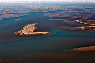
The Piep is the dominant tidal creek system off the Dithmarsch coast. The several kilometer long priel begins at the edge of the Dithmarscher Wadden Sea , forks into three arms in the Meldorfer Bucht and extends almost directly to the coastline of the Speichererkoog . Access to the port of Büsum is possible through the beep .
Towards the sea, the Tertius sand divides the river into a northern and southern part, Norderpiep and Süderpiep , with the tide flowing primarily through the southern part, while the ebb flows through both channels. Within the Meldorfer Bay about at the level of Büsum, the Piep divides into the northern Wöhrdener Loch, the middle Kronenloch and the southern Sommerkoog- Stertloch.
The exact dates vary greatly due to the dynamic nature of the Dithmarscher Wadden Sea. Between 1931 and 1991, the area was between 100 and 115 square kilometers, which were under water even at low tide, plus between 121 and 171 square kilometers of mudflats in the direct area of the river. Its maximum depth was between 1931 and 1991 at 21 to 27 meters and was 26 meters in 1991. The capacity in the same period was between 699 and 565 million cubic meters, in 1991 it was 577 million cubic meters. Today the maximum depth is 20 meters.
literature
- Petra Witez: Final report on the research project MTK 0608 (03 KIS 3160): Programs for the long-term conservation of the Wadden Sea - Prowatt . Edited by the Federal Ministry for Education and Research, Laboe 2002, pp. 74–90.
Coordinates: 54 ° 7 ′ 44 ″ N , 8 ° 47 ′ 19 ″ E
