Meldorfer Bucht
Coordinates: 54 ° 4 ′ 44 ″ N , 8 ° 54 ′ 0 ″ E
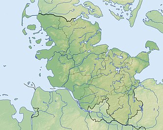
The Meldorfer Bucht (also Dithmarscher Bucht ) is a bay belonging to Schleswig-Holstein , which is located on the Helgoland Bay .
location
The bay is about 90 km north-west of Hamburg and 30 km north-northeast of Cuxhaven . In the north of the Meldorfer Bucht, which belongs to Dithmarschen and is located in the district of the same name, is the North Sea health resort Büsum , in the south is the bathing resort Friedrichskoog , which does not border directly on the Meldorfer Bucht. To the east is the town of Hemmingstedt and the town of Meldorf , which gave the bay its name. To the west, the bay opens up to the open North Sea . The dominant flow channel is the up to 20 meters deep Piep , which in the Meldorfer Bay divides into three flow arms , the Wöhrdener Loch (north), the Kronenloch and the Sommerkoog -steertloch (south).
history
With several severe storm surges in the late Middle Ages or at the beginning of the modern era, the bay expanded further and further into the rather low marshland and almost reached the city of Meldorf, which was built on a geestrip . It was not until the 16th century that the first reclamation of new land was carried out and the first creeks were diked in the bay.
On February 17, 1500, the independent peasant republic of Dithmarschen defended itself in the Battle of Hemmingstedt against the army of the King of Denmark and his brother. Almost all of the royal, mostly aristocratic cavalry were drowned in the waters of the high tide in the Meldorfer Bucht at Springtiede.
today
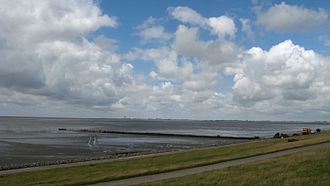
After the last dike , which took place from April 1969 to March 1978, the Meldorfer Bucht still has an area of (estimated) 30 km² with an extension of around 8.5 by 8 kilometers. The most recent dike did not focus on land reclamation , but rather on coastal protection . With the construction of the new 8.8 meter high and (in the core area of the bay) only 14.8 km long dike, both the dike crown and length were significantly increased. The newly created Dithmarschen reservoir on the Meldorfer Bucht is primarily intended to store the water masses flowing in from the interior of the country during floods and to discharge them via two sluice stations or pumping stations . In addition, the salt marshes serve as a protected retreat for the avifauna . Agriculture only plays a subordinate role in the Speichererkoog. The sheep grazing here should help to stabilize the dyke systems. Both the Speichererkoog and the other, not diked, Meldorfer Bucht belong to protection zone 1 of the Schleswig-Holstein Wadden Sea National Park and are therefore subject to special protection regulations.
Islands
In the Meldorfer Bucht lies the uninhabited former island of Helmsand , which was roughly comparable to a Hallig and was connected to the mainland by a dam several years ago. It is a bird sanctuary just like the island of Trischen off the bay , and the Blauort and Tertius sandbanks may only be entered with special permission. The former island of Dieksand now forms the western tip of Friedrichskoog.
Human use
The direct coastal areas are comprehensively developed for tourism. Norder- and Süderpiep serve the ships as fairways to the port of Büsum. The shrimp cutters stationed there fish in the Meldofer Bay, among other places. The southern part of the Meldorfer Bucht serves the Bundeswehr as a weapons testing area. In the western part, a little north of the Elbe estuary and the Großer Vogelsand, there is a burial site for burials at sea .
literature
- Hans Michelsen: The dike of the Meldorfer Bucht . In: Dithmarschen - Landeskunde - Kultur - Natur, 3/2008, pp. 24–43; Association for Dithmarsch regional studies (ed.), Heide 2008
- Gille, Klaus, Hansen, Schrum: Meldorf, Pictures of an old town , Verlag Boyens & Co., Heide, 1995, section DerMeldorfer Hafen , pp. 81–86, ISBN 3-8042-0688-3 / 3-8042-0688- 3
Web links
- Official website of the Schleswig-Holstein Wadden Sea National Park
- Official website of the NSGs "Kronenloch" and "Wöhrdener Loch" - NABU SH eV
- Official website of the Schutzstation Wattenmeer eV, Station Büsum
- Development plan for the old Meldorfer Hafen , pdf 2013
- Future of Meldorfer Hafen with pdf 2013
Individual evidence
- ↑ Burial at the Krautsand. (No longer available online.) In: seebestattungen-krautsand.de. Archived from the original on March 4, 2016 ; accessed on August 26, 2015 . Info: The archive link was inserted automatically and has not yet been checked. Please check the original and archive link according to the instructions and then remove this notice. (53 ° 58 'N 08 ° 37' E)


