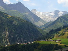
Piz Caschleglia
| Piz Caschleglia | ||
|---|---|---|
|
Piz Caschleglia (right) with the Glacier Express |
||
| height | 2935 m above sea level M. | |
| location | canton of Grisons | |
| Mountains | Graubünden Alps | |
| Coordinates | 712 205 / 167746 | |
|
|
||
The Piz Caschleglia is a mountain in the Graubünden Alps .
The mountain is 2935 m above sea level. M. high and is east of the Val Plattas in the area of the municipality of Medel (Lucmagn) . It can be climbed from the Medelserhütte .
literature
- Hiking map 1: 33'333, sheet 3326T Obere Surselva . Federal Office for Topography, Wabern 2015, ISBN 978-3-302-33326-7 .
Web links
Commons : Piz Caschleglia - collection of images, videos and audio files


